Lewes-Rehoboth Hundred near Rehoboth Beach in Sussex County, Delaware — The American Northeast (Mid-Atlantic)
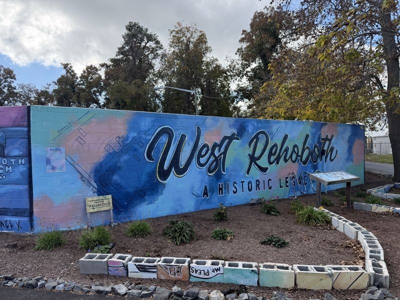
West Rehoboth
A Historic Legacy
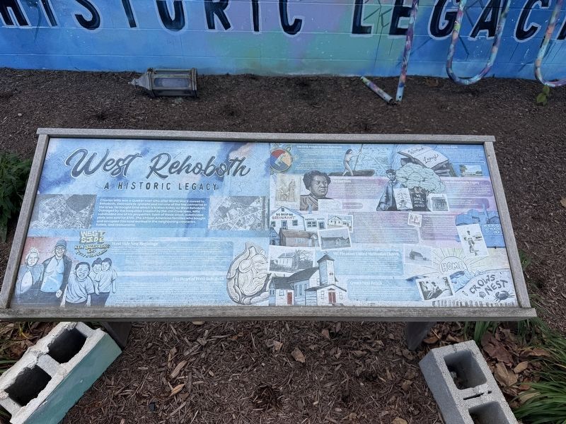
Charles Mills was a Quaker man who after World War II moved to Rehoboth, Delaware to operate and run one of the few canneries in the area. He bought land which is known today as West Rehoboth. Outraged by the inequalities created by the Jim Crow laws, Mills subdivided one of his properties. Each of these small, subdivided plots sold for $100. The African American families who bought and occupied this land worked in the neighboring canneries, hotels, and restaurants.
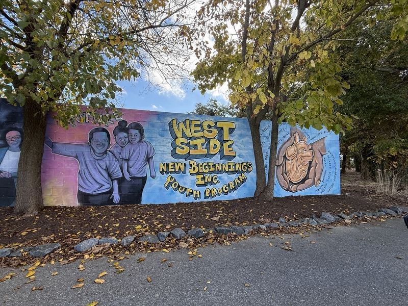
West Side New Beginnings
In 1990, West Side New Beginnings was formed and became incororated into a nonprofit in April 1992. In July 2002, the West Rehoboth Children & Youth Program (under the tutelage of WSNB, Inc.) was founded by Brenda Milbourne and Diaz Bonville. Diaz Bonville (quoted here on the mural) serves as the President. Brenda Milbourne serves as the nonprofit Executive Director. She has been honored with several awards for her work in the community.
Minnie Burton was the mentor of Diaz Bonville and Brenda Milbourne. She initiated the West Side movement with the help of the First State Action Agency. Together, they were able to push Minnie's
this page online
Delaware State Representative Pete Schwartzkopf declared a proclamation on March 14, 2009, regonizing Minnie Smith Burton for her contributions to West Rehoboth.
The Heart of West Rehoboth
"We will not be moved" coined by Ms. Brenda Milbourne in an oral history she took part in in 2009. "That's what we do here, we believe in West Rehoboth help us and believe in our community, we continue to keep the faith we will not be moved and we will beautify our community and we are going to clean our community up. We can't help the name but we can help to continue to keep it as West Rehoboth. We are not worried about who comes here and lives, what we are worried about is will you help make it affordable, that's what we are worried about. Not everybody has a college degree. Some people are still factory people, some people still hotel people, yes, they still need a place to live in West Rehoboth.
Regards to the gentrification
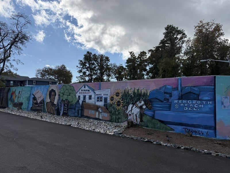
The First People of West Rehoboth
This section honors the Native American people who were indigenous to these lands. There were three main clans tied to the Delaware BAy area: the Munsee (Wolf Clan), the Unami (Turtle Clan), and the Unalachtigo (Turkey Clan).
The Nanticoke Native Americans of North America, represented here, were also called Lenni Lenape (Delaware People). They believe that the continent was formed on the back of the great box turtle and dubbed this land, Turtle Island (Turtle Clan). There are still descendants living in this area that are of Nanticoke Native American heritage.
The Green Book
The Green book or "Negro Motorist Green Book" was a travel guide for black and brown people that listed all the nationwide hotel restaurants, service stations, drug stores, taversn, and barber shops that were safe for them to patronize. In 1946, Mary and Bob Mallow; along with their daughter, Sheila, opened the motel. Malloy's Modern Cabins on Rehoboth Avenue 1A.
(Source NAncy Alexander via Cape Gazette, PHotograph from Malloy Family)
The Burtons
Eliza J. and William D. Burton are central figures in the early history of Rehoboth Beach. Married on December 25, 1879, their marriage license attested to their eligibility as "free" individuals. This was during the Jim Crow era and under Delaware State law, this was a requirement for all African Americans after 1863. Eliza's mother, Catherine, married Elijah Burton, who then donated one acre of land to Mt. Pleasant United Methodist Church.
Marriage Certificate
The Burton Family Legacy
Today, the ancestors of the Burton family continue their legacy by preserving the history of Rehoboth Beach's origins. Terrance Vann is not only the mural artist for this project but th egreat, great, great-grandson of Eliza and William. There are several descendants of the Burton family still living in the area, including, Aarin Burton and Antoine Vann, our project historians.
The Burton House - Once located by Faith United Methodist Church on Church St.
Built
In the 1920's Rehoboth School 200c was built for African American and Native American students during a time of racial prejudices and segregation. This school was one of ninety buildings that were funded by Pierre A. Dupont through his Delaware School Auxiliary Association during the Jim Crow era. Rehoboth School 200c was constructed as a two-room frame schoolhouse with a side-gabled roof. In the late 1960s, the building was moved just over one-tenth of a mile from its original location at 20080 Church Street to make way for the construction of the
The Bean Factory on Oyster Road
During the 1930s to the 1950s, the main income for most people of West Rehoboth was in cannery factories canning oysters and vegetables. The Charles A Mills "Bean" factory depicted here was sold in 1964 and was torn down in the early 2000's. This photograph is of Gertrude Nancy VAnn in front of the Bean Factory.
Photogrpahed is Gertrude Nancy Burton Vann in front of the Bean Factory.
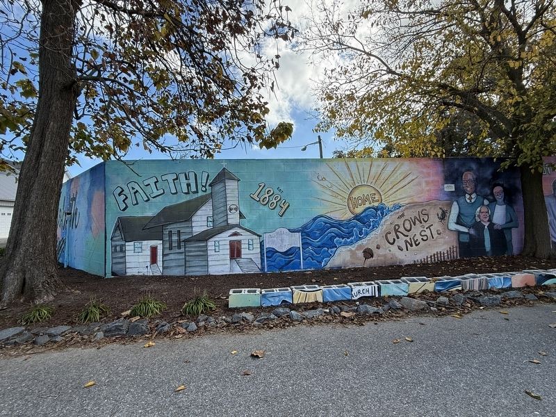
Mt. Pleasant United Methodist Church
Mt. Pleasant U.M. Church was originally Burton's Chapel AME Church. It later became known as Mount Pleasant Methodist Church and eventually Mount Pleasant United MEthodist Church. This Church was founded when Elijah Burton donated a one-acre plot of his family's land that would serve African Americans. "From my family and trustees for the church and their successors in office forever", Elijah Burton. The original deed from Mt. Pleasant United Methodist church was dated August 22, 1884. The church still has a strong congregation and is located on the corner of Canal Crossing and Church Street.
Crows Nest Beach
Crows
Photographed by Devry Becker Jones (CC0), October 29, 2026
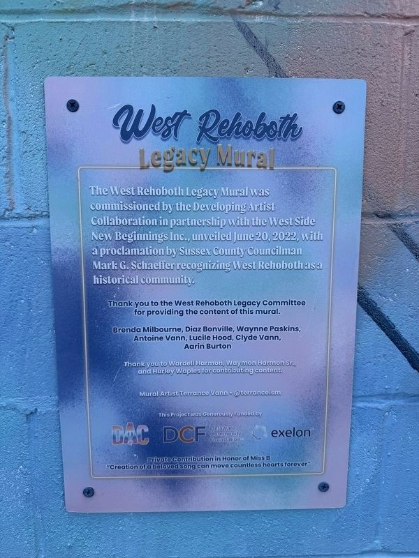
6. West Rehoboth Legacy Mural Dedication Plaque
Legacy Mural
Brenda Milbourne, Diaz Bonville, Waynne Paskins, Antoine Vann, Lucile Hood, Clyde Vann, Aarin Burton
,br> Thank you to Wardell Harmon, Waymon Harmon Sr., and Hurley Waples for contributing content.
Mural Artist Terrance Vann • @terranceism
This project was Generously Funded by
DAC • Delaware Community Foundation • Exelon
Private contribution in honor of Miss B
"Creation of a beloved song can move countless hearts forever"
Topics and series. This historical marker is listed in these topic lists: African Americans • Education • Industry & Commerce • Settlements & Settlers. In addition, it is included in the African Methodist Episcopal (AME) Church, and the Quakerism series lists. A significant historical date for this entry is March 14, 2009.
Location. 38° 42.884′ N, 75° 5.946′ W. Marker is near Rehoboth Beach, Delaware, in Sussex County. It is in Lewes-Rehoboth Hundred. It is at the intersection of Center Avenue and Malloy Street, on the right when traveling north on Center Avenue. Touch for map. Marker is at or near this postal address: 19860 Center Ave, Rehoboth Beach DE 19971, United States of America. Touch for directions.

Regionally, this marker is on Delaware’s Beaches. It is also in the American Mid-Atlantic, on the Delmarva Peninsula, and on the Eastern Seaboard. Globally, it is in the North Atlantic Region, North America, the Western Hemisphere, the Western World, and the Anglosphere. Historically, it finds itself in what was once New Netherland, one of the original Thirteen Colonies, and the Antebellum South.
Other nearby markers. At least 8 other markers are within walking distance of this marker: Mount Pleasant United Methodist Church (approx. 0.2 miles away); Commerce and the Canal (approx. 0.4 miles away); History of the Canal (approx. 0.4 miles away); Recreation and Tourism (approx. 0.4 miles away); Traveling to the Beach (approx. 0.4 miles away); The Nation's Summer Capitol (approx. 0.4 miles away); Cape Henlopen Lighthouse Replica (approx. 0.4 miles away); Delaware's Medal of Honor Recipients (approx. half a mile away). Touch for a list and map of all markers in Rehoboth Beach.
Credits. This page was last revised on October 31, 2026. It was originally submitted on October 31, 2026, by Devry Becker Jones of Washington, District of Columbia. This page has been viewed 20 times since then. Photos: 1, 2, 3, 4, 5, 6. submitted on October 31, 2026, by Devry Becker Jones of Washington, District of Columbia.
