Johns Island in Charleston County, South Carolina — The American South (South Atlantic)
The Angel Oak Tree
Photographed by Tom Bosse, October 25, 2026
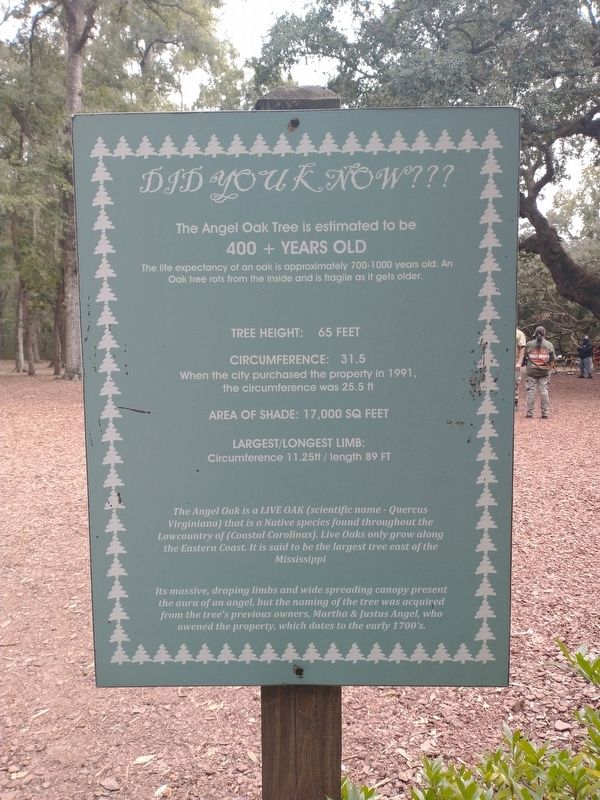
1. The Angel Oak Tree Marker
The Angel Oak Tree is estimated to be 400+ years old. The life expectancy of an oak is approximately 700-1000 years old. An Oak tree rots from the inside and is fragile as it gets older.
Tree Height: 65 feet
Circumference: 31.5
When the city purchased the property in 1991, the circumference was 2.5 ft.
Area of Shade: 17,000 Sq Feet
Largest/Longest Limb: Circumference 11.25 ft / length 89 ft
The Angel Oak is a Live Oak (scientific name - Quercus Virginiana) that is a native species found throughout the Lowcountry of (Coastal Carolinas). Live Oaks only grow along the Eastern Coast. It is said to be the largest tree east of the Mississippi.
Its massive, draping limbs and wide spreading canopy present the aura of an angel, but the naming of the tree was acquired from the tree's previous owners, Martha and Justus Angel, who owned the property, which dates to the early 1700's.
Topics. This historical marker is listed in this topic list: Horticulture & Forestry.
Location. 32° 43.045′ N, 80° 4.834′ W. Marker is on Johns Island, South Carolina,
this page online

Regionally, this marker is in the Lowcountry. It is also in the American South, specifically in the Deep South, and on the Eastern Seaboard. Globally, it is in the North Atlantic Region, North America, the Western Hemisphere, the Western World, and the Anglosphere. Historically, it finds itself in what was once the territory of the Mississippian Culture, one of the original Thirteen Colonies, one of the Confederate States of America, and the Antebellum South.
Other nearby markers. At least 8 other markers are within 6 miles of this marker, measured as the crow flies: St. John’s Episcopal Church (approx. 0.3 miles away); John's Island Presbyterian Church (approx. 2.2 miles away); Federal Expedition on John's Island / Battle of Burden's Causeway (approx. 3.4 miles away); The Progressive Club (approx. 3.6 miles away); Belvidere School Site
Photographed by Tom Bosse, October 25, 2026
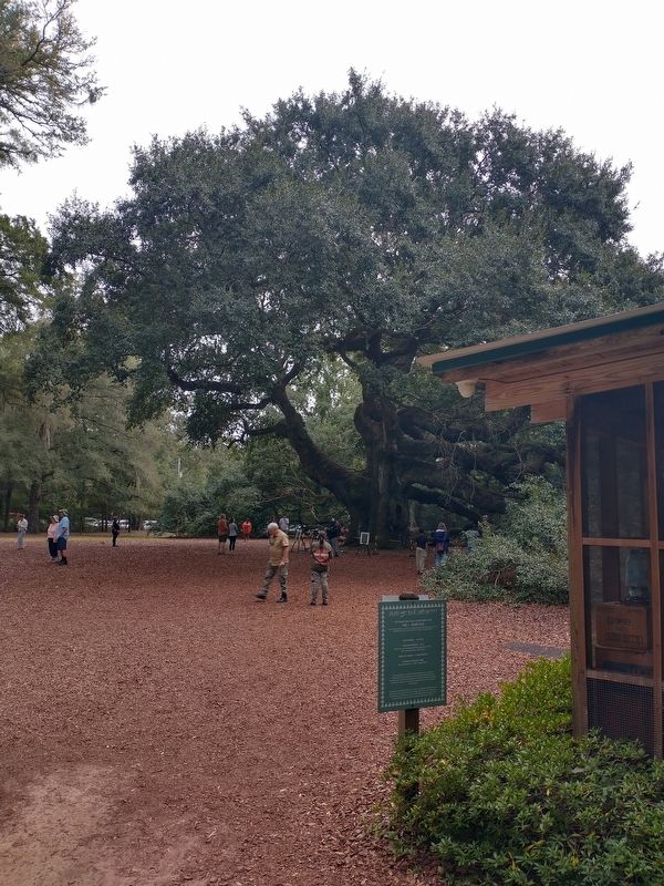
2. The Angel Oak Tree Marker
Photographed by Tom Bosse, October 25, 2026
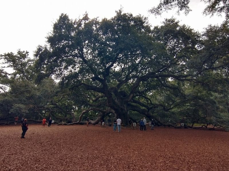
3. The Angel Oak Tree
Photographed by Tom Bosse, October 25, 2026
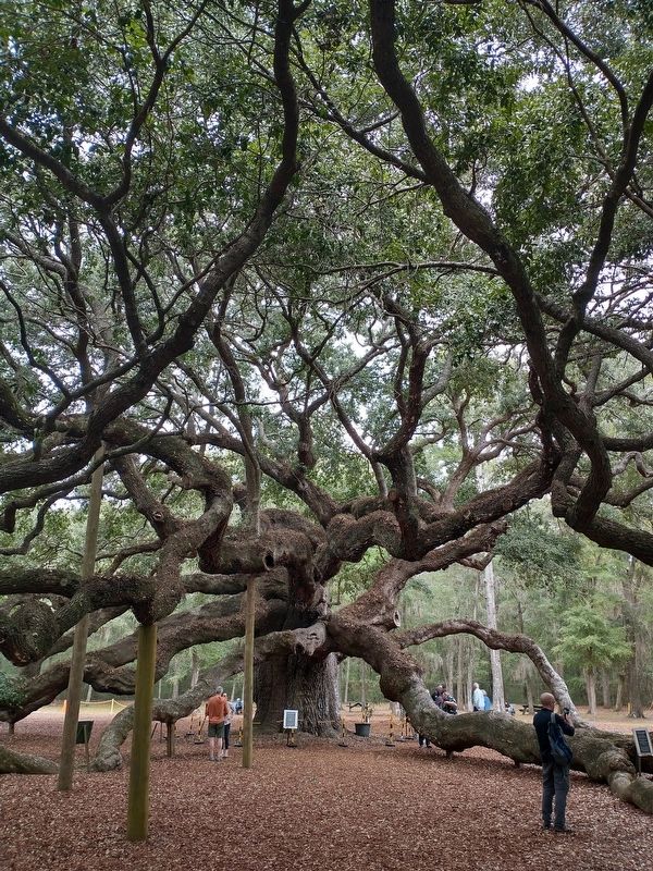
4. The Angel Oak Tree
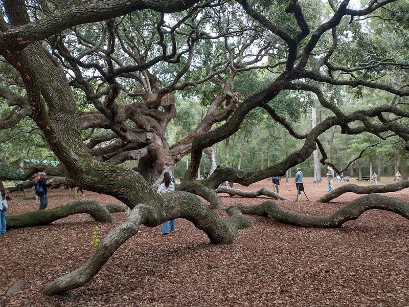
Photographed by Tom Bosse, October 25, 2026
5. The Angel Oak Tree
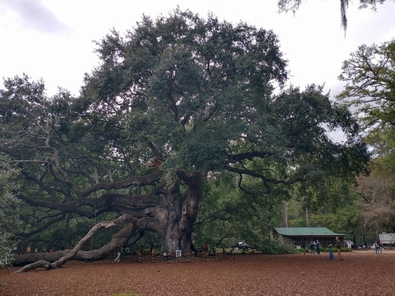
Photographed by Tom Bosse, October 25, 2026
6. The Angel Oak Tree
Credits. This page was last revised on November 8, 2026. It was originally submitted on November 1, 2026, by Tom Bosse of Jefferson City, Tennessee. This page has been viewed 12 times since then. Photos: 1, 2, 3, 4, 5, 6. submitted on November 1, 2026, by Tom Bosse of Jefferson City, Tennessee. • Bernard Fisher was the editor who published this page.
