Northampton in West Northamptonshire, England, United Kingdom — Northwestern Europe (the British Isles)
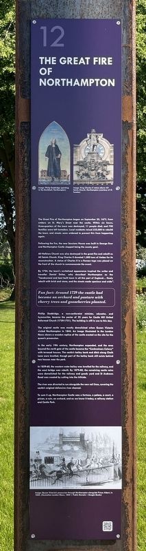
The Great Fire of Northampton
Photographed by Ray Gurganus, May 25, 2026
1. The Great Fire of Northampton Marker
Following the fire, the new Sessions House was built in George Row and Northampton Castle stopped being the county gaol.
All Hallows Church was also destroyed in the great fire and rebuilt as All Saints Church. King Charles II donated 1,000 tons of timber for its reconstruction. A statue of Charles II in a Roman toga was placed on the front of the church to commemorate the event.
By 1724, the town's revitalized appearance inspired the writer and traveller Daniel Defoe, who described Northampton as the "handsomest and best built town in all this part of England... finely rebuilt with brick and stone, and the streets made spacious and wide".
Fun fact: Around 1729 the castle had become an orchard and pasture with cherry trees and gooseberries planted.
Phillip Doddridge, a non-conformist
this page online
The original castle was mostly demolished when Queen Victoria visited Northampton in 1844. An image illustrated in the London News shows a wooden replica of the castle erected on the site for the queen's procession.
In the early 19th century, Northampton expanded, and the area beyond the north gate of the castle became the "Cordwainers Colony" with terraced houses. The castle's bailey bank and ditch along Chalk Lane were levelled, though part of the bailey bank still exists behind two houses near the park.
In 1859-60, the western outer bailey was levelled for the railway, and the west bridge was rebuilt. By 1879-80, the remaining castle ruins were demolished for the railway and goods yard and St Andrews Road was created by cutting into the hillside.
The river was diverted to run alongside the new rail lines, covering the castle's original defensive river channel.
To sum it up, Northampton Castle was a fortress, a palace, a court, a prison, a ruin, an orchard, and as we know it today, a railway station and Castle Park.
(Marker Number 12.)
Topics. This historical marker is listed in these topic lists: Disasters • Forts and Castles. A significant historical date for this entry is September 20, 1675.
Location. 52° 14.25′ N, 0° 54.25′ W. Marker is in Northampton, England, in West Northamptonshire. It is on Chalk Lane. Touch for map. Marker is at or near this postal address: 14 Chalk Lane, Northampton, England NN1 1SN, United Kingdom. Touch for directions.

Regionally, it is on the Atlantic Ocean, in the North Atlantic Region, in Europe, in Atlantic Europe, on one of the British Isles, in the Western World, and in the Anglosphere. Historically, it finds itself in what was once the Roman Empire.
Other nearby markers. At least 8 other markers are within walking distance of this marker: Shoe Industry (here, next to this marker); Archaeological Excavations (here, next to this marker); The Fall of the Castle Walls (a few steps from this marker); Hazelrigg House and the Old Black Lion (a few steps from this marker); Stories from the Castle (a few steps from this marker); Royals and the Castle (a few steps from this marker); Thomas Becket (a few steps from this marker); Visitors to the Castle (within shouting distance of this marker). Touch for a list and map of all markers in Northampton.
Credits. This page was last revised on November 3, 2026. It was originally submitted on November 1, 2026, by Ray Gurganus of Washington, District of Columbia. This page has been viewed 6 times since then. Photo 1. submitted on November 1, 2026, by Ray Gurganus of Washington, District of Columbia. • Andrew Ruppenstein was the editor who published this page.
Editor’s want-list for this marker. photo of the marker within its surroundings • Can you help?
