Dover in Kent, England, United Kingdom — Northwestern Europe (the British Isles)
Dunkirk, 1940
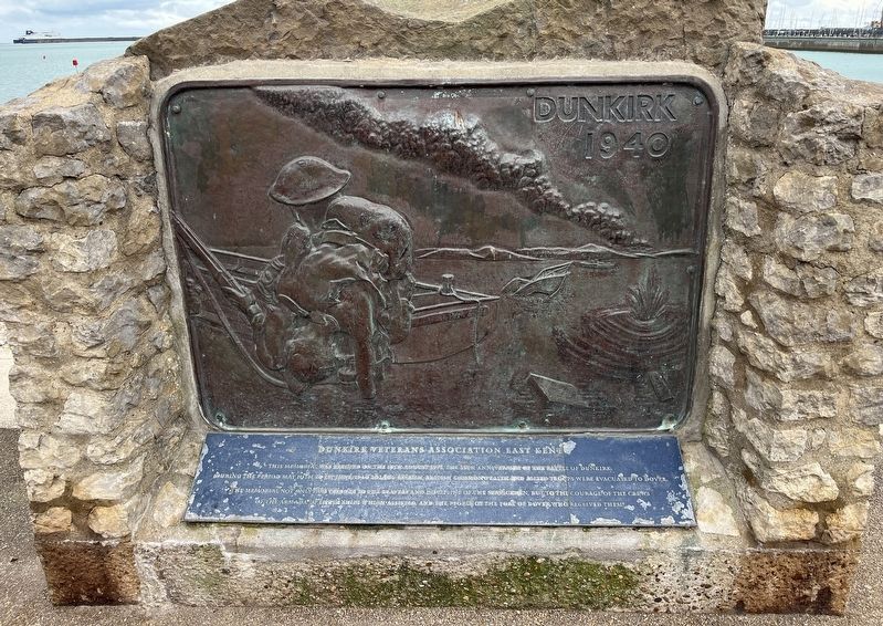
Dunkirk Veterans Association, East Kent
Photographed by Ray Gurganus, April 2, 2026
1. Dunkirk, 1940 Marker
During the period May 10th to 1st June 1940, 202,306 British, British Commonwealth and Allied troops were evacuated to Dover. The memorial not only pays tribute to the bravery and discipline of the servicemen, but to the courage of the crews of the armada of little ships which assisted, and the people of the port of Dover who received them.
Topics. This memorial is listed in this topic list: War, World II. A significant historical year for this entry is 1940.
Location. 51° 7.286′ N, 1° 18.856′ E. Memorial is in Dover, England, in Kent. It can be reached from Waterloo Crescent, on the right when traveling north. Touch for map. Memorial is at or near this postal address: 18-27 Waterloo Crescent, Dover, England CT17 9FS, United Kingdom. Touch for directions.

Regionally, this memorial is in the Greater South East. Globally, it is on the Atlantic Ocean, in the North Atlantic Region, in Europe, in Atlantic Europe, on one of the British Isles, in the Western World, and in the Anglosphere. Historically, it finds itself
this page online
Other nearby markers. At least 8 other markers are within walking distance of this marker: Waterloo Crescent and the War Memorials (within shouting distance of this marker); New Bridge (about 150 meters away, measured in a direct line); Charles Stewart Rolls (approx. 0.3 kilometers away); The Royal Norwegian Navy (approx. 0.4 kilometers away); Operation Fuller (approx. 0.4 kilometers away); Old Market Hall (approx. 0.4 kilometers away); Instruments of Punishment (approx. 0.4 kilometers away); Market Square (approx. 0.4 kilometers away). Touch for a list and map of all markers in Dover.
Credits. This page was last revised on November 3, 2026. It was originally submitted on November 2, 2026, by Ray Gurganus of Washington, District of Columbia. This page has been viewed 8 times since then. Photo 1. submitted on November 2, 2026, by Ray Gurganus of Washington, District of Columbia. • Andrew Ruppenstein was the editor who published this page.
