Echternach, Echternach, Luxembourg — Western Europe
Mur d’enceinte
⎯⎯⎯
Stadtmauer
⎯⎯⎯
City Walls
Photographed by Andrew Ruppenstein, October 21, 2026
1. Mur d’enceinte / Stadtmauer / City Walls Marker

(Monument classe)
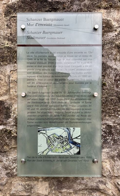
La ville d'Echternach a été entourée d'une enceinte au 12e siècle. Sa première représentation se trouve sur un sceau de 1249. A la fin du Moyen Age, le mur s'étendait sur une longueur d'environ 2000 mètres, comprenait 14 tours et 6 portes et était précédé d'un large fossé. L'enceinte a été en grande partie démolie aux 18e et 19e siècles, plusieurs tours sont devenues des maisons d'habitation. Les fouilles archéologiques et les travaux de restauration effectués en 1992 ont permis la mise en valeur des parties conservées. Trois tours ont été aménagées en appartements pour touristes par le Syndicat d'Initiative.
(Geschätztes Denkmal)
Die Stadt Echternach wurde im 12. Jahrhundert befestigt. Eine erste Darstellung des mauerbewehrten Ortes findet sich auf einem Siegel von 1249. Gegen Ende des Mittelalters war die Stadtmauer etwa 2000 Meter lang, umfasste 14 Türme und 6 Tore und war von einem breiten Graben umgeben. Im 18. und 19. Jahrhundert wurden die Befestigungen zu einem grossen Teil abgetragen, mehrere Türme wurden zu Wohnzwecken umgebaut. Im Jahre 1992 wurden die Reste der Anlage wissenschaftlich untersucht und instandgesetzt. Drei Türme wurden vom Verkehrsverein als Touristenwohnungen eingerichtet.
Schanzer Town Wall
(protected monument)
The town of Echternach was fortified in the 12th century. An early depiction of the walled settlement can be found on a seal dating from 1249. By the end of the Middle Ages, the town wall measured approximately 2,000 meters in length, incorporated 14 towers and 6 gates, and was surrounded by a wide moat. During the 18th and 19th centuries, much of the fortification system was dismantled, and several towers were converted into dwellings.
this page online
Erected by Service des Sites et Monuments nationaux.
Topics. This historical marker is listed in this topic list: Forts and Castles. A significant historical year for this entry is 1249.
Location. 49° 48.64′ N, 6° 25.529′ E. Marker is in Echternach, Iechternach (Echternach). It is on Rue des Redoutés, on the right when traveling east. Touch for map. Marker is at or near this postal address: Rue des Redoutés 30, Echternach, Iechternach 6476, Luxembourg. Touch for directions.

Regionally, this marker is in the Guttland and in the Mullerthal. Globally, it is in Europe, the European Union, the Benelux Low Countries, the Schengen Area, Western Europe, and the Western World. Historically, it finds itself in what was once the Roman Empire and specifically also the Holy Roman Empire.
Other nearby markers. At least 8 other markers are within walking distance of this marker: Neckel Welschbillig (within shouting distance of this marker);
Photographed by Andrew Ruppenstein, October 21, 2026
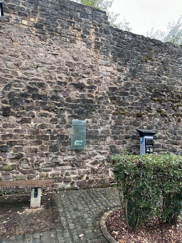
2. Mur d’enceinte / Stadtmauer / City Walls Marker - wide view
Also see . . . Iechternacher Stadmauer (Wikipedia, in Luxembourgish). Excerpt (in translation):
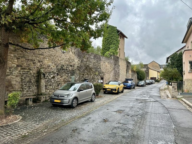
Of the medieval town wall of Echternach — which measured 2,360 m in length and was fronted by a moat — well-preserved sections can still be seen along "Hooveleker Buurchmauer" (Rue Hooveleker Buurchmauer), "Schanzer Buurchmauer" (Rue des Redoutes), and in the area known as "Kack".(Submitted on November 3, 2026.)
Of the original 14 or more towers, five remain in good condition and are currently used as residences or rented out to tourists: one tower on "Rue Jean-Pierre Brimmeyr," two on "Hooveleker Buurchmauer," and two on "Schanzer Buurchmauer." The ruins of a sixth tower canbe found in "Kack." A tower also once stood on "Wollefsgaass" (Rue de l'Hôpital); its remains—now largely concealed—have been incorporated into the rear of the building at No. 6 Rue des Remparts. Traces of another tower can also be found inside the building at No. 10 "Haaler Buurchmauer."Photographed by Andrew Ruppenstein3. Mur d’enceinte / Stadtmauer / City Walls and marker (looking west along Rue de Redoutés)
Photographed by Jacob van Deventer, 1550
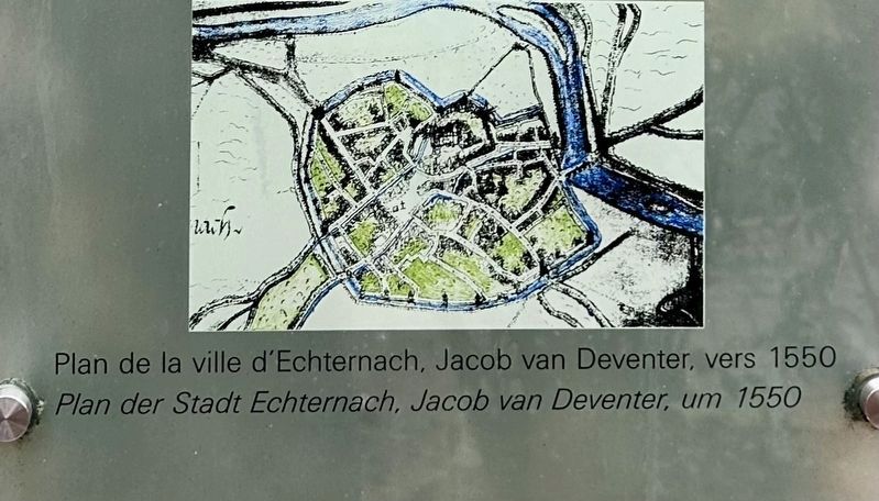
4. Marker inset map
The marker site is located at the southeast (lower right) corner of the town.
Credits. This page was last revised on November 3, 2026. It was originally submitted on November 3, 2026, by Andrew Ruppenstein of Lamorinda, California. This page has been viewed 6 times since then. Photos: 1, 2, 3, 4. submitted on November 3, 2026, by Andrew Ruppenstein of Lamorinda, California.
