Ridgefield in Fairfield County, Connecticut — The American Northeast (New England)
More of the Great Fire
Ridgefield, Connecticut
— The Museum in the Streets —
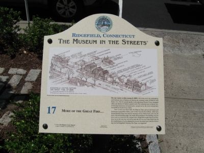
On the Night of December 8, 1895 a fire broke out in the undertaking and furniture store of Bedient & Mead at the northeast corner of Main St. and Bailey Ave. The fire spread rapidly to the adjoining Western Union telegraph office and Barhite & Valden's general store. Fire continued east on Bailey Ave. consuming businesses and apartments, jumped across the street and partially burned Hiram Scott's livery stable.
Next to burn was Town Hall, the Masonic Hall, and several homes and businesses along Main Street. Last to burn was the Scott Block, which also housed Bissell's drug store and the residence of Col. Hiram Scott, who was the town clerk and probate judge. His small office attached to the building was torn down and as a result the fire stopped there. Ridgefield sought help from Danbury, but by the time they arrived by train the fire was out. Long heard cries for the establishment of a fire department were at last acted upon, and the following year the Ridgefield Volunteer Fire Dept. was organized.
Erected 2008 by The Museum in the Streets®. (Marker Number 17.)
Topics and series. This historical marker is listed in these topic lists: Charity & Public Work • Disasters. In addition, it is included in the The Museum in the Streets®: Ridgefield, Connecticut series list. A significant historical date for this entry is December 8, 1981.
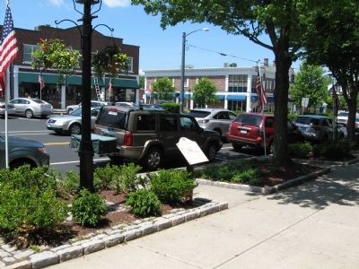
Location. 41° 16.86′ N, 73° 29.898′ W. Marker is in Ridgefield, Connecticut, in Fairfield County. Marker is at the intersection of Main Street (Connecticut Route 35) and Catoonah Street, on the right when traveling north on Main Street. The drawing on the marker shows the location of many of the buildings on Main Street destroyed in the fire. Touch for map. Marker is at or near this postal address: 392 Main Street, Ridgefield CT 06877, United States of America. Touch for directions.
Other nearby markers. At least 8 other markers are within walking distance of this marker. The Village Center in the Early 1900s (within shouting distance of this marker); The Great Fire of 1895 (within shouting distance of this marker); A Much-Loved Old Church and a Watering Trough for Horses (within shouting distance of this marker); Bissell's – Destroyed by Two Conflagrations (within shouting distance of this marker); Ridgefield, Connecticut (within shouting distance of this marker); The Original Episcopal Church (about 300 feet away, measured in a direct line); The First Society of Ridgefield (about 300 feet away); The Livery Stable and the First Catholic Church (about 400 feet away). Touch for a list and map of all markers in Ridgefield.
Credits. This page was last revised on August 7, 2023. It was originally submitted on June 6, 2010, by Michael Herrick of Southbury, Connecticut. This page has been viewed 996 times since then and 38 times this year. Photos: 1, 2. submitted on June 6, 2010, by Michael Herrick of Southbury, Connecticut.

