Ridgefield in Western Region, Connecticut — The American Northeast (New England)
State Police and the Benjamin Franklin School
Ridgefield, Connecticut
| — | The Museum in the Streets | — |
Photographed by Michael Herrick, June 2, 2010
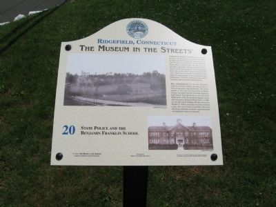
1. State Police and the Benjamin Franklin School Marker
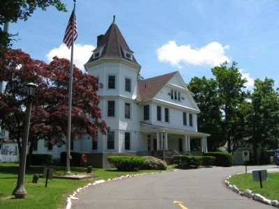
Looking Towards East Ridge from Governor Street, the four buildings on the hill have been an important part of Ridgefield's landscape for the last 100 years. On the left is the George Rockwell home, which, with the house next door was once the Vinton School for Girls. By the 1920s, the Connecticut State Police moved into the Rockwell house and made it their home for the next 50 years. When they relocated to Southbury it became the headquarters for the Ridgefield Police Department. The three buildings to the south of the police station remain private residences.
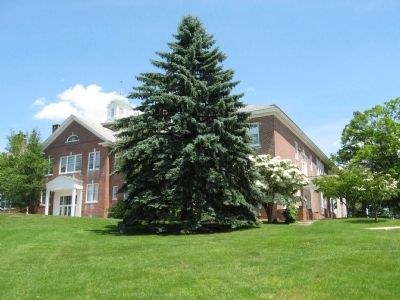
The Cornerstone for the new Benjamin Franklin Grammar School was laid on July 4, 1914 during a day-long celebration. The school opened in 1915, and its former home on Bailey Avenue was turned into the Alexander Hamilton High School. The high school was moved to East Ridge in the 1920s, the building enlarged, and its name changed to Ridgefield High School. In 2001 the old high school building officially became the Richard E. Venus municipal building honoring a man who was a former postmaster, dairyman, selectman, columnist, musician, master-storyteller and Ridgefield's
this page online
Erected by The Museum in the Streets®. (Marker Number 20.)
Topics and series. This historical marker is listed in these topic lists: Education • Notable Buildings. In addition, it is included in the The Museum in the Streets: Ridgefield, Connecticut series list. A significant historical month for this entry is July 1853.
Location. 41° 16.85′ N, 73° 29.625′ W. Marker is in Ridgefield in Western Region, Connecticut. It is at the intersection of Governor Street and East Ridge Street, on the right when traveling east on Governor Street. Touch for map. Marker is in this post office area: Ridgefield CT 06877, United States of America. Touch for directions.

Regionally, this marker is on the Connecticut Shoreline, on the Gold Coast, and in Greater Bridgeport. It is also in the American Northeast and in New England. Globally, it is in North America, the Western Hemisphere, the Western World, and the Anglosphere. Historically, it finds itself in what was once Fairfield County and also one of the original Thirteen Colonies.
Other nearby markers. At least 8 other markers are within walking distance of this
Photographed by Michael Herrick, June 2, 2010
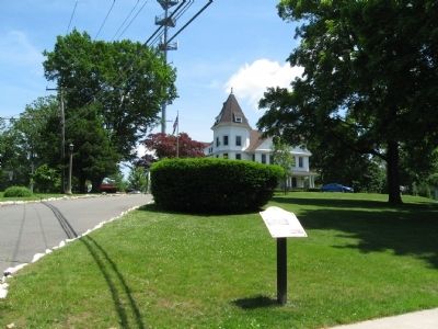
2. State Police and the Benjamin Franklin School Marker
In the background is the Ridgefield Police Headquarters, previously the Connecticut State Police Headquarters, the Vinton School for Girls, and the George Rockwell home.
Another marker is no longer nearby. Bailey Avenue: A Short-Cut to the Train Station (was approx. ¼ mile away but has been confirmed missing).
Related markers. Click here for a list of markers that are related to this marker. Take the Museum in the Streets Walking Tour in Ridgefield, Connecticut.
Photographed by Michael Herrick, June 2, 2010
3. The Ridgefield Police Headquarters
Photographed by Michael Herrick, June 2, 2010
4. The Benjamin Franklin School
Credits. This page was last revised on May 19, 2026. It was originally submitted on June 6, 2010, by Michael Herrick of Southbury, Connecticut. This page has been viewed 1,182 times since then and 26 times this year. Photos: 1, 2, 3, 4. submitted on June 6, 2010, by Michael Herrick of Southbury, Connecticut.
