Lacolle in Montérégie, Québec — Central Canada (French-Canadian)
L'Église Unie de Lacolle
Photographed by Cosmos Mariner, May 19, 2024
1. L'Église Unie de Lacolle Marker

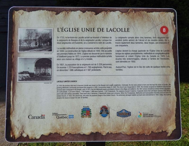
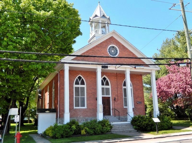
La société méthodiste en pleine croissance achète cette propriété en 1836. La construction de l'église débute en 1842. Elle accueille ses premiers fidèles en 1844. L'église est desservie par le ministre d'Odelltown jusqu'en 1872. Le premier pasteur méthodiste achète alors une maison au village et s'y installe.
En 1851, la population de la seigneurie est de 3 228 personnes. On recense 1 723 francophones et 1 760 anglophones. Parmi eux, on dénombre 1 886 catholiques et 1 597 protestants.
La seigneurie compte alors cinq tavernes, trois magasins qui vendent (entre autres) de l'alcool et six moulins variés. On y trouve également deux tanneries, deux forges, une brasserie et une briqueterie.
L'église devient la charge pastorale de l'Église Unie de Lacolle lorsque les églises presbytérienne, méthodiste et congrégationaliste fusionnent et créent l'Église Unie du Canada en 1925. Les écuries très endommagées, situées à l'arrière
this page online
Aujourd'hui, l'église est le lieu de culte de quelque trente-cinq familles.
In 1733, the territory that was to become Lacolle was known as the Beaujeu and Lacolle seigniories. Eventually, the two were joined to form one that kept the name of Lacolle. The growing Methodist community purchased this property in 1836. Construction began in 1842. The church was inaugurated in 1844. The minister assigned at Odelltown ensured that services were conducted in this temple, until, in 1872, the first Methodist pastor purchased a house in the village and settled in. The 1851 census revealed an evenly divided population. Of 3,228 people, 1,723 were French, 1,760 English, 1,886 were Catholic, 1,597 Protestants. The seigniory housed 5 taverns, 3 separate stores that sold liquor (among other things) and 6 mills with various specialties. There were also 2 tanneries, 2 blacksmith shops and a brewery. When the Presbyterian, Methodist and Episcopalian Churches joined to form the United Church, in 1925, this church too, fell under the pastoral charge of the United Church. The extremely
Photographed by Cosmos Mariner, May 19, 2024
2. L'Église Unie de Lacolle
The marker is beside the sidewalk, directly in front of the church entrance.
Erected by Tourisme Saint-Jean-sur-Richelieu & région. (Marker Number 8.)
Topics. This historical marker is listed in these topic lists: Religion & Religious Structures • Settlements & Settlers. A significant historical year for this entry is 1844.
Location. 45° 4.862′ N, 73° 22.369′ W. Marker is in Lacolle, Québec, in Montérégie. It is at the intersection of Rue de l'Église Nord (Québec Route 221) and Rue Van Vliet, on the right when traveling south on Rue de l'Église Nord. The marker is beside the sidewalk, directly in front of the church entrance. Touch for map. Marker is at or near this postal address: 1 Rue de l'Église Nord, Lacolle QC J0J 1J0, Canada. Touch for directions.

Regionally, this marker is in Greater Montréal. It is also in Central Canada. Globally, it is in North America, the Western Hemisphere, and the Western World. Historically, it finds itself in what was once a British colony, the Viceroyalty of New France, the Haudenosaunee (Iroquois) Confederacy, and Rupert’s Land.
Other nearby markers. At least 8 other markers are within 3 kilometers of this marker, measured as the crow flies: Hôtel de ville de Lacolle (a few steps from this marker); Lacolle War Memorial (within shouting distance of this marker); La bataille du pont de Lacolle (about 150 meters away, measured in a direct line); Église Notre-Dame-du-Mont-Carmel (approx. 0.2 kilometers away); Blockhaus de la Rivière-Lacolle (approx. 2.7 kilometers away); a different marker also named Blockhaus de la Rivière-Lacolle (approx. 2.7 kilometers away); Bataille du Moulin de Lacolle / Battle of the Lacolle Mill (approx. 2.7 kilometers away); Saint-Bernard-de-Lacolle Historique (approx. 3.1 kilometers away). Touch for a list and map of all markers in Lacolle.
Credits. This page was last revised on November 5, 2026. It was originally submitted on November 5, 2026, by Cosmos Mariner of Cape Canaveral, Florida. This page has been viewed 3 times since then. Photos: 1, 2. submitted on November 5, 2026, by Cosmos Mariner of Cape Canaveral, Florida.
