Castlefield in Manchester in Greater Manchester, England, United Kingdom — Northwestern Europe (the British Isles)
The Roman Fort
Photographed by Ian Lefkowitz, September 14, 2026
1. The Roman Fort Marker
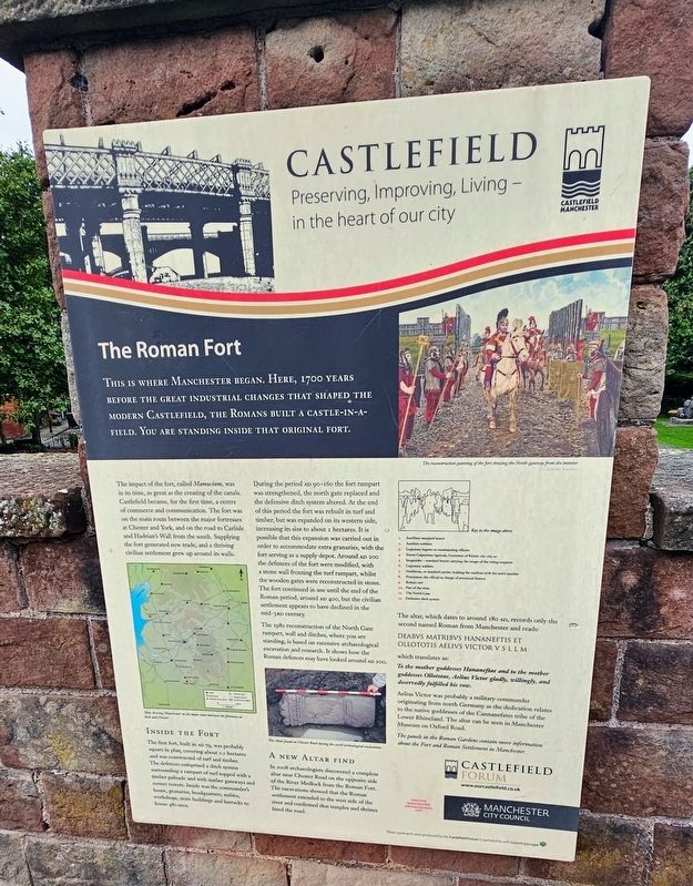
This is where Manchester began. Here, 1,700 years before the great industrial changes that shaped the modern Castlefield, the Romans built a castle-in-a-field. You are standing inside that original fort.
The impact of the fort, called Mamucium, was in its time, as great as the creating of the canals. Castlefield became, for the first time, a centre of commerce and communication. The fort was on the main route between the major fortresses at Chester and York, and on the road to Carlisle and Hadrian’s Wall from the south. Supplying the fort generated new trade, and a thriving civilian settlement grew up around its walls.
Inside the Fort
The first fort, built in AD 79, was probably square in plan, covering about 1.2 hectares and was constructed of turf and timber. The defences comprised a ditch system surrounding a rampart of turf topped with a timber palisade and with timber gateways and corner towers. Inside was the commander’s house, granaries, headquarters, stables, workshops, store buildings and barracks to house 480 men.
During the period AD 90–160 the fort rampart was strengthened, the north gate replaced
this page online
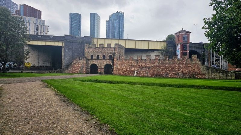
The 1982 reconstruction of the North Gate rampart, wall and ditches, where you are standing, is based on extensive archaeological excavation and research. It shows how the Roman defences may have looked around AD 200.
A New Altar Find
In 2008 archaeologists discovered a complete altar near Chester Road on the opposite side of the River Medlock from the Roman Fort. The excavations showed that the Roman settlement extended to the west side of the river and confirmed that temples and shrines lined the road.
The altar, which dates
Photographed by Ian Lefkowitz, September 14, 2026
2. The Roman Fort Marker
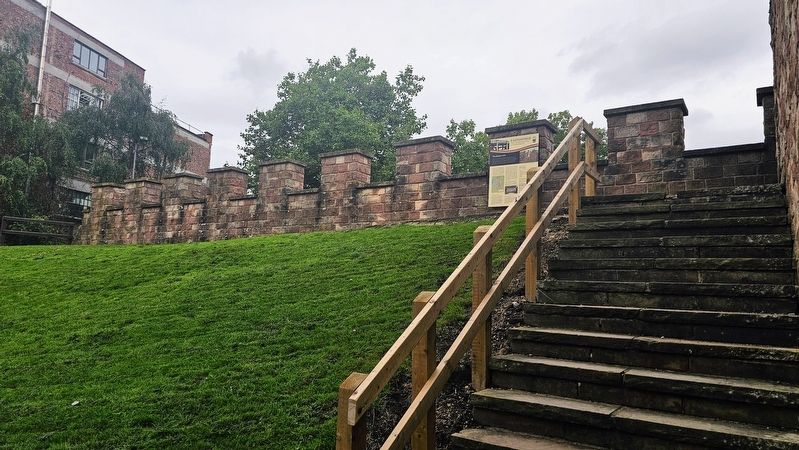
The marker is found on the south side of the reconstructed fort, at the top of a staircase.
DEABVS MATRIBVS HANANEFTIS ET OLLOTOTIS AELIVS VICTOR V S L L M
which translates as:
“To the mother goddesses Hananeftae and to the mother goddesses Ollototae, Aelius Victor gladly, willingly, and deservedly fulfilled his vow.”
Aelius Victor was probably a military commander originating from north Germany as the dedication relates to the native goddesses of the Cannanefates tribe of the Lower Rhineland. The altar can be seen in Manchester Museum on Oxford Road.
The panels in the Roman Gardens contain more information about the Fort and Roman Settlement in Manchester.
(Captions)
The reconstruction painting of the fort showing the North gateway from the interior © Graham Sumner
Key to the image above
1. Auxiliary standard bearer • 2. Auxiliary soldiers • 3. Legionary legates or commanding officers • 4. Sextus Calpurnius Agricola, Governor of Britain 162–165 AD • 5. Imaginifer — standard bearer carrying the image of the ruling emperor • 6. Legionary soldiers • 7. Vexillarius, or standard carrier, holding the vexillum with his unit’s number • 8. Procurator, the official in charge of provincial finance • 9. Roman cart • 10. Part of the vicus • 11. The North Gate • 12. Defensive ditch system
Map showing Manchester on the main route between the fortresses at York and Chester
The Altar found on Chester Road during the 2008 archaeological excavations
Erected by Castlefield
Photographed by Ian Lefkowitz, September 14, 2026
3. Mamucium
The reconstructed Roman fort was completed in 1982.
Topics. This historical marker is listed in this topic list: Forts and Castles. A significant historical year for this entry is 79 CE.
Location. 53° 28.527′ N, 2° 15.238′ W. Marker is in Manchester, England, in Greater Manchester. It is in Castlefield. It can be reached from the intersection of Duke Street and Beaufort Street, on the right when traveling north. The marker is located in Castlefield Urban Heritage Park. Touch for map. Marker is at or near this postal address: 28 Duke Street, Manchester, England M3 4NH, United Kingdom. Touch for directions.

Regionally, this marker is in North West England. Globally, it is on the Atlantic Ocean, in the North Atlantic Region, in Europe, in Atlantic Europe, on one of the British Isles, in the Western World, and in the Anglosphere. Historically, it finds itself in what was once the Roman Empire.
Other nearby markers. At least 8 other markers are within walking distance of this marker: The North Gate / Roman Settlement in Manchester (within shouting distance of this marker); Western Wall & Roman Granary (within shouting distance of this marker); Roman Manchester / Welcome to Castlefield (about 90 meters away, measured in a direct line); Campfield Markets & Fairs / Liverpool Road (about 120 meters away); Two Cylinder Crossley Engine (about 150 meters away); Pioneer Quay / Welcome to Castlefield (about 150 meters away); The Goods Office / 1830 Viaduct (about 210 meters away); John Owens (approx. 0.3 kilometers away). Touch for a list and map of all markers in Manchester.
Credits. This page was last revised on November 6, 2026. It was originally submitted on November 6, 2026, by Ian Lefkowitz of New York, New York. This page has been viewed 7 times since then. Photos: 1, 2, 3. submitted on November 6, 2026, by Ian Lefkowitz of New York, New York. • Andrew Ruppenstein was the editor who published this page.
