
Jackson in Aiken County, South Carolina — The American South (South Atlantic)
Silver Bluff Baptist Church
Photographed by Mike Stroud, 2010
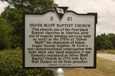
1. Silver Bluff Baptist Church Marker
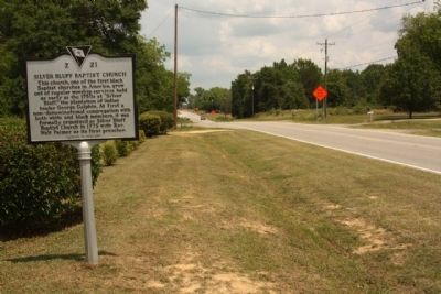
This church, one of the first black Baptist churches in America, grew out of regular worship services held as early as the 1750s at "Silver Bluff," the plantation of Indian trader George Galphin. At first a non-denominational congregation with both white and black members, it was formally organized as Silver Bluff Baptist Church in 1773 with Rev. David George as its first minister.
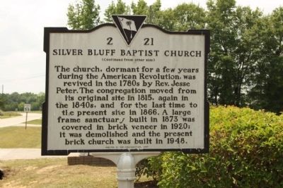
(Reverse text):
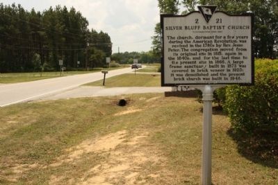
The church, dormant for a few years during the American Revolution, was revived in the 1780s by Rev. Jesse Peter. The congregation moved from its original site in 1815, again in the 1840s, and for the last time to the present site in 1866. A large frame sanctuary built in 1873 was covered in brick veneer in 1920; it was demolished and the present brick church was built in 1948.
Erected 2001 by The Congregation. (Marker Number 2-21.)
Topics. This historical marker is listed in these topic lists: African Americans • Religion & Religious Structures. A significant historical year for this entry is 1773.
Location. 33° 24.606′ N, 81° 53.51′ W. Marker is in Jackson, South Carolina, in Aiken County. It is on Old Jackson
this page online

Regionally, this marker is in Greater Augusta and in the Midlands. It is also in the American South and specifically in the Deep South. Globally, it is in North America, the Western Hemisphere, the Western World, and the Anglosphere. Historically, it finds itself in what was once the territory of the Mississippian Culture, one of the original Thirteen Colonies, one of the Confederate States of America, and the Antebellum South.
Other nearby markers. At least 10 other markers are within 6 miles of this marker, measured as the crow flies: Farm Equipment in the Twentieth Century (approx. 1½ miles away); Redcliffe Plantation (approx. 1½ miles away); Beech Island Baptist Church (approx. 1.9 miles away); Historic Church (approx. 2 miles away); Downer Institute & School / Downer School, 1924–1986 (approx. 2 miles away); Savannah Town / Fort Moore
Photographed by Mike Stroud, May 16, 2010
2. Silver Bluff Baptist Church Marker, reverse side
Another marker is no longer nearby. Beech Island Agricultural Club (was approx. 1.8 miles away but has been confirmed missing).
Also see . . . George Galphin. George Galphin (1708–1780) was an American Indian trader, Indian Commissioner, and plantation owner who lived and conducted business in the colonies of Georgia and South Carolina, primarily around the Augusta, Georgia area today. (Submitted on January 9, 2011, by Brian Scott of Anderson, South Carolina.)
Photographed by Mike Stroud, May 16, 2010
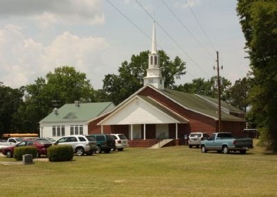
3. Silver Bluff Baptist Church
Photographed by Mike Stroud, May 16, 2010
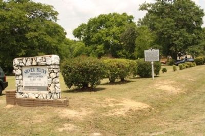
4. Silver Bluff Baptist Church Marker
Photographed by Mike Stroud, May 16, 2010
5. Silver Bluff Baptist Church Marker, looking north along Old Jackson Highway (State Road 2-5)
Photographed by Mike Stroud, May 16, 2010
6. Silver Bluff Baptist Church Marker, looking south
Credits. This page was last revised on October 13, 2020. It was originally submitted on June 7, 2010, by Mike Stroud of Bluffton, South Carolina. This page has been viewed 3,474 times since then and 94 times this year. Photos: 1, 2, 3, 4, 5, 6. submitted on June 7, 2010, by Mike Stroud of Bluffton, South Carolina.
