Saint-Jean-sur-Richelieu in Le Haut-Richelieu, Québec — Central Canada (French-Canadian)
Fort Saint-Jean and the Expedition of 1666
Photographed by Kevin Craft, November 3, 2026
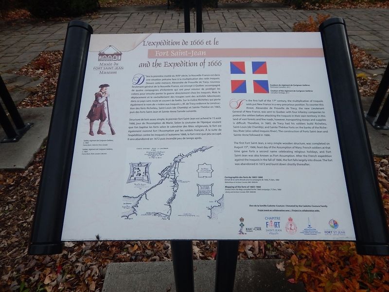
1. Fort Saint-Jean and the Expedition of 1666 Marker
In the first half of the 17th century, the multiplication of Iroquois raids put New France in a very precarious position. To counter this threat, Alexandre de Prouville de Tracy, the new Lieutenant General of New France, was sent to Quebec with four infantry companies to protect the settlers before attacking the Iroquois in their own territory. In this land of vast forests and few roads, however, transporting troops and supplies is difficult. Therefore, in 1665, de Tracy had his soldiers build Richelieu, Saint-Louis (de Chambly), and Sainte-Thérèse Forts on the banks of the Richelieu River (also called Iroquois River). The construction of Forts Saint-Jean and Sainte-Anne followed in 1666.
The first Fort Saint-Jean, a very simple wooden structure, was completed on August 15th, 1666, feast day of the Assumption of Mary. French soldiers at that time gave forts a second name celebrating religious holidays, and Fort Saint-Jean was also known as Fort Assumption. After the French expedition against the Iroquois in the fall of 1666, the fort falls largely into disuse. The fort was abandoned in 1672 and burnt down shortly thereafter.
{French text}
L’expédition de 1666 et le Fort Saint-Jean
Dans
this page online
Structure de bois assez simple, le premier fort Saint-Jean est achevé le 15 août 1666, jour de l’Assomption de Marie. Selon la coutume de l’époque voulant que l’on baptise les forts selon le calendrier des fêtes religieuses, le fort est également nommé fort l’Assomption par les soldats français. À la suite de l’expédition contre les Iroquois à l’automne 1666, le fort
Photographed by Kevin Craft, November 3, 2026
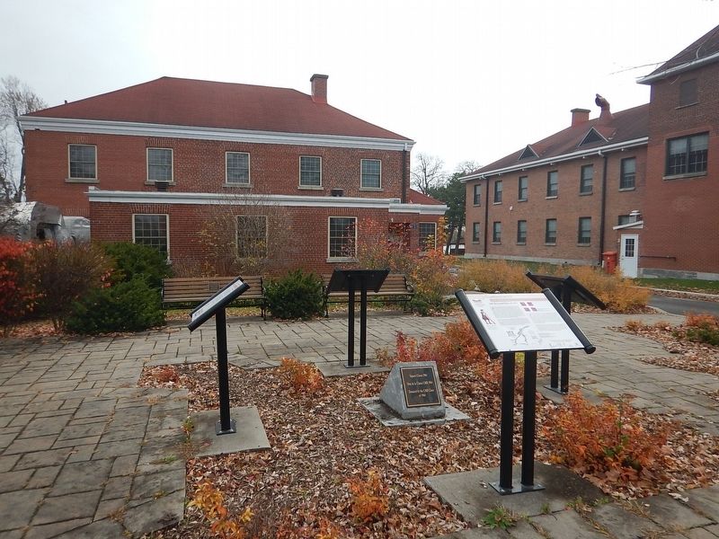
2. Wideview of Fort Saint-Jean and the Expedition of 1666 Marker
Erected by Musée du Fort Saint-Jean Museum and the CMR class of 1964.
Topics. This historical marker is listed in these topic lists: Forts and Castles • Settlements & Settlers. A significant historical date for this entry is August 15, 1666.
Location. 45° 17.967′ N, 73° 15.106′ W. Marker is in Saint-Jean-sur-Richelieu, Québec, in Le Haut-Richelieu. It is at the intersection of Rue Jacques-Cartier Nord and rue des Remparts, on the right when traveling north on Rue Jacques-Cartier Nord. Marker is located on the campus of the Collège Militaire Royale (CMR), just in front of the Fort Saint-Jean Museum. Touch for map. Marker is at or near this postal address: 15 rue Jacques-Cartier Nord, Saint-Jean-sur-Richelieu QC J3B 8R8, Canada. Touch for directions.

Regionally, this marker is in Greater Montréal. It is also in Central Canada. Globally, it is in North America, the Western Hemisphere, and the Western World. Historically, it finds itself in what was once a British colony, the Viceroyalty of New France, the Haudenosaunee (Iroquois) Confederacy, and Rupert’s Land.
Other nearby markers. At least 8 other markers are within 2 kilometers of this marker, measured as the crow flies: Fort Saint-Jean and the reconstruction of 1776 (here, next to this marker); Fort Saint-Jean and the fortifications of 1748 (here, next to this marker); Fort Saint-Jean and the American invasion of 1775 (here, next to this marker); Fort Saint-Jean (about 150 meters away, measured in a direct line); a different marker also named Fort Saint-Jean (about 210 meters away); First Railway in Canada (approx. 0.4 kilometers away); Former Grand Trunk Railway Station (approx. 0.4 kilometers away); Iberville War Memorial (approx. 1.6 kilometers away). Touch for a list and map of all markers in Saint-Jean-sur-Richelieu.
More about this marker. The campus of the Collège Militaire Royale (CMR)(and the museum) is open to the public year round BY APPOINTMENT ONLY.
Credits. This page was last revised on November 8, 2026. It was originally submitted on November 8, 2026, by Kevin Craft of Bedford, Quebec. This page has been viewed 4 times since then. Photos: 1, 2. submitted on November 8, 2026, by Kevin Craft of Bedford, Quebec.
