Saint-Jean-sur-Richelieu in Le Haut-Richelieu, Québec — Central Canada (French-Canadian)
Fort Saint-Jean and the fortifications of 1748
Photographed by Kevin Craft, November 3, 2026
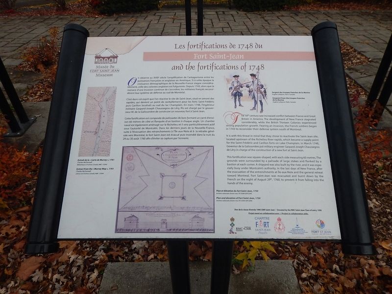
1. Fort Saint-Jean and the fortifications of 1748 Marker
The 18th century saw increased conflict between France and Great Britain in America. The development of New France stagnated considerably, while the British Thirteen Colonies experienced strong population growth. Fearing an invasion, the French soldiers began in 1743 to reconsider their defense system south of Montreal.
It is with this threat in mind that they chose to reactivate the Saint-Jean site, located upstream of the Richelieu River rapids, which became a supply point for the Saint-Frédéric and Carillon forts on Lake Champlain. In March 1748, Governor de la Galissonière put military engineer Gaspard-Joseph Chaussegros de Léry in charge of the construction of a new fort at Saint-Jean.
This fortification was square-shaped, with each side measuring 60 metres. The grounds were surrounded by a palisade of large stakes and flanked by a bastion at each corner. A shipyard was also built by the river, and it was especially busy under Montcalm’s authority. In the last days of New France, after the evacuation of the entrenchments at Île-aux-Noix and the general retreat toward Montreal, Fort Saint-Jean was evacuated and burnt
this page online
{French text}
Les fortifications de 1748 du Fort Saint-Jean
On observe au XVIIIe siècle l’amplification de l’antagonisme entre les puissances françaises et anglaises en Amérique. Si à cette époque la croissance démographique de la Nouvelle-France stagne considérablement, celle des colonies anglaises est fulgurante. Depuis 1743, alors que la menace d’une invasion continue de s’accroître, les militaires français reconsidèrent leur système de défense au sud de Montréal.
C’est dans cet esprit que l’on réactive le site de Saint-Jean, situé en amont des rapides, qui devient un point de ravitaillement pour les forts Saint-Frédéric puis Carillon localisés au sud du lac Champlain. En mars 1748, l’ingénieur militaire Gaspard-Joseph Chaussegros de Léry, fils est chargé par le gouverneur M. de la Galissonière de construire un nouveau fort à Saint-Jean.
Cette fortification est composée de palissades de bois formant un carré d’environ 60 mètres de côté et flanquée d’un bastion à chaque angle. Un chantier naval est également aménagé sur le Richelieu
Photographed by Kevin Craft, November 3, 2026
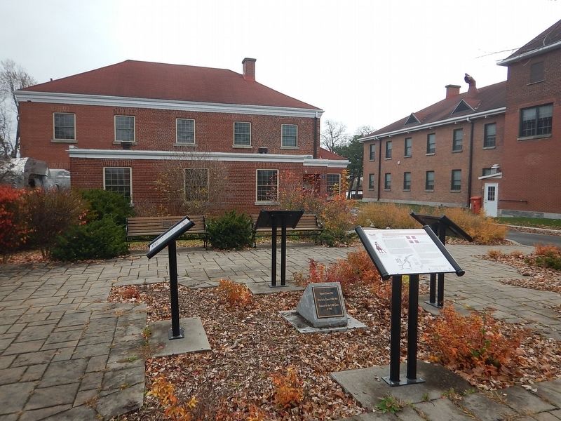
2. Wideview of Fort Saint-Jean and the fortifications of 1748 Marker
Erected by Musée du Fort Saint-Jean Museum and the CMR class of 1964.
Topics. This historical marker is listed in these topic lists: Forts and Castles • Settlements & Settlers. A significant historical date for this entry is August 29, 1760.
Location. 45° 17.965′ N, 73° 15.104′ W. Marker is in Saint-Jean-sur-Richelieu, Québec, in Le Haut-Richelieu. It is at the intersection of Rue Jacques-Cartier Nord and rue des Remparts, on the right when traveling north on Rue Jacques-Cartier Nord. Marker is located on the campus of the Collège Militaire Royale (CMR), just in front of the Fort Saint-Jean Museum. Touch for map. Marker is at or near this postal address: 15 rue Jacques-Cartier Nord, Saint-Jean-sur-Richelieu QC J3B 8R8, Canada. Touch for directions.

Regionally, this marker is in Greater Montréal. It is also in Central Canada. Globally, it is in North America, the Western Hemisphere, and the Western World. Historically, it finds itself in what was once a British colony, the Viceroyalty of New France, the Haudenosaunee (Iroquois) Confederacy, and Rupert’s Land.
Other nearby markers. At least 8 other markers are within 2 kilometers of this marker, measured as the crow flies: Fort Saint-Jean and the American invasion of 1775 (here, next to this marker); Fort Saint-Jean and the Expedition of 1666 (here, next to this marker); Fort Saint-Jean and the reconstruction of 1776 (here, next to this marker); Fort Saint-Jean (about 150 meters away, measured in a direct line); a different marker also named Fort Saint-Jean (about 210 meters away); First Railway in Canada (approx. 0.4 kilometers away); Former Grand Trunk Railway Station (approx. 0.4 kilometers away); Iberville War Memorial (approx. 1.6 kilometers away). Touch for a list and map of all markers in Saint-Jean-sur-Richelieu.
More about this marker. The campus of the Collège Militaire Royale (CMR)(and the museum) is open to the public year round BY APPOINTMENT ONLY.
Credits. This page was last revised on November 8, 2026. It was originally submitted on November 8, 2026, by Kevin Craft of Bedford, Quebec. This page has been viewed 3 times since then. Photos: 1, 2. submitted on November 8, 2026, by Kevin Craft of Bedford, Quebec.
