Saint-Jean-sur-Richelieu in Le Haut-Richelieu, Québec — Central Canada (French-Canadian)
Fort Saint-Jean and the American invasion of 1775
Photographed by Kevin Craft, November 3, 2026
1. Fort Saint-Jean and the American invasion of 1775 Marker
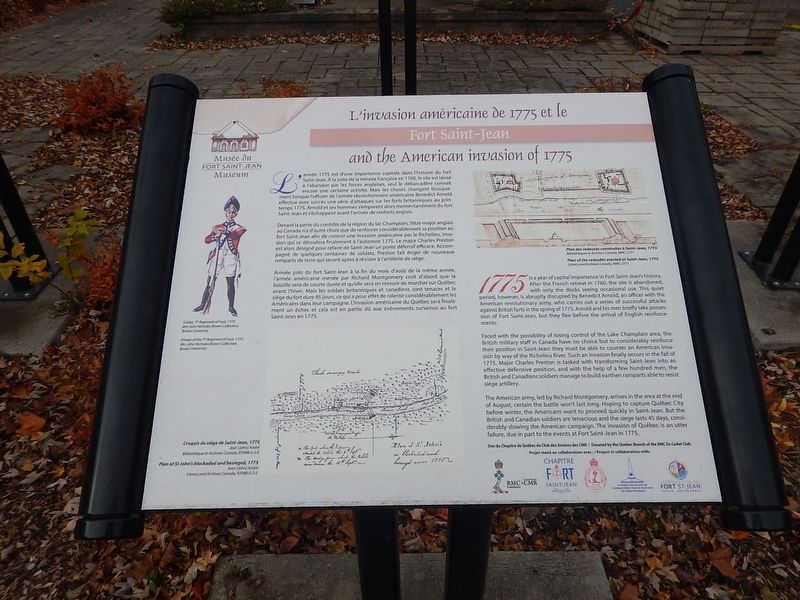
1775 is a year of capital importance in Fort Saint-Jean’s history. After the French retreat in 1760, the site is abandoned, with only the docks seeing occasional use. This quiet period, however, is abruptly disrupted by Benedict Arnold, an officer with the American revolutionary army, who carries out a series of successful attacks against British forts in the spring of 1775. Arnold and his men briefly take possession of Fort Saint-Jean, but they flee before the arrival of English reinforcements.
Faced with the possibility of losing control of the Lake Champlain area, the British military staff in Canada have no choice but to considerably reinforce their position in Saint-Jean: they must be able to counter an American invasion by way of the Richelieu River. Such an invasion finally occurs in the fall of 1775. Major Charles Preston is tasked with transforming Saint-Jean into an effective defensive position, and with the help of a few hundred men, the British and Canadians soldiers manage to build earthen ramparts able to resist siege artillery.
The American army, led by Richard Montgomery, arrives in the area at the end of
this page online
{French text}
L’invasion américaine de 1775 et le Fort Saint-Jean
L’année 1775 est d’une importance capitale dans l’histoire du fort Saint-Jean. À la suite de la retraite française en 1760, le site est laissé à l’abandon par les forces anglaises, seul le débarcadère connaît encore une certaine activité. Mais les choses changent brusquement lorsque l’officier de l’armée révolutionnaire américaine Benedict Arnold effectue avec succès une série d’attaques sur les forts britanniques au printemps 1775. Arnold et ses hommes s’emparent alors momentanément du fort Saint-Jean et s’échappent avant l’arrivée de renforts anglais.
Devant la perte du contrôle de la région du lac Champlain, l’état-major anglais au Canada n’a d’autre choix que de renforcer considérablement sa position au fort Saint-Jean
Photographed by Kevin Craft, November 3, 2026
2. Wideview of Fort Saint-Jean and the American invasion of 1775 Marker
Arrivée près du fort Saint-Jean à la fin du mois d’août de la même année, l’armée américaine menée par Richard Montgomery croit d’abord que la bataille sera de courte durée et qu’elle sera en mesure de marcher sur Québec avant l’hiver. Mais les soldats britanniques et canadiens sont tenaces et le siège du fort dure 45 jours, ce qui a pour effet de ralentir considérablement les Américains dans leur campagne. L’invasion américaine du Québec sera finalement un échec et cela est en partie dû aux évènements survenus au fort Saint-Jean en 1775.
Erected by Musée du Fort Saint-Jean Museum and the CMR class of 1964.
Topics. This historical marker is listed in these topic lists: Forts and Castles • War, US Revolutionary. A significant historical year for this entry is 1775.
Location. 45° 17.967′ N, 73° 15.103′ W. Marker is in Saint-Jean-sur-Richelieu, Québec, in Le Haut-Richelieu. It is at the intersection of Rue Jacques-Cartier Nord and rue des Remparts, on the right when traveling north on Rue Jacques-Cartier Nord. Marker is located on the campus of the Collège Militaire Royale (CMR), just in front of the Fort Saint-Jean Museum. Touch for map. Marker is at or near this postal address: 15 rue Jacques-Cartier Nord, Saint-Jean-sur-Richelieu QC J3B 8R8, Canada. Touch for directions.

Regionally, this marker is in Greater Montréal. It is also in Central Canada. Globally, it is in North America, the Western Hemisphere, and the Western World. Historically, it finds itself in what was once a British colony, the Viceroyalty of New France, the Haudenosaunee (Iroquois) Confederacy, and Rupert’s Land.
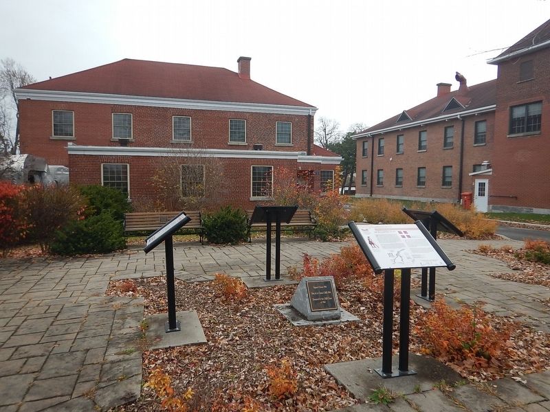
Other nearby markers. At least 8 other markers are within 2 kilometers of this marker, measured as the crow flies: Fort Saint-Jean and the reconstruction of 1776 (here, next to this marker); Fort Saint-Jean and the fortifications of 1748 (here, next to this marker); Fort Saint-Jean and the Expedition of 1666 (here, next to this marker); Fort Saint-Jean (about 150 meters away, measured in a direct line); a different marker also named Fort Saint-Jean (about 210 meters away); First Railway in Canada (approx. 0.4 kilometers away); Former Grand Trunk Railway Station (approx. 0.4 kilometers away); Iberville War Memorial (approx. 1.6 kilometers away). Touch for a list and map of all markers in Saint-Jean-sur-Richelieu.
More about this marker. The campus of the Collège Militaire Royale (CMR)(and the museum) is open to the public year round BY APPOINTMENT ONLY.
Credits. This page was last revised on November 8, 2026. It was originally submitted on November 8, 2026, by Kevin Craft of Bedford, Quebec. This page has been viewed 3 times since then. Photos: 1, 2. submitted on November 8, 2026, by Kevin Craft of Bedford, Quebec.
