Saint-Jean-sur-Richelieu in Le Haut-Richelieu, Québec — Central Canada (French-Canadian)
Fort Saint-Jean and the reconstruction of 1776
Photographed by Kevin Craft, November 3, 2026
1. Fort Saint-Jean and the reconstruction of 1776 Marker
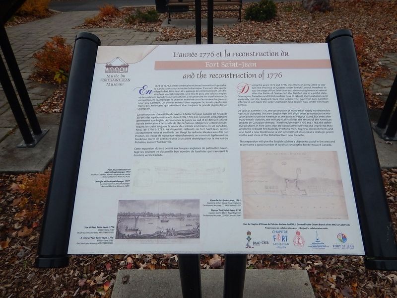
During the years 1775 and 1776, the American army failed to capture the Province of Quebec under British control. Needless to say, the siege of Fort Saint-Jean and the ensuing American retreat after the Battle of Quebec left the fortified site in a pitiful state. Once again, Canadian and British soldiers have to rebuild the installations and especially put the boatyard back into action. The governor Guy Carleton intends to win back the large Champlain lake region now under American control.
As soon as summer 1776, the construction of many small highly manoeuvrable vessels is launched. This new English fleet will allow them to continue the war south and to crush the American at the Battle of Valcour Island. But even after many British victories, the military staff still fear the return of the American soldiers on Canadian territory. Therefore, between 1776 and 1783, the defensive positions in Fort Saint-Jean are continually reviewed and improved: they widen the redoubt first build by Preston’s men, dig new entrenchments and also build a new blockhouse (a sort of small fort situated at a strategic point) on the east shore
this page online
This expansion will give the English soldiers a chance to patrol in the area and to welcome a good number of loyalist crossing the border toward Canada.
{French text}
L’année 1776 et la reconstruction du Fort Saint-Jean
En 1775 et 1776, l’armée américaine échoue à envahir et à prendre le Canada alors sous contrôle britannique. Il va sans dire que le siège du fort Saint-Jean et le passage des Américains ont laissé le site dans un état pitoyable. Une fois de plus, des soldats anglais et des miliciens canadiens se sont affairés à reconstruire les installations et à complètement réaménager le chantier maritime sous les ordres du gouverneur Guy Carleton. Ce dernier entend bien regagner le terrain perdu aux mains des Américains qui contrôlent alors toujours la grande région du lac Champlain.
La construction d’une flotte de navires à faible tonnage capable de naviguer au-delà des rapides est lancée durant l’été 1776. Ces nouvelles embarcations permettent aux Anglais de poursuivre la guerre au sud et de détruire la force navale américaine à la bataille de l’île de Valcour. Malgré les victoires britanniques,
Photographed by Kevin Craft, November 3, 2026
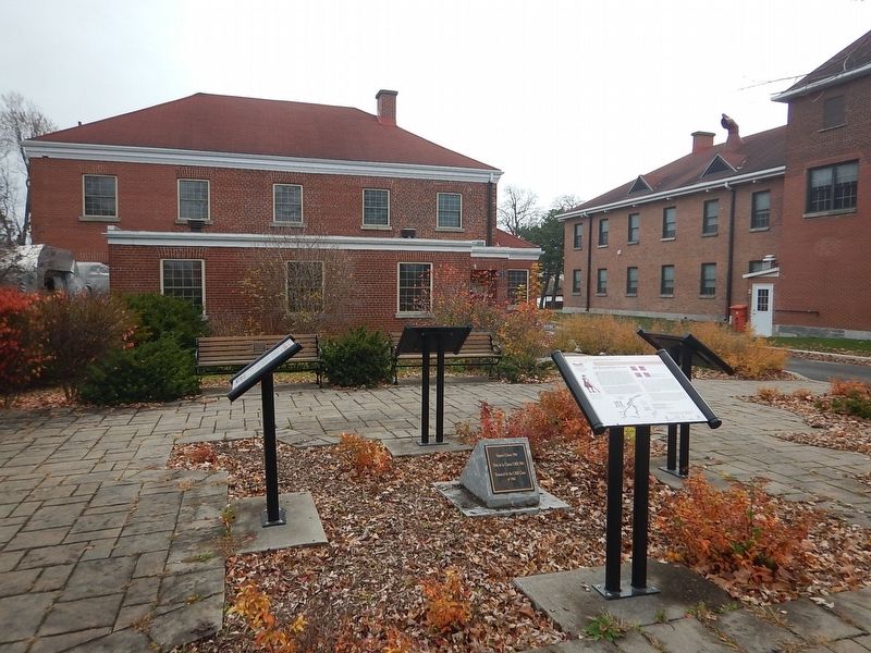
2. Wideview of Fort Saint-Jean and the reconstruction of 1776 Marker
Cette expansion du fort permit aux troupes anglaises de patrouiller davantage les environs et d’accueillir bon nombre de loyalistes qui traversent la frontière vers le Canada.
Erected by Musée du Fort Saint-Jean Museum and the CMR class of 1964.
Topics. This historical marker is listed in these topic lists: Forts and Castles • Settlements & Settlers • War, US Revolutionary. A significant historical year for this entry is 1775.
Location. 45° 17.968′ N, 73° 15.104′ W. Marker is in Saint-Jean-sur-Richelieu, Québec, in Le Haut-Richelieu. It is at the intersection of Rue Jacques-Cartier Nord and rue des Remparts, on the right when traveling north on Rue Jacques-Cartier Nord. Marker is located on the campus of the Collège Militaire Royale (CMR), just in front of the Fort Saint-Jean Museum. Touch for map. Marker is at or near this postal address: 15 rue Jacques-Cartier Nord, Saint-Jean-sur-Richelieu QC J3B 8R8, Canada. Touch for directions.

Regionally, this marker is in Greater Montréal. It is also in Central Canada. Globally, it is in North America, the Western Hemisphere, and the Western World. Historically, it finds itself in what was once a British colony, the Viceroyalty of New France, the Haudenosaunee (Iroquois) Confederacy, and Rupert’s Land.
Other nearby markers. At least 8 other markers are within 2 kilometers of this marker, measured as the crow flies: Fort Saint-Jean and the American invasion of 1775 (here, next to this marker); Fort Saint-Jean and the Expedition of 1666 (here, next to this marker); Fort Saint-Jean and the fortifications of 1748 (here, next to this marker); Fort Saint-Jean (about 150 meters away, measured in a direct line); a different marker also named Fort Saint-Jean (about 210 meters away); First Railway in Canada (approx. 0.4 kilometers away); Former Grand Trunk Railway Station (approx. 0.4 kilometers away); Iberville War Memorial (approx. 1.6 kilometers away). Touch for a list and map of all markers in Saint-Jean-sur-Richelieu.
More about this marker. The campus of the Collège Militaire Royale (CMR)(and the museum) is open to the public year round BY APPOINTMENT ONLY.
Credits. This page was last revised on November 8, 2026. It was originally submitted on November 8, 2026, by Kevin Craft of Bedford, Quebec. This page has been viewed 5 times since then. Photos: 1, 2. submitted on November 8, 2026, by Kevin Craft of Bedford, Quebec.
