Saint-Jean-sur-Richelieu in Le Haut-Richelieu, Québec — Central Canada (French-Canadian)
CF-104 Starfighter
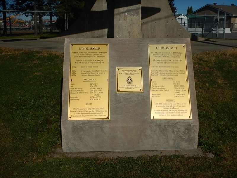
Photographed by Kevin Craft, October 21, 2026
1. CF-104 Starfighter Marker
The CF-104, which is derived from the Lockheed F-104 Starfighter, was assembled under license by Canadair and powered by the Oranda built J-79 GE/OEL turbojet engine.
The CF-104 was in service with the RCAF/CF from 1961 to 1986 in Canada and Europe, most recently with:
417 Sqn: Operational Training in Canada
421 Sqn, 439 Sqn, 441 Sqn: Air-to-ground attack Tactical Fighter with NATO in Germany, Technical support was provided by 1 Aerospace Maintenance Squadron
CHARACTERISTICS
Length 16.7 m / 55 ft
Span 6.7 m / 22 ft
Weight (max take-off) 12 180 kg / 26 800 lbs
Thrust (in after-burner) 7 180 kg / 15 830 lbs
Max speed (36 000 ft / 11 000 m) 2 220 km/h / 1 380 mph (Mach 2)
Service ceiling 16 770 m / 55 000 ft
Operation range 1 200 km / 745 mi
HISTORY
CF 104784 entered service in May 1962 and was retired in Europe on 26 February 1985 with more than 3 300 hours flying time. It was then displayed at CFB Lahr until Spring 1993. It was moved to 16 Wing, upon Canadian Forces Europe closure.
Topics. This historical marker is listed in this topic list: Military. A significant historical date for this entry is February 26, 1985.
Location. 45° 17.997′ N, 73° 16.763′ W.
this page online

Regionally, this marker is in Greater Montréal. It is also in Central Canada. Globally, it is in North America, the Western Hemisphere, and the Western World. Historically, it finds itself in what was once a British colony, the Viceroyalty of New France, the Haudenosaunee (Iroquois) Confederacy, and Rupert’s Land.
Other nearby markers. At least 8 other markers are within 3 kilometers of this marker, measured as the crow flies: Former Grand Trunk Railway Station (approx. 2 kilometers away); Fort Saint-Jean (approx. 2 kilometers away); First Railway in Canada (approx. 2 kilometers away); a different marker also named Fort Saint-Jean (approx. 2.1 kilometers away); Fort Saint-Jean and the Expedition of 1666 (approx.
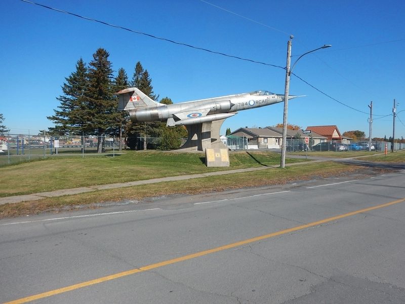
Photographed by Kevin Craft, October 21, 2026
2. Wideview of CF-104 Starfighter Marker
Credits. This page was last revised on November 9, 2026. It was originally submitted on November 9, 2026, by Kevin Craft of Bedford, Quebec. This page has been viewed 2 times since then. Photos: 1, 2. submitted on November 9, 2026, by Kevin Craft of Bedford, Quebec.
