Near Richmond in Madison County, Kentucky — The American South (East South Central)
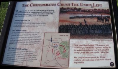
The Confederates Crush The Union Left
Manson's Fragile Union Line
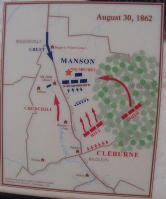
General Mahlon Manson, the Union commander, saw the Confederates advancing toward the left end of his line. He kept shifting his line east all morning, hoping to counter an expected attack. He did not see the other Confederate force hidden by the ravine west of the road.
Two Confederate Assaults
The first Confederate assault came from the ravine and hit the Union left, halting near the base of the knoll. As the main Confederate advance began, a second assault was initiated by the Tennessee troops massed in the ravine. The hidden Confederates emerged from the ravine, "howling like the wind" and smashed the stunned and ill-trained Indiana defenders. This attack came just as the weakly held Union flank across the road was disintegrating under the pressure of another Confederate flank attack.
The Union Line Breaks and Runs
These coordinated attacks pushed both ends of the Union line toward the middle. The pressure was too much for the inexperienced Union soldiers. After a very brief stand they fled north in confusion. The second Union column under General Charles Cruft was caught in a whirlwind. Fleeing soldiers swept over Cruft's men and they, too, were swept away by the unstoppable Confederate juggernaut.
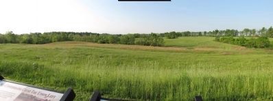
On a small knoll about 125 yards to your southeast, Confederate infantry, hidden by the adjacent ravine to your left, attacked the left left flank and rear of the Union line.
The Confederates routed the Union soldiers, who retreated in disorder toward Rogersville.
Erected by Civil War Discovery Trail.
Topics. This historical marker is listed in this topic list: War, US Civil. A significant historical year for this entry is 1862.
Location. 37° 40.508′ N, 84° 15.075′ W. Marker is near Richmond, Kentucky, in Madison County. The marker is located on the Bluegrass Army Depot. This is a restricted-access area and not accessible to the general public. Touch for map. Marker is in this post office area: Richmond KY 40475, United States of America. Touch for directions.
Other nearby markers. At least 8 other markers are within walking distance of this marker. Manson's First Line (here, next to this marker); Civil War Field Hospital (approx. 0.2 miles away); Mt. Zion Church - Field Hospital (approx. 0.2 miles away); Michigan Light Artillery Regiment / Batteries F and G (approx. 0.2 miles away); Union Artillery (approx. 0.2 miles away); The Skirmishers (approx. 0.4 miles away); Manson's Mistake (approx. 0.6 miles away); A Reckless And Useless Charge (approx. 0.6 miles away). Touch for a list and map of all markers in Richmond.
Credits. This page was last revised on June 16, 2016. It was originally submitted on June 7, 2010, by Lee Hattabaugh of Capshaw, Alabama. This page has been viewed 844 times since then and 16 times this year. Photos: 1, 2, 3. submitted on June 7, 2010, by Lee Hattabaugh of Capshaw, Alabama. • Craig Swain was the editor who published this page.


