
Huntingdon in Cambridgeshire, England, United Kingdom — Northwestern Europe (the British Isles)
Huntingdon Castle Hills
Photographed by Ray Gurganus, May 3, 2026
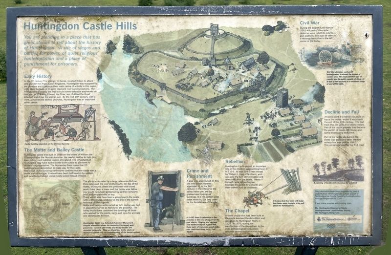
1. Huntingdon Castle Hills Marker
Early History
In the 9th century The Vikings, or Danes, invaded Britain to attack and plunder the Anglo Saxon kingdoms. Huntingdon was occupied by the invaders and it became their main centre of activity in this region, most likely because of its good road and river communications. The Vikings were probably the first to build some defensive earthworks on this site. In 921 King Edward the Elder, son of Alfred the Great, attacked and drove the Vikings out. By the mid 10th century, with a mint, a market and several churches, Huntingdon was an important urban centre.
The Motte and Bailey Castle
Huntingdon castle was built in 1068 on the orders of William the Conqueror after the Norman invasion. He needed castles to help him keep military and political control of England. The inhabitants of Huntingdon may have had to come to the castle to pay taxes to William's representative. The Domesday Book states that 20 dwellings
this page online
The layout of the surviving earthworks confirms that the castle was a motte and bailey type. It would have been built quickly by soldiers and local forced labour, using mostly wood instead of stone.
The site is surrounded by a large defensive ditch on three sides and the river on the fourth. On top of the motte, or mound, where the pine trees now stand would have been a tower and the bailey area below you would have been protected by earthen ramparts with wooden palisades on top.
There would also have been a gatehouse to the castle with a drawbridge, probably at the site of the current entrance off the ringroad.
Motte and bailey castles acted as forts during war, but in peacetime served as homes for the powerful. The bailey would have contained the dwellings of those who worked for the castle, barns and pens for animals and storehouses for food.
Huntingdon Castle is a Scheduled Ancient Monument. Despite alterations down the centuries it is largely well-preserved. Around 600 motte and bailey castles are recorded nationally. They are important to the study of Norman England and
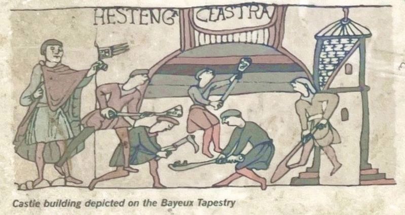
Illustration from the marker
2. Castle building depicted on the Bayeux Tapestry
Crime and Punishment
A gaol was also housed on this site with prison warders appointed up to the 16th century. In the interior of the bailey below you are the grassed-over footings of buildings. It is not certain what these relate to, but they could be the foundations of the gaol.
In 1492 there is reference in the archives to the cost of repair for the gaol stocks: 'Hewing and carriage and workmanship of a great oak, three pairs of iron gives, great bolts, iron chain and three locks, cost 42s8d.'
Rebellion
Huntingdon Castle played an important role in the rebellion against King Henry II in 1174. At that time it was owned by William I, King of Scotland, who was also the Earl of Huntingdon and who sided with the rebels. Henry II himself came to Huntingdon, besieged the castle for a month and then ordered it to be destroyed.
The Chapel
A stone chapel that had been built at the castle survived the demolition and was given to Huntingdon Priory in 1327. In 1975, during the construction of the steps down to the river, archaeological excavations revealed several human burials here.
Civil War
During
Photographed by Ray Gurganus, May 3, 2026
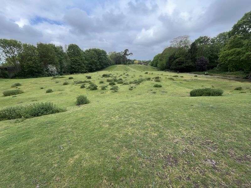
3. Huntingdon Castle Hills
Civil War defences used earth embankments to absorb the impact of cannon shot. The most common type of cannon was the saker, capable of firing a 6lb ball of iron or stone, to a maximum range of over 2000 yards.
Decline and Fall
At some point a windmill was built on top of the motte, where it stood until the end of the 19th century. The cart track that led up to it is clearly visible. Part of the castle grounds then became the garden of Castle Hill House and some landscaping took place.
Part of the castle site behind the motte was destroyed when the first railway line was built in 1847. This cut is now used by the A14 road.
Topics. This historical marker is listed in this topic list: Forts and Castles.
Location. 52° 19.644′ N, 0° 10.766′ W. Marker is in Huntingdon, England, in Cambridgeshire. It can be reached from Castle Moat Road, on the left when traveling west. Touch for map. Marker is in this post office area: Huntingdon, England PE29 3TL, United Kingdom. Touch for directions.

Regionally, this marker is in East Anglia. Globally, it is on the Atlantic Ocean, in the North Atlantic Region, in Europe, in Atlantic Europe, on one of the British Isles, in the Western World, and in the Anglosphere. Historically, it finds itself in what was once the Roman Empire.
Other nearby markers. At least 8 other markers are within walking distance of this marker: Market Hill (approx. half a kilometer away); Oliver Cromwell (approx. half a kilometer away); Oliver Cromwell and Huntingdon (approx. half a kilometer away); King Charles I (approx. 0.6 kilometers away); Commonwealth War Graves (approx. 0.7 kilometers away); Notable Burials (approx. 0.7 kilometers away); Sebastopol Cannon (approx. 0.7 kilometers away); The Great Northern Railway Disaster (approx. 0.7 kilometers away). Touch for a list and map of all markers in Huntingdon.
Credits. This page was last revised on November 11, 2026. It was originally submitted on November 10, 2026, by Ray Gurganus of Washington, District of Columbia. This page has been viewed 9 times since then. Photos: 1, 2, 3. submitted on November 10, 2026, by Ray Gurganus of Washington, District of Columbia. • Andrew Ruppenstein was the editor who published this page.
Editor’s want-list for this marker. photo of the marker within its surroundings • Can you help?
