
Betchworth in Surrey, England, United Kingdom — Northwestern Europe (the British Isles)
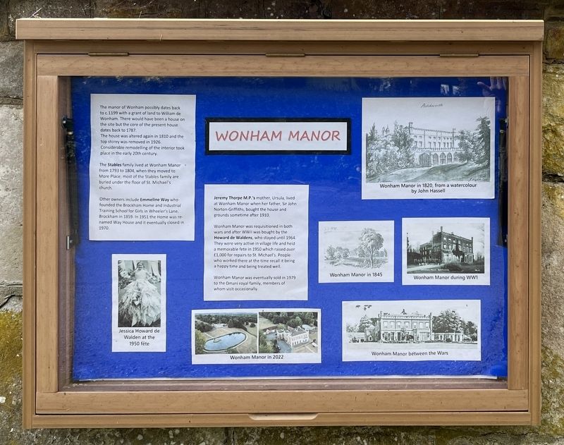
Wonham Manor
Photographed by Ray Gurganus, April 14, 2026
1. Wonham Manor Marker
The house was altered again in 1810 and the top story was removed in 1926. Considerable remodelling of the interior took place in the early 20th century.
The Stables family lived at Wonham Manor from 1793 to 1804, when they moved to More Place; most of the Stables family are buried under the floor of St. Michael's church.
Other owners include Emmeline Way who founded the Brockham Home and industrial Training School for Girls in Wheeler's Lane, Brockham in 1859. In 1951 the Home was renamed Way House and it eventually closed in 1970.
Jeremy Thorpe MP's mother, Ursula, lived at Wonham Manor when her father, Sir John Norton-Griffiths, bought the house and grounds sometime after 1910.
Wonham Manor was requisitioned in both wars and after WWII was bought by the Howard de Waldens, who stayed until 1964 They were very active in village life and held a memorable fete in 1950 which raised over £1,000 for repairs to St. Michael's.
this page online
Wonham Manor was eventually sold in 1979 to the Omani royal family, members of whom visit occasionally.
Topics. This historical marker is listed in this topic list: Notable Buildings. A significant historical year for this entry is 1199.
Location. 51° 14.059′ N, 0° 16.073′ W. Marker is in Betchworth, England, in Surrey. It is on Church Street, on the right when traveling south. Touch for map. Marker is at or near this postal address: 3 Church Street, Betchworth, England RH3 7DP, United Kingdom. Touch for directions.

Regionally, this marker is in the Greater South East. Globally, it is on the Atlantic Ocean, in the North Atlantic Region, in Europe, in Atlantic Europe, on one of the British Isles, in the Western World, and in the Anglosphere. Historically, it finds itself in what was once the Roman Empire.
Other nearby markers. At least 8 other markers are within 5 kilometers of this marker, measured as the crow flies: Welcome to Betchworth (approx. 1.6 kilometers away); Thomas Cubitt (approx. 4 kilometers away); Willow Walk, Meadowbank
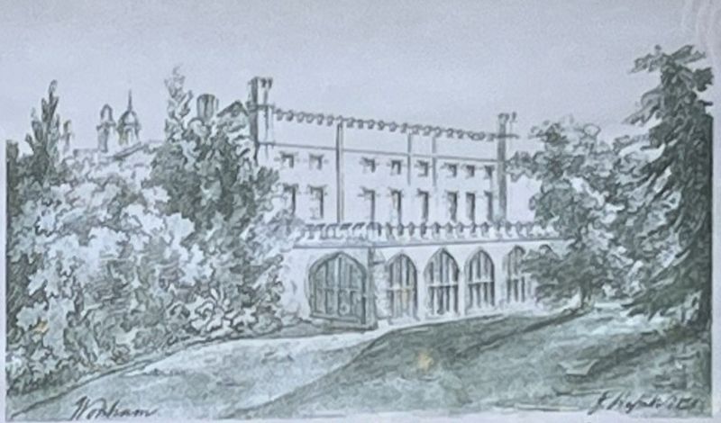
Illustration from the marker, April 14, 2026
2. Wonham Manor in 1820, from a watercolour by John Hassell
Credits. This page was last revised on November 11, 2026. It was originally submitted on November 10, 2026, by Ray Gurganus of Washington, District of Columbia. This page has been viewed 7 times since then. Photos: 1, 2. submitted on November 10, 2026, by Ray Gurganus of Washington, District of Columbia. • Andrew Ruppenstein was the editor who published this page.
Editor’s want-list for this marker. photo of the marker within its surroundings • Can you help?
