Blenheim in Marlboro County, South Carolina — The American South (South Atlantic)
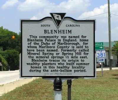
Blenheim
Erected 1973 by Marlboro County Historic Preservation Commission. (Marker Number 35-16.)
Topics. This historical marker is listed in these topic lists: Notable Places • Political Subdivisions.
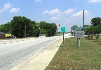
Location. 34° 30.618′ N, 79° 39.174′ W. Marker is in Blenheim, South Carolina, in Marlboro County. Marker is at the intersection of South Main Street (State Highway 38) and East High Street (State Highway 381), on the right when traveling north on South Main Street. Touch for map. Marker is in this post office area: Blenheim SC 29516, United States of America. Touch for directions.
Other nearby markers. At least 8 other markers are within 7 miles of this marker, measured as the crow flies. Robert Blair Campbell / John Campbell (here, next to this marker); Battle of Hunt's Bluff / Old River Road (approx. 4.1 miles away); Brownsville Baptist Church (approx. 4.9 miles away); Blenheim Mineral Springs (approx. 5.1 miles away); Brownsville Church (approx. 5.8 miles away); Grave of Mason Lee / Will of Mason Lee (approx. 6.2 miles away); Frederick Charles Hans Bruno Poellnitz / Ragtown (approx. 6.4 miles away); Barnabas Kelet Henagan Home Site (approx. 6.6 miles away). Touch for a list and map of all markers in Blenheim.
Also see . . . Blenheim History >> Blenheim Ginger Ale. (Submitted on June 7, 2010, by PaulwC3 of Northern, Virginia.)
Credits. This page was last revised on June 16, 2016. It was originally submitted on June 7, 2010, by PaulwC3 of Northern, Virginia. This page has been viewed 1,354 times since then and 75 times this year. Photos: 1, 2, 3. submitted on June 7, 2010, by PaulwC3 of Northern, Virginia.


