
King's Lynn in Norfolk, England, United Kingdom — Northwestern Europe (the British Isles)
Red Mount Chapel
| — | The Walks | — |
Photographed by Ray Gurganus, April 29, 2026
1. Red Mount Chapel Marker
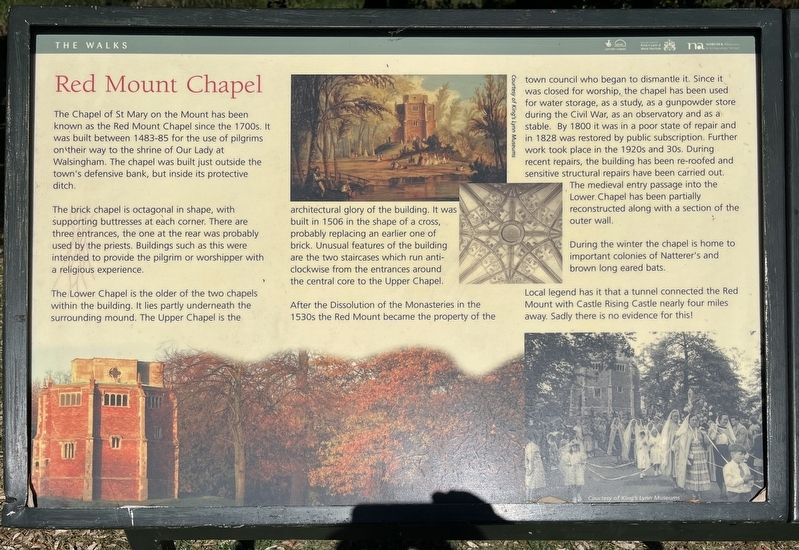
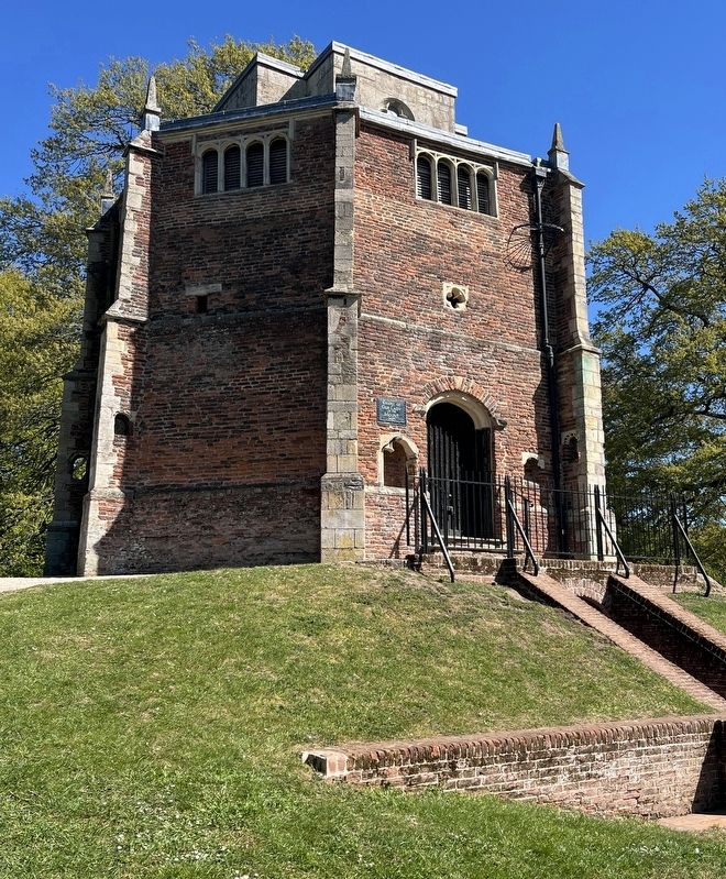
The brick chapel is octagonal in shape, with supporting buttresses at each corner. There are three entrances, the one at the rear was probably used by the priests. Buildings such as this were intended to provide the pilgrim or worshipper with a religious experience.
The Lower Chapel is the older of the two chapels within the building. It lies partly underneath the surrounding mound. The Upper Chapel is the architectural glory of the building. It was built in 1506 in the shape of a cross, probably replacing an earlier one of brick. Unusual features of the building are the two staircases which run anti-clockwise from the entrances around the central core to the Upper Chapel.
After the Dissolution of the Monasteries in the 1530s the Red Mount became the property of the town council who began to dismantle it. Since it was closed
this page online
During the winter the chapel is home to important colonies of Natterer's and brown long eared bats.
Local legend has it that a tunnel connected the Red Mount with Castle Rising Castle nearly four miles away. Sadly there is no evidence for this!
Erected by Borough Council of King's Lynn & West Norfolk.
Topics. This historical marker is listed in this topic list: Religion & Religious Structures. A significant historical year for this entry is 1483.
Location. 52° 45.129′ N, 0° 24.318′ E. Marker is in King's Lynn, England, in Norfolk. It can be reached from Blackfriars Road. The marker is located in The Walks, along the Red
Photographed by Ray Gurganus, April 29, 2026
2. Red Mount Chapel

Regionally, this marker is in East Anglia. Globally, it is on the Atlantic Ocean, in the North Atlantic Region, in Europe, in Atlantic Europe, on one of the British Isles, in the Western World, and in the Anglosphere. Historically, it finds itself in what was once the Roman Empire and also the Hanseatic League.
Other nearby markers. At least 8 other markers are within walking distance of this marker: St John's Walk (about 210 meters away, measured in a direct line); St James' Park (approx. 0.3 kilometers away); a different marker also named St James' Park (approx. 0.3 kilometers away); St James' Chapel (approx. 0.3 kilometers away); Exploring Greyfriars Tower (approx. 0.4 kilometers away); Tower Gardens (approx. 0.4 kilometers away); King's Lynn Greyfriars 1538 (approx. 0.4 kilometers away); Greyfriars Tower (approx. 0.4 kilometers away). Touch for a list and map of all markers in King's Lynn.
Credits. This page was last revised on November 12, 2026. It was originally submitted on November 12, 2026, by Ray Gurganus of Washington, District of Columbia. This page has been viewed 6 times since then. Photos: 1, 2. submitted on November 12, 2026, by Ray Gurganus of Washington, District of Columbia. • Andrew Ruppenstein was the editor who published this page.
