
King's Lynn in Norfolk, England, United Kingdom — Northwestern Europe (the British Isles)
Exploring Greyfriars Tower

Photographed by Ray Gurganus, April 29, 2026
1. Exploring Greyfriars Tower Marker
When the friary was closed in 1538, much of it was demolished in 1577 many cartloads of stone were taken from here to the Town Hall, to build a new prison.
The tower was kept as a sea-mark, to help ships locate their position when navigating the Wash and the River Ouse. It has been a distinctive feature of King's Lynn ever since.
The engraving (below) shows the lower from the north in the 1670s. At that time, the archways were filled in and floors inserted to form a house.
The windmill behind the tower, built in 1655, was owned until 1728 by the family of Henry Bell, the architect of Lynn's classical Custom House.
Beyond the windmill you can see the tower s of All Saints Church which collapsed in 1763.
In the drawing (left), made in 1808 by Edward Edwards, you can see a surviving part of the cloisters and the remains of a chimney, built against the side of the Tower.
The buildings under the lower, and some adjacent cottages, had just been removed.
The six-sided tower and staircase
this page online
Illustration Captions
These windows gave light to the walking place. They are four metres high and were originally glazed.
The ground floor walls, of 13th century date, are of carstone, ginger in colour, which may have been quarried locally from either Middleton or Blackborough End.
This small turret contains a steep circular stairway.
Notice the battlements and weathervane at roof level.
This top chamber held a single bell.
This door led to the space above the ceiling of the choir.
This archway was rebuilt after 1450 It lay between the choir and the walking place.
Erected by Borough Council of King's Lynn & West Norfolk.
Topics. This historical marker is listed in this topic list: Religion & Religious Structures.
Location. 52° 45.078′ N, 0° 23.999′ E. Marker is in King's Lynn, England, in Norfolk. It is at the intersection of Saint James Road and St James Street, on the left when traveling north on Saint James Road. The marker is located
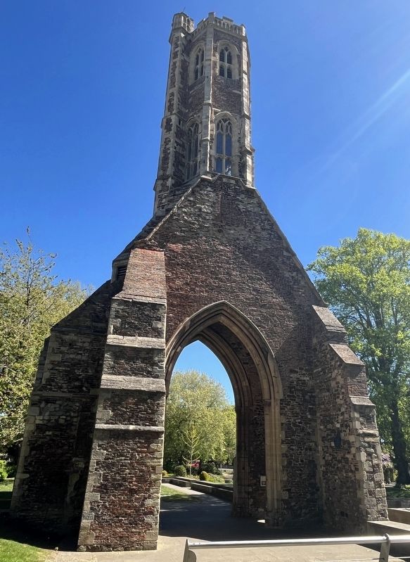
Photographed by Ray Gurganus, April 29, 2026
2. Greyfriars Tower

Regionally, this marker is in East Anglia. Globally, it is on the Atlantic Ocean, in the North Atlantic Region, in Europe, in Atlantic Europe, on one of the British Isles, in the Western World, and in the Anglosphere. Historically, it finds itself in what was once the Roman Empire and also the Hanseatic League.
Other nearby markers. At least 8 other markers are within walking distance of this marker: Tower Gardens (within shouting distance of this marker); St James' Chapel (within shouting distance of this marker); King's Lynn Greyfriars 1538 (within shouting distance of this marker); St James' Park (within shouting distance of this marker); Greyfriars Tower (within shouting distance of this marker); Greyfriars, King's Lynn (about 90 meters away, measured in a direct line); All Saints Church (about 180 meters away); a different marker also named St James' Park (about 210 meters away). Touch for a list and map of all markers in King's Lynn.
Credits. This page was last revised on November 12, 2026. It was originally submitted on November 12, 2026, by Ray Gurganus of Washington, District of Columbia. This page has been viewed 9 times since then. Photos: 1, 2. submitted on November 12, 2026, by Ray Gurganus of Washington, District of Columbia. • Andrew Ruppenstein was the editor who published this page.
