
King's Lynn in Norfolk, England, United Kingdom — Northwestern Europe (the British Isles)
All Saints Church
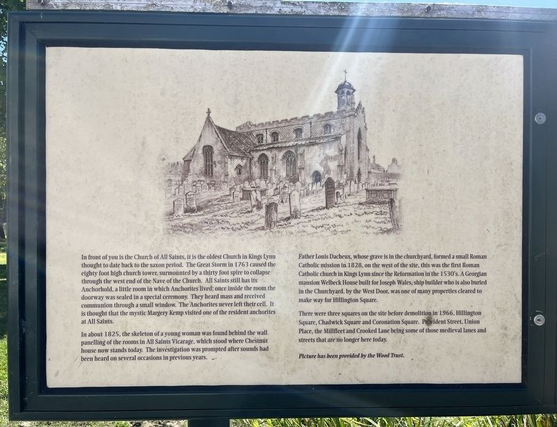
Photographed by Ray Gurganus, April 29, 2026
1. All Saints Church Marker
In about 1825, the skeleton of a young woman was found behind the wall panelling of the rooms in All Saints Vicarage, which stood where Chestnut house now stands today. The investigation was prompted after sounds had been heard on several occasions in previous years.
Father Louis Dacheux, whose grave is in the churchyard, formed a small Roman Catholic mission in 1828, on the west of the site, this was the first Roman Catholic church in Kings Lynn since the Reformation in the 1530's. A Georgian mansion
this page online
There were three squares on the site before demolition in 1966, Hillington Square, Chadwick Square and Coronation Square. Provident Street, Union Place, the Millfleet and Crooked Lane being some of those medieval lanes and streets that are no longer here today.
Topics. This historical marker is listed in this topic list: Religion & Religious Structures.
Location. 52° 44.99′ N, 0° 23.929′ E. Marker is in King's Lynn, England, in Norfolk. It is on Hillington Square. Touch for map. Marker is at or near this postal address: 24 Hillington Square, King's Lynn, England PE30 5JE, United Kingdom. Touch for directions.

Regionally, this marker is in East Anglia. Globally, it is on the Atlantic Ocean, in the North Atlantic Region, in Europe, in Atlantic Europe, on one of the British Isles, in the Western World, and in the Anglosphere. Historically, it finds itself in what was once the Roman Empire and
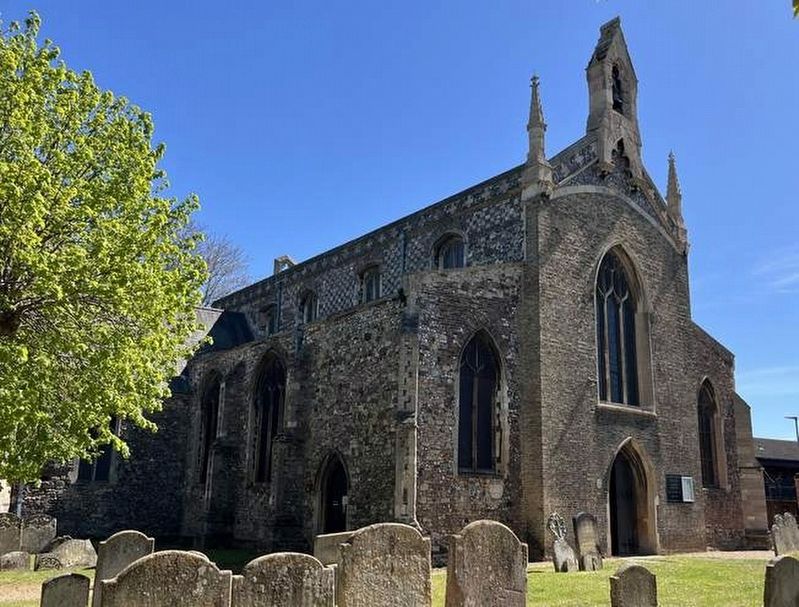
Photographed by Ray Gurganus, April 29, 2026
2. All Saints Church
Other nearby markers. At least 8 other markers are within walking distance of this marker: Tower Gardens (about 150 meters away, measured in a direct line); King's Lynn Greyfriars 1538 (about 150 meters away); Ladybridge (about 150 meters away); Greyfriars Tower (about 180 meters away); Exploring Greyfriars Tower (about 180 meters away); Greyfriars, King's Lynn (about 180 meters away); St James' Chapel (about 210 meters away); St James' Park (about 240 meters away). Touch for a list and map of all markers in King's Lynn.
Credits. This page was last revised on November 12, 2026. It was originally submitted on November 12, 2026, by Ray Gurganus of Washington, District of Columbia. This page has been viewed 7 times since then. Photos: 1, 2. submitted on November 12, 2026, by Ray Gurganus of Washington, District of Columbia. • Andrew Ruppenstein was the editor who published this page.
