
Halesworth in Suffolk, England, United Kingdom — Northwestern Europe (the British Isles)
The Angel Yard Maltings
Halesworth - a historic malt town
| — | The Malt Heritage Trail | — |
Photographed by Ray Gurganus, April 20, 2026
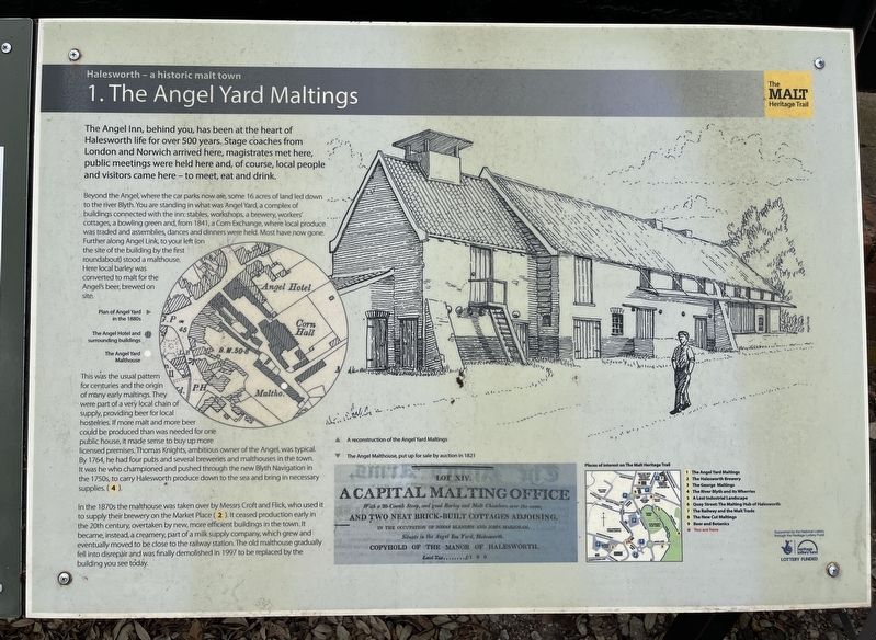
1. The Angel Yard Maltings Marker
Beyond the Angel, where the car parks now are, some 16 acres of land led down to the river Blyth. You are standing in what was Angel Yard, a complex of buildings connected with the inn: stables, workshops, a brewery, workers' cottages, a bowling green and from 1841, a Corn Exchange, where local produce was traded and assemblies, dances and dinners were held. Most have now gone. Further along Angel Link to your left on the site of the building by the first roundabout stood a malthouse. Here local barley was converted to malt for the Angel's beer, brewed on site.
This was the usual patter for centuries and the origin of many early maltings. They were part of a very local chain of supply, providing beer for local hostelries. If more malt and more beer could be produced than was needed for one public house, it made sense to buy up more licensed premises.
this page online
In the 1870s the malthouse was taken over by Messrs Croft and Flick, who used it to supply their brewery on the Market Place (2). It ceased production early in the 20th century, overtaken by new, more efficient buildings in the town. It became, instead, a creamery, part of a milk supply company, which grew and eventually moved to be close to the railway station. The old malthouse gradually fell into disrepair and was finally demolished in 1997 to be replaced by the building you see today. (Marker Number 1.)
Topics. This historical marker is listed in these topic lists: Food & Drink • Industry & Commerce.
Location. 52° 20.581′ N, 1° 30.149′ E. Marker is in Halesworth, England, in Suffolk. It is at the intersection of Thoroughfare and Angel Link, on the right when traveling east on Thoroughfare. Touch for map. Marker is at or near this postal address: 30 Thoroughfare, Halesworth, England IP19 8AP, United Kingdom. Touch for directions.

Regionally, this marker is in East Anglia. Globally, it is on the Atlantic Ocean, in the North Atlantic Region, in Europe, in Atlantic Europe, on one of the British Isles, in the Western World, and in the Anglosphere. Historically, it finds itself in what was once the Roman Empire.
Other nearby markers. At least 8 other markers are within walking distance of this marker: Discover our historic market town (here, next to this marker); Over the Centuries (within shouting distance of this marker); Discover in and around the Thoroughfare (about 90 meters away, measured in a direct line); Discover in and around the Market Place (about 90 meters away); Church of St Mary the Virgin (about 90 meters away); Discover two ways to explore the town (about 210 meters away); The Old Rectory; Land Girls (about 210 meters away); Discover what used to be here (approx. 0.3 kilometers away). Touch for a list and map of all markers in Halesworth.
Credits. This page was last revised on November 19, 2026. It was originally submitted on November 14, 2026, by Ray Gurganus of Washington, District of Columbia. This page has been viewed 5 times since then. Photo 1. submitted on November 14, 2026, by Ray Gurganus of Washington, District of Columbia. • Andrew Ruppenstein was the editor who published this page.
Editor’s want-list for this marker. photo of the marker within its surroundings • Can you help?
