
Hamburg-Mitte in Hamburg-Mitte, Germany — Central Europe
Flakturm
⎯⎯⎯
Flak Tower
Photographed by James Hulse
1. Flakturm / Flak Tower Marker

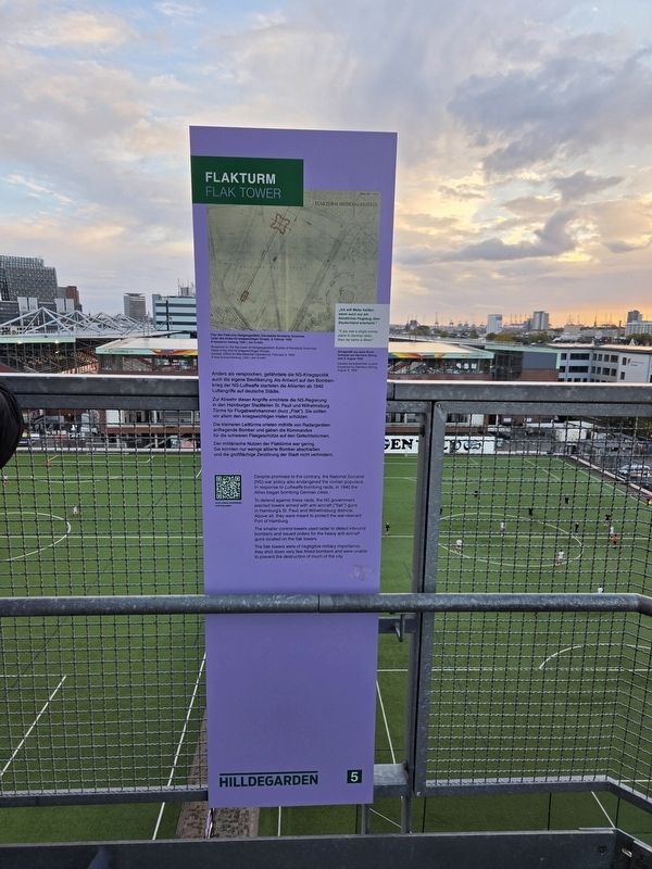
Zur Abwehr dieser Angriffe errichtete die NS-Regierung in den Hamburger Stadtteilen St. Pauli und Wilhelmsburg Türme für Flugabwehrkanonen (kurz „Flak“). Sie sollten vor allem den kriegswichtigen Hafen schützen.
Die kleineren Leittürme orteten mithilfe von Radargeräten anfliegende Bomber und gaben die Kommandos für die schweren Flakgeschütze auf den Gefechtstürmen.
Der militärische Nutzen der Flaktürme war gering. Sie konnten nur wenige alliierte Bomber abschießen und die großflächige Zerstörung der Stadt nicht verhindern.
„Ich will Meier heißen, wenn auch nur ein feindliches Flugzeug über Deutschland erscheint.“
Sinngemäß aus einer Rundfunkrede von Hermann Göring vom 9. August 1939
Plan des Flakturms Heiligengeistfeld, Dienststelle Konstanty Gutschow, Leiter des Amtes für kriegswichtigen Einsatz, 9. Februar 1942
© Staatsarchiv Hamburg, 7200-1_344-15-A355
this page online
To defend against these raids, the NS government erected towers armed with anti-aircraft (“flak”) guns in Hamburg’s St. Pauli and Wilhelmsburg districts. Above all, they were meant to protect the war-relevant Port of Hamburg.
The smaller control towers used radar to detect inbound bombers and issued orders for the heavy anti-aircraft guns located on the flak towers.
The flak towers were of negligible military importance; they shot down very few Allied bombers and were unable to prevent the destruction of much of the city.
“If you see a single enemy plane in German skies, then my name is Meier.”
Loosely translated from a radio broadcast by Hermann Göring, August 9, 1939
Blueprints for the flak tower at Heiligengeistfeld, Bureau of Konstanty Gutschow, Head of the Amt für kriegswichtigen Einsatz (loosely: Office for War-essential Operations), February 9, 1942
© State Archives Hamburg, 7200-1_344-15-A355
Erected by Hilldegarden e.V. (Marker Number 5.)
Topics.
Photographed by James Hulse, October 10, 2026
2. Flakturm / Flak Tower Marker
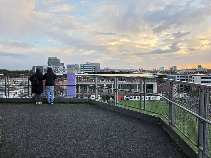
Location. 53° 33.378′ N, 9° 58.156′ E. Marker is in Hamburg, in Hamburg-Mitte. It is in Hamburg-Mitte. It is on Feldstraße just west of Heiligengeistfeld, on the left when traveling west. The markers are placed along the Hamburg Bunker’s exterior staircase. Touch for map. Marker is at or near this postal address: Feldstraße 66, Hamburg 20357, Germany. Touch for directions.

Regionally, it is in Europe, the European Union, Atlantic Europe, Central Europe, the Schengen Area, Western Europe, and the Western World. Historically, it finds itself in what was once the Holy Roman Empire, the Hanseatic League, and the former West Germany.
Other nearby markers. At least 8 other markers are within walking distance of this marker: Trümmerräumung / Removing Debris (within shouting distance of this marker); Beschreibung Flakturm IV / Description of the Flak Tower IV (within shouting distance of this marker); Bau des Flakturms IV / Construction of the Flak Tower IV (within shouting distance of this
Photographed by James Hulse, October 10, 2026
3. Flakturm / Flak Tower Marker
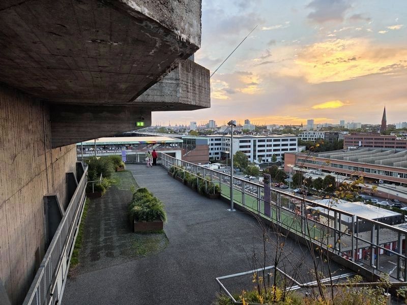
Marker 5 is on the far left, and marker 6 is on the right.
More about this marker. The former flak tower is now the Hamburg Bunker, a complex with a hotel, restaurants, music and event spaces, and a rooftop garden. An exterior walkway leads upward past historical panels explaining its wartime history.
Photographed by James Hulse, October 10, 2026
4. Flakturm / Flak Tower
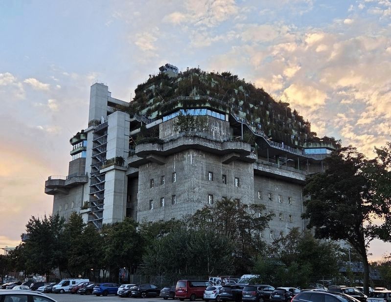
The view of the Flak Tower from the street.
Credits. This page was last revised on November 17, 2026. It was originally submitted on November 16, 2026, by James Hulse of Medina, Texas. This page has been viewed 5 times since then. Photos: 1, 2, 3, 4. submitted on November 17, 2026, by James Hulse of Medina, Texas.
