
Near Lamoni in Decatur County, Iowa — The American Midwest (Upper Plains)
Spurrier School
Community of Christ
Photographed by Jason Voigt, October 19, 2026
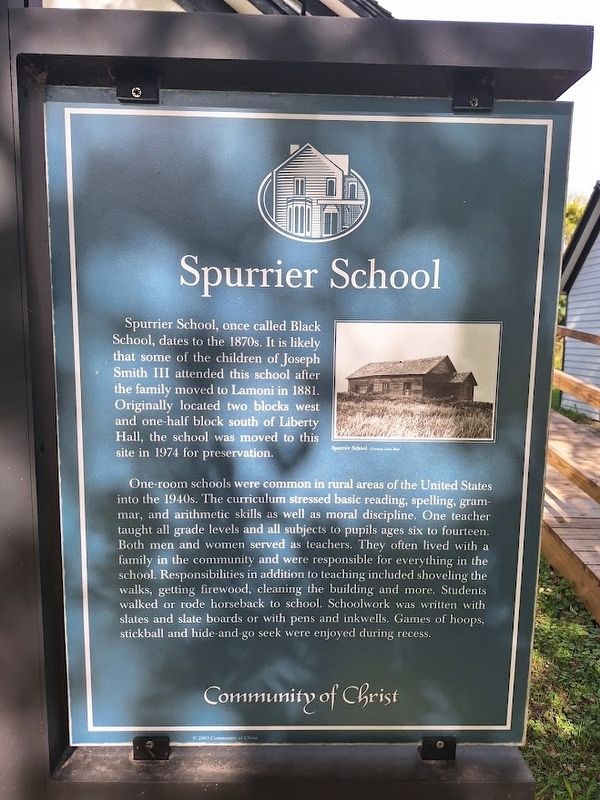
1. Spurrier School Marker
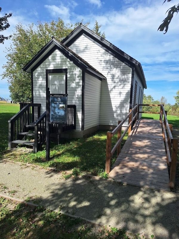
Spurrier School, once called Black School, dates to the 1870s. It is likely that some of the children of Joseph Smith III attended this school after the family moved to Lamoni in 1881. Originally located two blocks west and one-half block south of Liberty Hall, the school was moved to this site in 1974 for preservation.
One-room schools were common in rural areas of the United States into the 1940s. The curriculum stressed basic reading, spelling, grammar, and arithmetic skills as well as moral discipline. One teacher taught all grade levels and all subjects to pupils ages six to fourteen. Both men and women served as teachers. They often lived with a family in the community and were responsible for everything in the school. Responsibilities in addition to teaching included shoveling the walks, getting firewood, cleaning the building and more. Students walked or rode horseback to school. Schoolwork was written with slates and slate boards or with pens and inkwells. Games of hoops, stickball and hide-and-go seek were enjoyed during recess.
Erected by Community of Christ's Historic Sites Foundation.
Topics.
this page online
Location. 40° 37.444′ N, 93° 57.156′ W. Marker is near Lamoni, Iowa, in Decatur County. It can be reached from West Main Street east of North Fayette Road. Touch for map. Marker is at or near this postal address: 1138 W Main St, Lamoni IA 50140, United States of America. Touch for directions.

Regionally, this marker is in Southern Iowa. It is also in the American Midwest and in the Corn Belt. Globally, it is in North America, the Western Hemisphere, the Western World, and the Anglosphere. Historically, it finds itself in what was once the territory of the Mississippian Culture and also the Louisiana Purchase.
Other nearby markers. At least 5 other markers are within 6 miles of this marker, measured as the crow flies: Liberty Hall (within shouting distance of this marker); a different marker also named Liberty Hall (within shouting distance of this marker); France Building (approx. one mile away); Veterans Memorial (approx. 3 miles away); The Mormon Trail / Utopian Experiments in Southern Iowa
Photographed by Jason Voigt, October 19, 2026
2. Spurrier School Marker
Also see . . . Spurrier School & Liberty Hall (Historic Sites Foundation). (Submitted on November 17, 2026, by Jason Voigt of Glen Carbon, Illinois.)
Credits. This page was last revised on November 17, 2026. It was originally submitted on November 17, 2026, by Jason Voigt of Glen Carbon, Illinois. This page has been viewed 8 times since then. Photos: 1, 2. submitted on November 17, 2026, by Jason Voigt of Glen Carbon, Illinois.
