
Albany in Carroll County, New Hampshire — The American Northeast (New England)
Albany Covered Bridge: A Vital Link to Town
Photographed by Maxine Booth, November 19, 2026
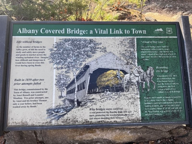
1. Albany Covered Bridge: A Vital Link to Town Marker
Life without bridges
As the number of farms in the valley grew, so did the need to easily and safely move people and goods to market across the winding turbulent river. Imagine how difficult and dangerous it would have been to cross this river during spring floods.
Built in 1859 after two prior attempts failed
This bridge, commissioned by the Town of Albany, was constructed by Amzi Russell and Leander Moulton. Two prior attempts, one by Amzi and his brother Thomas only a year before, had been washed away by floods.
Why bridges were covered
A roof prtected the flooring from rain and snow, protecting the wooden planks from rot and almost doubling their lifespan.
"A load of hay wide"
The early bridges were built by judgement rather than by exact engineering design. The bridge was sized "a load of hay high and a load of hay wide" to allow the passage of farm wagons.
Restoring the bridge
A hundred years after its construction, the U.S. Forest Service and the town of Albany undertook the first major repair of the Albany Covered Bridge.
Repairs were made as much as possible in a fashion true to the original
this page online
Erected by U.S. Forest Service.
Topics and series. This historical marker is listed in this topic list: Bridges & Viaducts. In addition, it is included in the Covered Bridges series list. A significant historical year for this entry is 1859.
Location. 44° 0.347′ N, 71° 14.42′ W. Marker is in Albany, New Hampshire, in Carroll County. It is on Passaconaway Road east of Kancamagus Highway, on the left when traveling north. Touch for map. Marker is in this post office area: Conway NH 03818, United States of America. Touch for directions.

Regionally, this marker is in the White Mountains. It is also in the American Northeast and in New England. Globally, it is in North America, the Western Hemisphere, the Western World, and the Anglosphere. Historically, it finds itself in what was once one of the original Thirteen Colonies.
Other nearby markers. At least 8 other markers are within 6 miles of this marker, measured as the crow flies: How the Covered Bridge was Built
Photographed by Maxine Booth, November 19, 2026
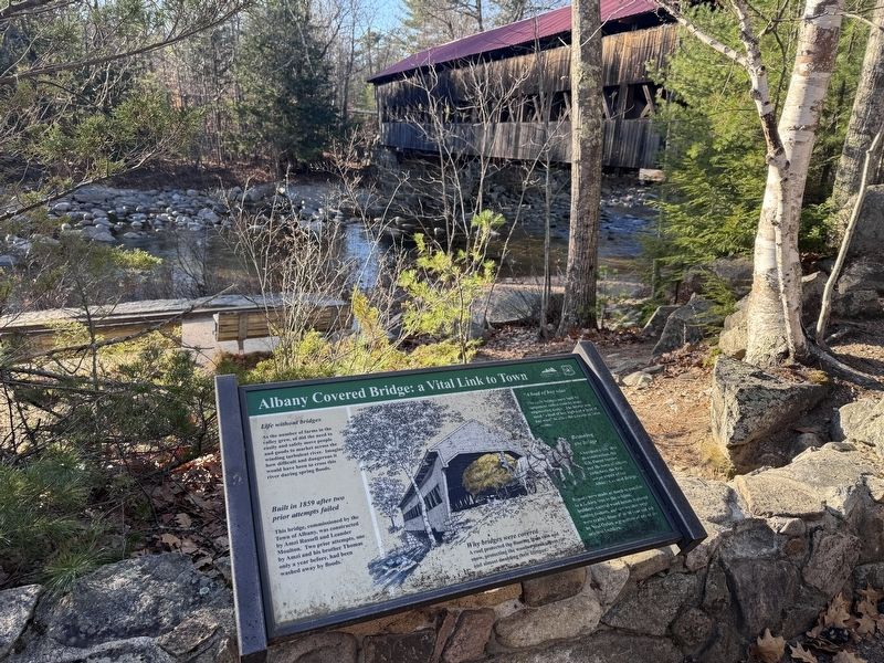
2. Albany Covered Bridge: A Vital Link to Town Marker
The Albany Covered Bridge is closeby
Another marker is no longer nearby. How the Covered Bridge was built (was within shouting distance of this marker but has been replaced with another marker now near it).
Credits. This page was last revised on November 19, 2026. It was originally submitted on November 19, 2026, by Maxine Booth of Albany, New Hampshire. This page has been viewed 7 times since then. Photos: 1, 2. submitted on November 19, 2026, by Maxine Booth of Albany, New Hampshire. • Andrew Ruppenstein was the editor who published this page.
