Springettsbury Township near York in York County, Pennsylvania — The American Northeast (Mid-Atlantic)
Camp Security
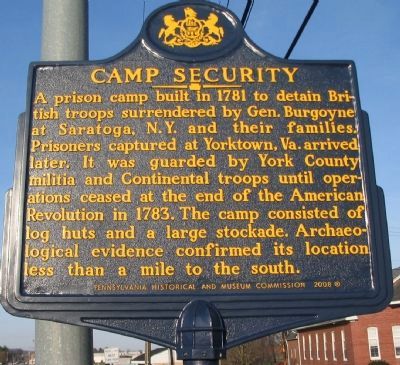
Photographed by Craig Swain, March 27, 2010
1. Camp Security Marker
Erected 2008 by Pennsylvania Historical and Museum Commission.
Topics and series. This historical marker is listed in this topic list: War, US Revolutionary. In addition, it is included in the Pennsylvania Historical and Museum Commission (PHMC) series list. A significant historical year for this entry is 1781.
Location. 39° 59.032′ N, 76° 38.901′ W. Marker is near York, Pennsylvania, in York County. It is in Springettsbury Township. It is at the intersection of Lincoln Highway (State Highway 462) and Locust Grove Road, on the right when traveling east on Lincoln Highway. Touch for map. Marker is in this post office area: York PA 17402, United States of America. Touch for directions.

Regionally,
this page online
Other nearby markers. At least 8 other markers are within 4 miles of this marker, measured as the crow flies: It's a Dog House! (approx. 1.2 miles away); The Haines Shoe House (approx. 1.2 miles away); New Eastern Market (approx. 1.8 miles away); Hallam Borough and Township Honor Roll (approx. 2.7 miles away); Veterans Memorial (approx. 3 miles away); Fifth Ward World War II Community Honor Roll (approx. 3.1 miles away); White Rose Post No. 556 Veterans of Foreign Wars of the United States (approx. 3.2 miles away); Defenders of the Flag (approx. 3.2 miles away). Touch for a list and map of all markers in York.
Also see . . . Camp Security. Website offering more details of the
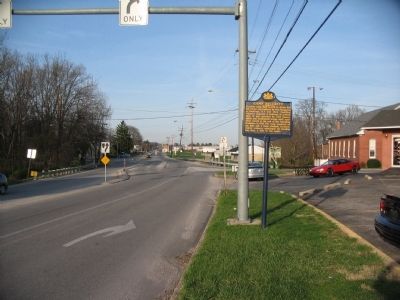
Photographed by Craig Swain, March 27, 2010
2. Camp Security Marker
Credits. This page was last revised on June 17, 2025. It was originally submitted on June 12, 2010, by Craig Swain of Leesburg, Virginia. This page has been viewed 1,442 times since then and 63 times this year. Photos: 1, 2. submitted on June 12, 2010, by Craig Swain of Leesburg, Virginia.
