Lancaster in Worcester County, Massachusetts — The American Northeast (New England)
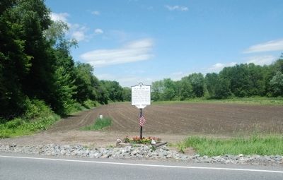
Site of the Great Elm
Erected by Lancaster Historical Commission.
Topics. This historical marker is listed in these topic lists: Horticulture & Forestry • Landmarks • Natural Features. A significant historical year for this entry is 1888.
Location. 42° 26.725′ N, 71° 40.057′ W. Marker is in Lancaster, Massachusetts, in Worcester County. Marker is on Center Bridge Road, 0.1 miles north of Still River Road (Route 110), on the right when traveling north. Marker is directly across the street from the Lancaster Recycling Center. Touch for map. Marker is in this post office area: Lancaster MA 01523, United States of America. Touch for directions.
Other nearby markers. At least 8 other markers are within 4 miles of this marker, measured as the crow flies. Neck Bridge (approx. half a mile away); Site of Mary Rowlandson’s Capture (approx. half a mile away); Sawyer-Carter Bridge (approx. 0.8 miles away); Rowlandson Rock (approx. one mile away); a different marker also named Rowlandson Rock (approx. 1.7 miles away); Prescott Grist Mill (approx. 1.9 miles away); Lancaster (approx. 2.6 miles away); Mary Sawyer’s Birthplace (approx. 3.7 miles away). Touch for a list and map of all markers in Lancaster.
Also see . . . Picture of Great Elm. In this scan of an 1879 book about Lancaster, MA, you can click back to pages 34-35 for a description of the tree. (Submitted on June 13, 2010, by Roger W. Sinnott of Chelmsford, Massachusetts.)
Credits. This page was last revised on June 16, 2016. It was originally submitted on June 13, 2010, by Roger W. Sinnott of Chelmsford, Massachusetts. This page has been viewed 1,717 times since then and 49 times this year. Photos: 1, 2. submitted on June 13, 2010, by Roger W. Sinnott of Chelmsford, Massachusetts. • Syd Whittle was the editor who published this page.

