Sullivans Island in Charleston County, South Carolina — The American South (South Atlantic)
Harbor Vigilance
1944 - 1945
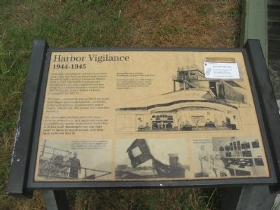
The Harbor Defense System included electronic surveillance and coastal lookouts, minefields, harbor gun batteries, minesweepers, patrol vessels, and aircraft. The system was controlled from here.
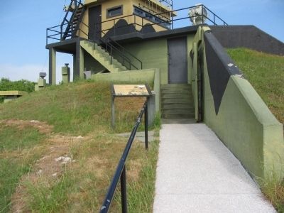
The observation platform and radio room, message center room, and operations room are equipped today as they were during World War II. If you walk downstairs you can visit some of these restored rooms, and step back into World War II.
Harbor Entrance Control Post / Harbor Defense Command Post
In the lower rooms, two officers and a crew of 36 staffed this "nerve center" day and night. From here they could coordinate air and sea forces and coastal artillery.
Topics. This historical marker is listed in this topic list: War, World II. A significant historical year for this entry is 1944.
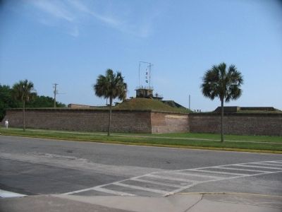
Location. 32° 45.562′ N, 79° 51.432′ W. Marker is on Sullivans Island, South Carolina, in Charleston County. Marker is at the intersection of Middle Street and Palmetto Street, on the right when traveling east on Middle Street. Located inside Fort Moultrie National Monument. Touch for map. Marker is in this post office area: Sullivans Island SC 29482, United States of America. Touch for directions.
Other nearby markers. At least 8 other markers are within walking distance of this marker. Harbor Defense 1898-1939 (a few steps from this marker); Cannon Row (within shouting distance of this marker); Civil War Defense of Sullivan's Island (within shouting distance of this marker); H.L. Hunley Disappears (within shouting distance of this marker); Discovering the Hunley (within shouting distance of this marker); The Hunley Recovery Project (within shouting distance of this marker); From Military Base to National Park (within shouting distance of this marker); 13-Inch Seacoast Mortar (within shouting distance of this marker). Touch for a list and map of all markers in Sullivans Island.
More about this marker. In the upper center is a cutaway diagram of the HECP/HDCP facility. Photos across the bottom show equipment in use during the war. From the upper decks Navy signalmen used lights and flags to challenge and clear ships entering Charleston Harbor. Another photo shows World War II radio room and personnel.
Also see . . . Fort Moultrie. National Park Service site. (Submitted on June 14, 2010, by Craig Swain of Leesburg, Virginia.)
Credits. This page was last revised on November 2, 2020. It was originally submitted on June 14, 2010, by Craig Swain of Leesburg, Virginia. This page has been viewed 513 times since then and 8 times this year. Photos: 1, 2, 3. submitted on June 14, 2010, by Craig Swain of Leesburg, Virginia.


