Ridgefield in Fairfield County, Connecticut — The American Northeast (New England)
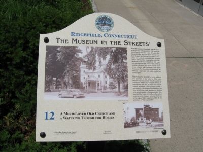
A Much-Loved Old Church and a Watering Trough for Horses
Ridgefield, Connecticut
— The Museum in the Streets —
Inscription.
The Methodist Episcopal Church had its beginnings in Ridgefield 1n 1787 when the first meeting was held – just 21 years after Methodism had been introduced into the U.S. from England. In 1789 Jesse Lee, a native of Virginia, was sent north as a circuit rider. His third sermon in Connecticut was preached at the Independent Schoolhouse on Main St. In 1841 a second meetinghouse was built, and in 1883 the building was moved back on the property where it was enlarged and remodeled in the Queen Anne style. The church was demolished in the 1960s and a new church built further south on the old town green.
The Watering Trough for horses and dogs was presented to the town by John Ames Mitchell some time around 1912. It stood at the intersection of Main and Catoonah Streets, remaining there until 1922, by which time cars had replaced horses and it was no longer needed. It was moved to Titicus where it remained until the flood of 1955 when it was again moved, this time to its present location at the intersection of Olmstead and West Lanes. Mitchell was Harvard-educated, an artist, illustrator and writer. He founded the original "Life" magazine in 1883. He died at his home on West Lane in 1918.
Erected 2008 by The Museum in the Streets®. (Marker Number 12.)
Topics and series. This historical marker is listed in these topic lists: Animals • Architecture • Charity & Public Work • Churches & Religion. In addition, it is included in the The Museum in the Streets®: Ridgefield, Connecticut series list. A significant historical year for this entry is 1787.
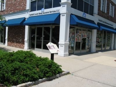
Location. 41° 16.889′ N, 73° 29.914′ W. Marker is in Ridgefield, Connecticut, in Fairfield County. Marker is at the intersection of Main Street (Connecticut Route 35) and Catoonah Street, on the right when traveling south on Main Street. Touch for map. Marker is in this post office area: Ridgefield CT 06877, United States of America. Touch for directions.
Other nearby markers. At least 8 other markers are within walking distance of this marker. The Great Fire of 1895 (within shouting distance of this marker); Ridgefield, Connecticut (within shouting distance of this marker); More of the Great Fire (within shouting distance of this marker); The Livery Stable and the First Catholic Church (within shouting distance of this marker); The Village Center in the Early 1900s (within shouting distance of this marker); The Village in the 1900s
(about 400 feet away, measured in a direct line); Bissell's – Destroyed by Two Conflagrations (about 400 feet away); Out of the Ashes … (about 400 feet away). Touch for a list and map of all markers in Ridgefield.
More about this marker. The photos on the marker show the Methodist Episcopal Church in the 1950s and the Watering Trough in its original location on Main Street with Town Hall behind it.
Related markers. Click here for a list of markers that are related to this marker. Together, they comprise the Museum in the Streets.
Credits. This page was last revised on August 7, 2023. It was originally submitted on June 16, 2010, by Michael Herrick of Southbury, Connecticut. This page has been viewed 1,332 times since then and 63 times this year. Photos: 1, 2, 3. submitted on June 16, 2010, by Michael Herrick of Southbury, Connecticut.


