Ridgefield in Western Region, Connecticut — The American Northeast (New England)
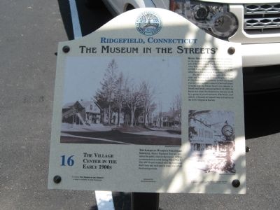
The Village Center in the Early 1900s
Ridgefield, Connecticut
| — | The Museum in the Streets | — |
Photographed by Michael Herrick, June 2, 2010
1. The Village Center in the Early 1900s Marker
Henry Mead and His Wife are seen standing on the stoop of their grocery store in the early part of the 20th century. The building was moved when Ridgefield Hardware built their new store in 1948. Today Ridgefield Hardware is one of the oldest family businesses in Ridgefield.
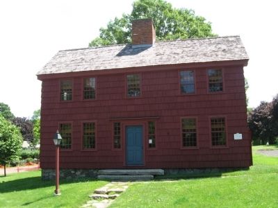
The Scott house, to the right of the Mead Store was built around 1714 on Proprietor's Lot #13 by Irish-born David Scott. In 1925 the house was moved around the corner to Catoonah Street to make way for Ernest Scott's (no relation to David) new brick commercial block. In 1999, the house was slated for demolition, but was saved by a group of preservationists. The house, now rebuilt, is located on Sunset Lane and serves as the town's Historical Society.
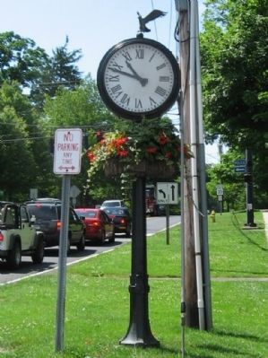
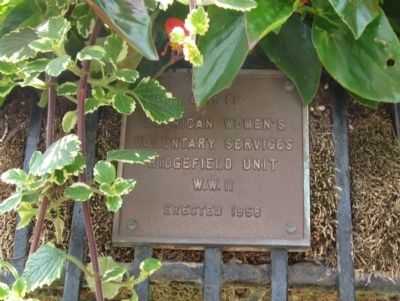
The American Women's Voluntary Services, Motor Transport Service, presented the public clock to the town in 1958 to commemorate its work during World War II. The AWVS unit worked with the American Red Cross and took part in many war effort fund raising events.
Erected by The Museum in the Streets®. (Marker Number 16.)
Topics and series. This historical marker is listed in these topic
this page online
Location. 41° 16.85′ N, 73° 29.917′ W. Marker is in Ridgefield in Western Region, Connecticut. It is at the intersection of Main Street (Connecticut Route 35) and Catoonah Street, on the right when traveling south on Main Street. Touch for map. Marker is at or near this postal address: 383 Main Street, Ridgefield CT 06877, United States of America. Touch for directions.

Regionally, this marker is on the Connecticut Shoreline, on the Gold Coast, and in Greater Bridgeport. It is also in the American Northeast and in New England. Globally, it is in North America, the Western Hemisphere, the Western World, and the Anglosphere. Historically, it finds itself in what was once Fairfield County and also one of the original Thirteen Colonies.
Other nearby markers. At least 8 other markers are within walking distance of this marker: More of the Great Fire (within shouting distance of this marker); Bissell's – Destroyed by Two Conflagrations
Photographed by Michael Herrick, June 2, 2010
2. The Village Center in the Early 1900s Marker
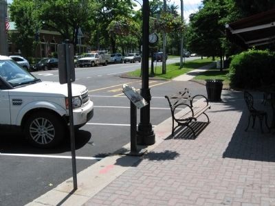
The Public Clock is in the background.
Another marker is no longer nearby. Bailey Avenue: A Short-Cut to the Train Station (was about 300 feet away but has been confirmed missing).
Photographed by Michael Herrick, June 15, 2001
3. The Ridgefield Historical Society Building
Originally the David Scott House, in its third location
Photographed by Michael Herrick, June 15, 2001
4. Marker on the David Scott House
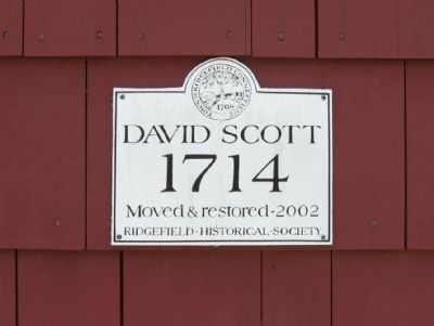
1714
Moved & restored – 2002
Ridgefield Historical Society
Photographed by Michael Herrick, June 15, 2001
5. The Public Clock
Photographed by Michael Herrick, June 15, 2001
6. The Plaque on The Public Clock
American Women's
Voluntary Services
Ridgefield Unit
W.W. II
Erected 1958
Credits. This page was last revised on May 19, 2026. It was originally submitted on June 16, 2010, by Michael Herrick of Southbury, Connecticut. This page has been viewed 1,212 times since then and 26 times this year. Photos: 1, 2, 3, 4, 5, 6. submitted on June 16, 2010, by Michael Herrick of Southbury, Connecticut.
