Dublin Township near Shade Gap in Huntingdon County, Pennsylvania — The American Northeast (Mid-Atlantic)
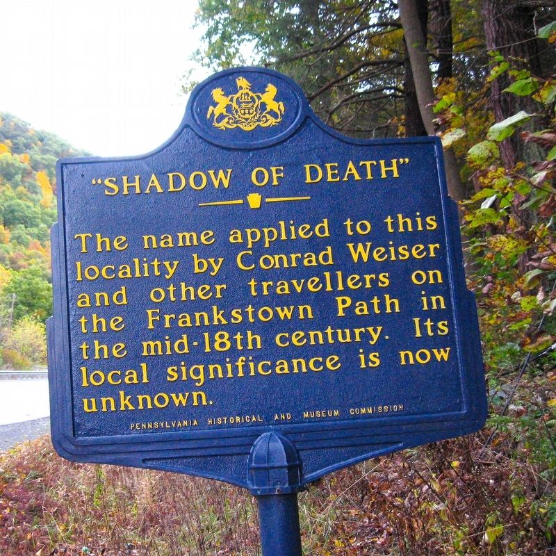
"Shadow of Death"
Erected 1947 by Pennsylvania Historical and Museum Commission.
Topics and series. This historical marker is listed in this topic list: Roads & Vehicles. In addition, it is included in the Pennsylvania Historical and Museum Commission series list.
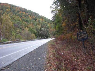
Location. 40° 11.308′ N, 77° 52.531′ W. Marker is near Shade Gap, Pennsylvania, in Huntingdon County. It is in Dublin Township. Marker is on Croghan Pike (Route 522) near Covered Bridge Road, on the right when traveling east. Touch for map. Marker is at or near this postal address: 20942 Covered Bridge Rd, Shade Gap PA 17255, United States of America. Touch for directions.
Other nearby markers. At least 8 other markers are within 4 miles of this marker, measured as the crow flies. FBI Special Agent Terry Ray Anderson (approx. 0.8 miles away); Veterans Memorial (approx. one mile away); Grand Army of the Republic Picnic (approx. one mile away); a different marker also named Grand Army of the Republic Picnic (approx. one mile away); Juniata Iron (approx. 3.2 miles away); Bedford Furnace (approx. 3.6 miles away); Admiral Wm Sims (approx. 3.8 miles away); East Broad Top Railroad (approx. 3.8 miles away). Touch for a list and map of all markers in Shade Gap.
Regarding "Shadow of Death". Conrad Weiser was a pioneer Indian interpreter, and treaty maker, 1732-1760. The Indians called him "Holder of the Heavens. For thirty years, Weiser served as Pennsylvania's Indian agent and interpreter.
The Frankstown Path ran from Paxtang (modern-day Harrisburg) on the Susquehanna River to the Allegheny River, and passed through Assunepachla at the Juniata River.
Also see . . . Weird U.S. entry. Excerpt:
The heavily wooded mountains are peppered with caves, which makes it next to impossible to find an attacker. In 1966, this fact was brought home forcibly to the townsfolk. The events of that May brought the FBI and state police together to mount what was at the time the largest manhunt in history.(Submitted on December 5, 2020.)
Additional commentary.
1. Possible meaning of sign
My Family owned a large tract of land near the Shadow of Death. It was passed through several generations. The land is known as Lockes Valley. My Grandfather told me the early settlers were regularly ambushed by local Indians at the narrow pass known as Shadow of Death. I have reason to believe what he told me, And I can prove that Native Americans were indeed hiding in the Mountain pass. When I was a young child I explored the mountains, and found evidence to support what he told me. What I was told could be a small part of history that has been lost to time.
— Submitted December 15, 2010, by Jeffrey A Locke of Huntingdon, Pennsylvania.
2. Possible meaning of sign
My family has lived in the nearby Village of Burnt Cabins for 5 generations. As a young boy, I spent my summers visiting them. Now & again I would join my grandfather on his trip to Orbisonia for ball games or a haircut. We would pass through the "Valley of Death". I always liked the 'fear' factor associated with the sign as we passed.
In Anne Colver's book "Bread and Butter Indian", published in 1964, on page 27, the author offers the explanation, based on the main character's family journal, the name refers to The Bible's twenty-third Psalm "A psalm of David", which spoke of the "darkest valley". Word translations may have contributed to the name we know today.
— Submitted December 1, 2020, by M.Knowles of Sterling, Virginia.
Additional keywords. Conrad Weiser, Frankstown Path
Credits. This page was last revised on February 7, 2023. It was originally submitted on June 29, 2010, by Howard C. Ohlhous of Duanesburg, New York. This page has been viewed 8,675 times since then and 355 times this year. Photos: 1, 2. submitted on June 29, 2010, by Howard C. Ohlhous of Duanesburg, New York. • Craig Swain was the editor who published this page.

