Clearwater in Pinellas County, Florida — The American South (South Atlantic)
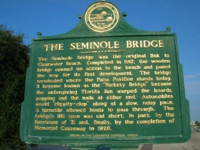
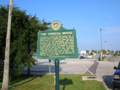
The Seminole Bridge
Erected by Clearwater Historical Society.
Topics. This historical marker is listed in this topic list: Bridges & Viaducts. A significant historical year for this entry is 1917.
Location. 27° 58.44′ N, 82° 48.141′ W. Marker is in Clearwater, Florida, in Pinellas County. Marker is on Seminole Street near North Osceola Avenue, on the left when traveling west. Touch for map. Marker is in this post office area: Clearwater FL 33755, United States of America. Touch for directions.
Other nearby markers. At least 8 other markers are within 2 miles of this marker, measured as the crow flies. Clearwater Athletic Field (approx. 0.6 miles away); Clearwater Post Office (approx. 0.7 miles away); Jack Russell Memorial Stadium (approx. ¾ mile away); The Old Pinellas County Courthouse (approx. 0.8 miles away); North Greenwood African American Memorial Cemetery (approx. 1.1 miles away); South Ward School Site (approx. 1.1 miles away); Harbor Oaks Historic District (approx. 1.2 miles away); Fort Harrison (approx. 1.2 miles away). Touch for a list and map of all markers in Clearwater.
Regarding The Seminole Bridge. What’s left of the bridge is now a boat launch/fishing pier with a huge parking lot.
Credits. This page was last revised on June 16, 2016. It was originally submitted on November 1, 2007, by Julie Szabo of Oldsmar, Florida. This page has been viewed 2,689 times since then and 63 times this year. Photos: 1, 2. submitted on November 1, 2007, by Julie Szabo of Oldsmar, Florida. • J. J. Prats was the editor who published this page.

