Greenville in Greenville County, South Carolina — The American South (South Atlantic)
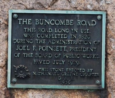
The Buncombe Road
Erected 1936 by Nathanael Greene Chapter, Daughters of the American Revolution.
Topics and series. This historical marker is listed in these topic lists: Charity & Public Work • Roads & Vehicles. In addition, it is included in the Daughters of the American Revolution series list. A significant historical date for this entry is July 17, 1926.
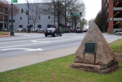
Location. 34° 51.183′ N, 82° 24.017′ W. Marker is in Greenville, South Carolina, in Greenville County. Marker is at the intersection of Buncombe Street and Richardson Street on Buncombe Street. Marker is across the street from the south side of Buncombe Street United Methodist Church. Touch for map. Marker is at or near this postal address: 200 Buncombe Street, Greenville SC 29601, United States of America. Touch for directions.
Other nearby markers. At least 8 other markers are within walking distance of this marker. Buncombe Street Methodist Church (within shouting distance of this marker); McKay Memorial Chapel (part of First Presbyterian Church) (about 500 feet away, measured in a direct line); Max Heller Legacy Plaza (about 800 feet away); Textile Hall (approx. 0.2 miles away); Sterling High School Memorial (approx. 0.2 miles away); Greenville Woman's College (approx. 0.2 miles away); St Mary's Catholic Church (approx. 0.2 miles away); Stradley and Barr Dry Goods Store (approx. 0.2 miles away). Touch for a list and map of all markers in Greenville.
Credits. This page was last revised on December 13, 2019. It was originally submitted on April 3, 2009, by Brian Scott of Anderson, South Carolina. This page has been viewed 1,170 times since then and 76 times this year. Last updated on July 3, 2010, by Richard E. Miller of Oxon Hill, Maryland. Photos: 1, 2. submitted on April 3, 2009, by Brian Scott of Anderson, South Carolina. • Craig Swain was the editor who published this page.

