Near Junction City in Geary County, Kansas — The American Midwest (Upper Plains)
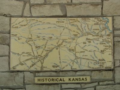
Historical Kansas
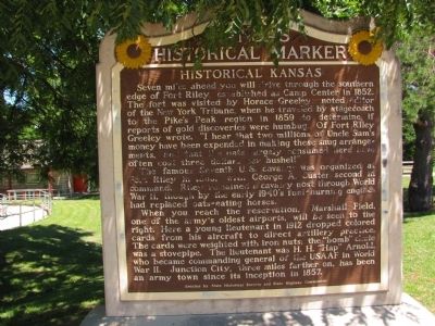
Seven miles ahead you will drive through the southern edge of Fort Riley, established as Camp Center in 1852. The fort was visited by Horace Greeley, noted editor of the New York Tribune, when he traveled by stagecoach to the Pike's Peak region in 1859 to determine if reports of gold discoveries were humbug. Of Fort Riley Greeley wrote, "I hear that two millions of Uncle Sam's money have been expended in making these snug arrangements, and that the oats largely consumed here have often cost three dollars per bushel!"
The famous Seventh U.S. cavalry was organized at Fort Riley in 1865, with George A. Custer second in command. Riley remained a cavalry post through World War II, though by the early 1940's fuel-burning engines had replaced oats-eating horses.
When you reach the reservation, Marshall Field, one of the army's oldest airports, will be seen to the right. Here a young lieutenant in 1912 dropped colored cards from his aircraft to direct artillery practice. The cards were weighted with iron nuts: the "bomb" chute was a stovepipe. The lieutenant was H.H. "Hap" Arnold, who became commanding general of the USAAF in World War II. Junction City, three miles farther on, has been an army town since its inception in 1857.
Erected by State Historical Society and State Highway Commission. (Marker Number 99.)
Topics and series. This historical marker is listed in these topic lists: Forts and Castles • Settlements & Settlers. In addition, it is included in the Kansas Historical Society series list. A significant historical year for this entry is 1852.
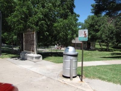
Location. 39° 4.015′ N, 96° 37.326′ W. Marker is near Junction City, Kansas, in Geary County. Marker can be reached from Interstate 70, 4˝ miles west of Pillsbury Drive (State Highway 177), on the right when traveling west. Marker is located at the west-bound rest area. Touch for map. Marker is in this post office area: Junction City KS 66441, United States of America. Touch for directions.
Other nearby markers. At least 8 other markers are within 7 miles of this marker, measured as the crow flies. Fort Riley & Junction City (a few steps from this marker); Purple Heart Trail in Kansas (within shouting distance of this marker); a different marker also named Historical Kansas (approx. 0.4 miles away); Veteran's Memorial (approx. 5.8 miles away); Ogden (approx. 5.9 miles away); The Tallgrass Prairie (approx. 6.3 miles away); Konza Prairie (approx. 6.4 miles away); Geology at Konza (approx. 6.4 miles away).
Credits. This page was last revised on September 9, 2020. It was originally submitted on July 6, 2010, by Lee Hattabaugh of Capshaw, Alabama. This page has been viewed 1,041 times since then and 13 times this year. Photos: 1, 2, 3. submitted on July 6, 2010, by Lee Hattabaugh of Capshaw, Alabama. • Craig Swain was the editor who published this page.


