Downtown in Omaha in Douglas County, Nebraska — The American Midwest (Upper Plains)
Trans-Mississippi and International Exposition of 1898
Photographed by Paul Crumlish, July 10, 2010
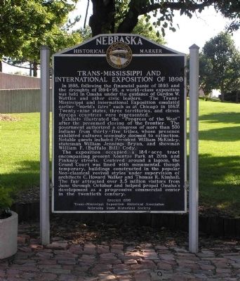
1. Trans-Mississippi and International Exposition of 1898 Marker
In 1898, following the financial panic of 1893 and the droughts of 1894-95, a world-class exposition was held in Omaha under the guidance of Gurdon W. Wattles and other civic leaders. The Trans-Mississippi and International Exposition emulated earlier “world's fairs” such as at Chicago in 1893. Twenty-nine states, three territories, and eleven foreign countries were represented.
Exhibits illustrated the “Progress of the West” after the presumed closing of the frontier. The government authorized a congress of more than 500 Indians from thirty-five tribes, whose presence exhibited cultures seemingly doomed to extinction. Notable guests included President William McKinley, statesman William Jennings Bryan, and showman William F. (Buffalo Bill) Cody.
The exposition occupied a 184-acre tract encompassing present Kountze Park at 20th and Pinkney streets. Centered around a lagoon, the Grand Court was lined with monumental, though temporary, buildings constructed in the popular Neo-classical revival styles under supervision of architects C. Howard Walker and Thomas R. Kimball. The fair
this page online
Erected by Trans-Mississippi Exposition Historical Association, Nebraska State Historical Society. (Marker Number 400.)
Topics and series. This historical marker is listed in these topic lists: Entertainment • Notable Events. In addition, it is included in the Former U.S. Presidents: #25 William McKinley, and the Nebraska State Historical Society series lists. A significant historical year for this entry is 1898.
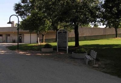
Location. 41° 15.549′ N, 95° 55.476′ W. Marker is in Omaha, Nebraska, in Douglas County. It is in Downtown. It can be reached from Douglas Street 0.1 miles east of South 8th Street, on the right when traveling east. The marker is located in Heartland of America Park along a walkway from a parking lot off Dodge Street to the park. The parking lot and marker are underneath the I-480/Gerald R. Ford Freeway Bridge. Touch for map. Marker is at or near this postal address: Dodge Street, Omaha NE 68102, United States of America. Touch for directions.

Regionally,
Photographed by Paul Crumlish, July 10, 2010
2. Wide view of the Trans-Mississippi and International Exposition of 1898 Marker
Other nearby markers. At least 8 other markers are within walking distance of this marker: Union Walk (about 700 feet away, measured in a direct line); Captain William Clark and Private Reuben Field (approx. 0.2 miles away); Omaha Firefighters Memorial (approx. ¼ mile away); Burlington Building 1879 (approx. ¼ mile away); Missouri River Flood (approx. 0.3 miles away); Labor (approx. 0.3 miles away); Missouri River Flooding (approx. 0.3 miles away); United States National Bank Building Arch (approx. 0.3 miles away). Touch for a list and map of all markers in Omaha.
Also see . . . Trans-Mississippi Exposition, Omaha, Nebraska, 1898. (Submitted on July 14, 2010, by PaulwC3 of Northern, Virginia.)
Credits. This page was last revised on February 16, 2023. It was originally submitted on July 14, 2010, by PaulwC3 of Northern, Virginia. This page has been viewed 1,621 times since then and 57 times this year. Photos: 1, 2. submitted on July 14, 2010, by PaulwC3 of Northern, Virginia.
