Near Milan in Bradford County, Pennsylvania — The American Northeast (Mid-Atlantic)
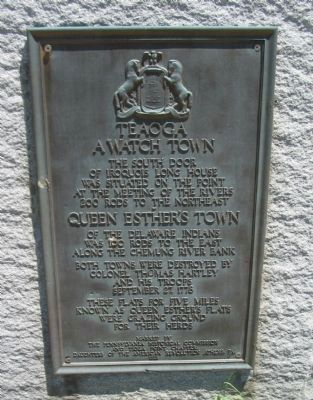
Teaoga
A Watch Town
of Iroquois Long House
was situated on the point
at the meeting of the rivers
200 rods to the northeast
Queen Esther's Town
of the Delaware Indians
was 100 rods to the east
along the Chemung River Bank
Both towns were destroyed by
Colonel Thomas Hartley
and his troops
September 27, 1778
These flats for five miles
known as Queen Esther's flats
were grazing ground
for their herds
Erected 1928 by The Pennsylvania Historical Commission and the Tioga Point Chapter, D.A.R.
Topics and series. This historical marker is listed in these topic lists: Native Americans • War, US Revolutionary. In addition, it is included in the Daughters of the American Revolution, and the Pennsylvania Historical and Museum Commission series lists. A significant historical date for this entry is September 27, 1778.
Location. 41° 55.143′ N, 76° 31.49′ W. Marker is near Milan, Pennsylvania, in Bradford County. Marker is on Main Street (U.S. 220), on the right when traveling north. Touch for map. Marker is in this post office area: Milan PA 18831, United States of America. Touch for directions.
Other nearby markers. At least 8 other markers are within 3 miles of this marker, measured as the crow flies. Stone Wall Hill (approx. 1.2 miles away); a different marker also named Teaoga (approx. 1.8 miles away); Fort Sullivan (approx. 2.1 miles away); Carrying Path (approx. 2.1 miles away); a different marker also named Fort Sullivan (approx. 2.1 miles away); a different marker also named Fort Sullivan (approx. 2.2 miles away); Roll of Honor (approx. 2.3 miles away); Vietnam Veterans (approx. 2.3 miles away).
Also see . . . Queen Esther - Indian Friend of Fiend?. Discussion of Queen Esther's role with the American frontier in the American Revolution. (Submitted on July 17, 2010, by Craig Swain of Leesburg, Virginia.)
Credits. This page was last revised on June 16, 2016. It was originally submitted on July 17, 2010, by Craig Swain of Leesburg, Virginia. This page has been viewed 955 times since then and 28 times this year. Photos: 1, 2, 3. submitted on July 17, 2010, by Craig Swain of Leesburg, Virginia.


