New City in Rockland County, New York — The American Northeast (Mid-Atlantic)
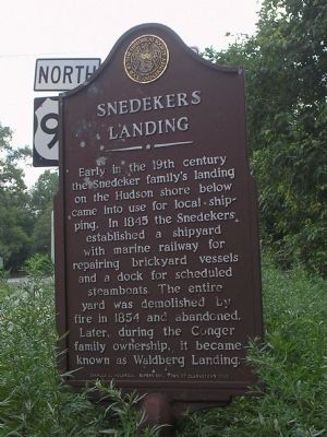
Snedekers Landing
the Snedeker family’s landing
on the Hudson shore below
came into use for local shipping.
In 1845 the Snedekers
established a shipyard
with marine railway for
repairing brickyard vessels
and a dock for scheduled
steamboats. The entire
yard was demolished by
fire in 1854 and abandoned.
Later, during the Conger
family ownership, it became
known as Waldberg Landing.
Charles E. Holbrook, Supervisor, Town of Clarkstown – 1980
Erected by The Historical Society of Rockland County.
Topics and series. This historical marker is listed in these topic lists: Colonial Era • Settlements & Settlers. In addition, it is included in the New York, Historical Society of Rockland County series list. A significant historical year for this entry is 1845.
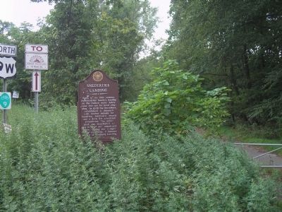
Location. 41° 10.477′ N, 73° 56.662′ W. Marker is in New City, New York, in Rockland County. Marker is on U.S. 9W, on the right when traveling north. Touch for map. Marker is in this post office area: New City NY 10956, United States of America. Touch for directions.
Other nearby markers. At least 8 other markers are within 2 miles of this marker, measured as the crow flies. King's Highway and the Long Clove (approx. 0.2 miles away); Andre The Spy (approx. ¼ mile away); Treason Site (approx. ¼ mile away); Brick Industry (approx. 1.4 miles away); Snedeker Farm (approx. 1½ miles away); Congers World War I Memorial (approx. 1.7 miles away); Congers School (approx. 1.7 miles away); Kings Highway (approx. 1.7 miles away).
Also see . . . The Historical Society of Rockland County website. (Submitted on July 18, 2010, by Bill Coughlin of Woodland Park, New Jersey.)
Credits. This page was last revised on June 16, 2016. It was originally submitted on July 18, 2010, by Bill Coughlin of Woodland Park, New Jersey. This page has been viewed 2,551 times since then and 102 times this year. Photos: 1, 2, 3. submitted on July 18, 2010, by Bill Coughlin of Woodland Park, New Jersey.


