Easton Forrest in Norfolk, Virginia — The American South (Mid-Atlantic)
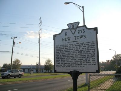
New Town
Erected 2002 by Department of Historic Resources. (Marker Number K273.)
Topics and series. This historical marker is listed in these topic lists: Colonial Era • Settlements & Settlers • War, US Revolutionary. In addition, it is included in the Virginia Department of Historic Resources (DHR) series list. A significant historical year for this entry is 1697.
Location. 36° 50.461′ N, 76° 11.365′ W. Marker is in Norfolk, Virginia. It is in Easton Forrest. Marker is at the intersection of South Newtown Road and Princess Ann Road, on the right when traveling south on South Newtown Road. Touch for map. Marker is in this post office area: Norfolk VA 23502, United States of America. Touch for directions.
Other nearby markers. At least 8 other markers are within 3 miles of this marker, measured as the crow flies. VFW Veterans Memorial (approx. 1.2 miles away); Princess Anne County Training School / Union Kempsville High School (approx. 1.7 miles away); Kempsville (approx. 1.7 miles away); Princess Anne County Courthouse (approx. 1.8 miles away); The Skirmish Of Kempsville (approx. 1.8 miles away); Skirmish at Kemp’s Landing (approx. 1.9 miles away); Filipinos in the U.S. Navy (approx. 2.6 miles away); Filipino American Veterans of Hampton Roads (approx. 2.6 miles away).
Credits. This page was last revised on February 1, 2023. It was originally submitted on November 5, 2007, by Laura Troy of Burke, Virginia. This page has been viewed 1,629 times since then and 68 times this year. Photo 1. submitted on November 5, 2007, by Laura Troy of Burke, Virginia. • J. J. Prats was the editor who published this page.
