Roxbury in Morris County, New Jersey — The American Northeast (Mid-Atlantic)
The Morris Canal 1824 – 1924
Morris Canal Greenway
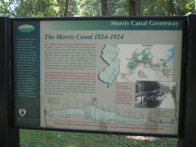
The Morris Canal was an engineering marvel of its time. A system of 23 lift locks and 23 inclined planes enabled the canal to overcome more elevation change than any other transportation canal ever built. Large changes in elevation were overcome using the canal’s famous inclined planes which were short, water powered marine railways on which canal boats were pulled up or let down hillsides. The locks operated like water elevators, overcoming smaller changes in elevation. Mules were the power source that pulled the boats across the state in five days.
The Morris Canal was crucial to the economy and development of northern New Jersey from the time of the waterway’s construction until after the Civil War. Running from Phillipsburg to Jersey City, the canal linked the anthracite coal fields of northern Pennsylvania with northern New Jersey’s iron industry, major industrial cities, and the New York area markets. Open from 1831 to 1924, the canal carried anthracite coal, iron ore, timber, limestone, and agricultural products.
The Morris Canal overcame 1,674 feet of elevation change, more than any other transportation canal in the world!
[ Sidebar: ]
Morris Canal Greenway
The Morris Canal Greenway encompasses part of the historic Morris Canal’s alignment and is a cooperative effort of the New Jersey Division of Parks and Forestry, the Canal Society of New Jersey, the Village of Waterloo and the Friends of the Morris Canal. The Greenway’s purpose is to preserve the remains of the Morris Canal and its associated natural environment, to interpret canal sites to the public, and to offer recreational opportunities. As you walk the Greenway, you will see the remains of canal features, including inclined planes, locks, canal bed, and historic industries and communities directly related to the Morris Canal’s operation.
Erected by Canal Society of New Jersey, New Jersey Division of Parks and Forestry.
Topics and series. This historical marker is listed in these topic lists: Industry & Commerce • Waterways & Vessels. In addition, it is included in the Morris Canal series list. A significant historical year for this entry is 1831.
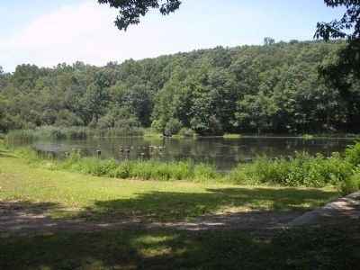
Location. 40° 52.883′ N, 74° 39.465′ W. Marker is in Roxbury, New Jersey, in Morris County. Marker can be reached from the intersection of Emmans Road and Canal Street, on the left when traveling north. Marker is in Morris Canal Ledgewood Park. Parking lot is accessible from Emmans Road, near Canal Street. Touch for map. Marker is in this post office area: Ledgewood NJ 07852, United States of America. Touch for directions.
Other nearby markers. At least 8 other markers are within 2 miles of this marker, measured as the crow flies. Morris Canal (about 500
feet away, measured in a direct line); Silas Riggs House (approx. 0.3 miles away); Morris Canal "King's Basin" (approx. 0.3 miles away); King House Museum (approx. 0.4 miles away); Lake Rogerene (approx. one mile away); First Presbyterian Church at Suckasunny Plains (approx. 1.4 miles away); a different marker also named Morris Canal (approx. 1.4 miles away); Lake Hopatcong Station (approx. 1.6 miles away).
More about this marker. The top right of the marker features two maps. One shows an outline of the State of New Jersey showing the locations of the Delaware & Raritan Canal and the Morris Canal with the marker's location indicated. Next to this is a map of the Summit Region of New Jersey, from Hackettstown to Ledgewood, showing the locations of State Parks, Municipal Parks and Greenway along the Morris Canal.
Below the maps is a photograph of “Two mules towing a Morris Canal boat in Dover.” The bottom of the marker features a “profile show[ing] the changes in elevation as boats traveled through locks and over inclined planes on their route from the Delaware River to the Hudson River.”
Credits. This page was last revised on December 31, 2020. It was originally submitted on July 19, 2010, by Bill Coughlin of Woodland Park, New Jersey. This page has been viewed 1,441 times since then and 18 times this year. Photos: 1, 2, 3, 4, 5, 6. submitted on July 19, 2010, by Bill Coughlin of Woodland Park, New Jersey.
