Fernandina Beach in Nassau County, Florida — The American South (South Atlantic)
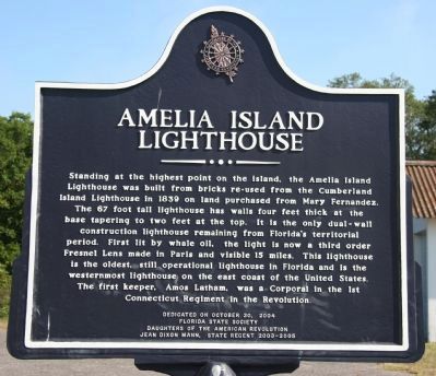
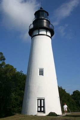
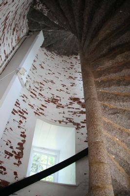
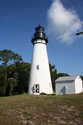
Amelia Island Lighthouse
Erected 2004 by Florida State Society Daughters of the American Revolution, Jean Dixon Mann, State Regent 2003-2005.
Topics and series. This historical marker is listed in these topic lists: Architecture • Communications • War, US Revolutionary • Waterways & Vessels. In addition, it is included in the Daughters of the American Revolution, and the Lighthouses series lists. A significant historical year for this entry is 1839.
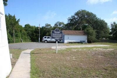
Location. 30° 40.392′ N, 81° 26.549′ W. Marker is in Fernandina Beach, Florida, in Nassau County. Marker can be reached from Lighthouse Circle north of O'Hagan Lane. This historical marker is located just northeast of the Amelia Island Lighthouse, on private U.S. government property. There is a gated entrance to the property on a private road, that both my map and the Google Maps does not show, called O'Hagan Lane. Touch for map. Marker is in this post office area: Fernandina Beach FL 32034, United States of America. Touch for directions.
Other nearby markers. At least 8 other markers are within one mile of this marker, measured as the crow flies. Egmont Plantation (approx. 0.3 miles away); McClure's Hill (approx. ¾ mile away); Nassau County American Revolutionary War Memorial (approx. 0.8 miles away); New Zion Baptist Church (approx. 0.9 miles away); The Good Shepherd Church 1887-1966 (approx. 0.9 miles away); First Missionary Baptist Church of Fernandina (approx. one mile away); St. Peter's Church (approx. one mile away); Trinity United Methodist Church (approx. one mile away). Touch for a list and map of all markers in Fernandina Beach.
More about this marker. This historical marker is difficult to locate and even more difficult to see. To add to the confusion, in the immediate vicinity of the lighthouse there is a street called Lighthouse Lane that does not provide any access to the lighthouse or the historical marker, at least not that I could see. There is a gated entrance to the lighthouse property at the end of O'Hagan
Lane, which is just north of the intersection of O'Hagan Lane and Lighthouse Circle. The gate appears to be locked most of the time and multiple "No Trespassing" signs are clearly posted. When you stand just outside the gate you can get a somewhat obstructed view of the nearby lighthouse, but the historical marker is completely blocked from view, being located behind the lighthouse. The only legal way to view the historical marker is to receive permission to tour the lighthouse grounds or to be there at the times when the lighthouse grounds are open for supervised tours.
Also see . . . Amelia Island, FL. This link to some extensive information regarding both Amelia Island area and the Amelia Island Lighthouse is provided by "lighthousefriends.com." (Submitted on July 21, 2010, by Dale K. Benington of Toledo, Ohio.)
Photographed By Dale K. Benington, June 25, 2010
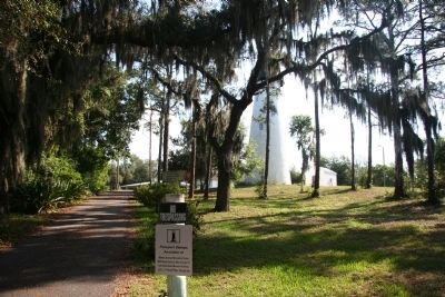
6. Amelia Island Lighthouse
Photo taken just outside of the gated entrance to the Amelia Island Lighthouse showing the limited and somewhat obstructed view that is generally all that is available for visitors to see. The photo also shows one of several posted "No Trespassing" signs.
Photographed By Dale K. Benington, June 25, 2010
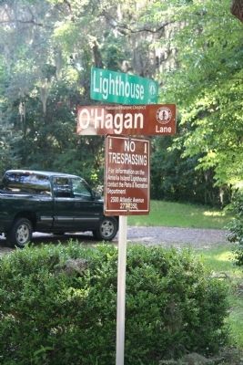
7. Amelia Island Lighthouse Marker
Photo showing the intersection sign for the street that isn't on any of my maps or Google Maps, as well as an additional "No Trespassing" sign. This is the sign to look for when driving on Lighthouse Circle, when attempting to locate the Amelia Island Lighthouse and it's historical marker.
Credits. This page was last revised on August 19, 2020. It was originally submitted on July 21, 2010, by Dale K. Benington of Toledo, Ohio. This page has been viewed 1,792 times since then and 71 times this year. Photos: 1, 2, 3, 4, 5, 6, 7. submitted on July 21, 2010, by Dale K. Benington of Toledo, Ohio.
