Pittstown, Franklin Township in Hunterdon County, New Jersey — The American Northeast (Mid-Atlantic)
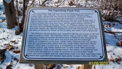
The Capoolong Creek Trail
Pittstown Branch of the Lehigh Valley Railroad
The Capoolong Creek Trail is on the former Pittstown 3.9 mile trail branch of the Lehigh Valley Railroad. This rail line connected Pittstown to the Lehigh Valley main line located at Landsdown. During the 1890s, this important rail line service supported local peach harvesting; delivering peaches to markets throughout the New York metropolitan area. In 1895 an insect blight destroyed the Hunterdon peach industry killing millions of tress over a few years time, and the peach industry moved to Southern New Jersey. In the early 1900s, the Pittstown station was used by the newly formed Pittstown Milk Association shipping local products to New York area markets. By 1968 the Pittstown branch was abandoned; and in 1973 the state purchased the former rail line property and made it into a nature trail.
The Pittstown rail line branch was completed with the man power of 100 men over 3 months in 1891. The Pittstown Station open in July of 1891. Peaches and peach basket production flourished here in Pittstown and throughout all of Hunterdon County. At the other end of this trail was the passenger station at Landsdown on the busy Lehigh Valley main line. Across from the Landsdown train station was the Lehigh Valley Railroad's Clinton branch, which was 1.5 mile long. In comparison to 4 daily trains on the Pittstown branch, the Clinton branch had 10 daily trains. After passenger service ended in 1936 on the Clinton branch, the station at Landsdown and Clinton were demolished. In order to continue to accommodate freight trains, the wood bridges over the Capoolong Creek and other waterways were replaced and upgraded with heavier steel girder bridges in the mid 1940s.
Erected by N.J. State Department of Fish and Wildlife.
Topics. This historical marker is listed in these topic lists: Industry & Commerce • Railroads & Streetcars. A significant historical month for this entry is July 1891.
Location. 40° 35.965′ N, 74° 55.395′ W. Marker is in Franklin Township, New Jersey, in Hunterdon County. It is in Pittstown, Franklin Township. Marker is on Sidney Road (County Road 617) just north of Lower Kingtown Road, on the left when traveling north. Touch for map. Marker is in this post office area: Pittstown NJ 08867, United States of America. Touch for directions.
Other nearby markers. At least 8 other markers are within 2 miles of this marker, measured as the crow flies. August Wilhelm Knispel (approx. half a mile away); Lehigh Valley Railroad Three Story Station House (approx. 0.7 miles away); Camp Buck (approx. one mile away); Colonel Charles Stewart House (approx. 1.1 miles away); General Stewart Mansion (approx. 1.1 miles away); The Village of Hamden, New Jersey (approx. 1.2 miles away); Milky Way Farm (approx. 1.2 miles away); Bethlehem Presbyterian Church (approx. 1.4 miles away).
More about this marker. There is another similar marker with the same text at the intersection of Lower Kingtown Road and Upper Kingtown Road.
Related marker. Click here for another marker that is related to this marker. Lehigh Valley Railroad Three Story Station House
Also see . . . Pittstown Historic District. Living Places website entry (Submitted on November 24, 2021, by Larry Gertner of New York, New York.)
Credits. This page was last revised on February 7, 2023. It was originally submitted on January 5, 2010, by David Goessling of High Bridge, New Jersey. This page has been viewed 1,991 times since then and 155 times this year. Last updated on July 21, 2010, by David Goessling of High Bridge, New Jersey. Photos: 1. submitted on January 6, 2010, by David Goessling of High Bridge, New Jersey. 2. submitted on July 18, 2010, by Alan Edelson of Union Twsp., New Jersey. • Kevin W. was the editor who published this page.

