Fernandina Beach in Nassau County, Florida — The American South (South Atlantic)
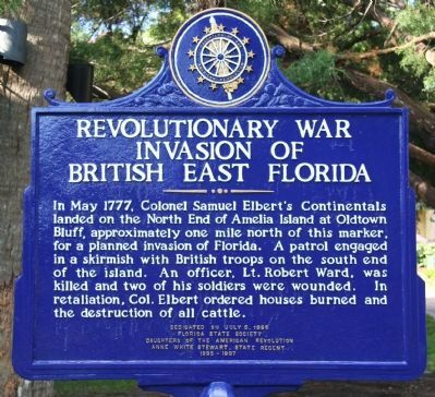
Revolutionary War Invasion of British East Florida
Inscription.
In May 1777, Colonel Samuel Elbert's Continentals landed on the North End of Amelia Island at Oldtown Bluff, approximately one mile north of Florida. A patrol engaged in a skirmish with British troops on the south end of the island. An officer, Lt. Robert Ward, was killed and two of his soldiers were wounded. In retaliation, Col. Elbert ordered houses burned and the destruction of all cattle.
Erected 1996 by Florida State Society, Daughters of the American Revolution, Anne White Stewart State Regent 1995-1997.
Topics and series. This historical marker is listed in these topic lists: Military • War, US Revolutionary. In addition, it is included in the Daughters of the American Revolution series list. A significant historical month for this entry is May 1777.
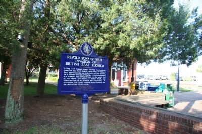
Location. 30° 40.276′ N, 81° 27.867′ W. Marker is in Fernandina Beach, Florida, in Nassau County. Marker is on Center Avenue east of Front Street, on the left when traveling west. This historical marker is located in the downtown business district, near the water front area along the Amelia River, and just east of the town's old railroad depot. Touch for map. Marker is in this post office area: Fernandina Beach FL 32034, United States of America. Touch for directions.
Other nearby markers. At least 8 other markers are within walking distance of this marker. Florida's First Atlantic to Gulf Railroad (a few steps from this marker); William Bartram Trail (within shouting distance of this marker); Florida House (about 600 feet away, measured in a direct line); David L. Yulee (about 800 feet away); U.S. Post Office–Customs House-Courthouse (about 800 feet away); Post Office Lamp Posts (approx. 0.2 miles away); The Lesesne House (approx. 0.2 miles away); Nassau County Historic Courthouse (approx. 0.2 miles away). Touch for a list and map of all markers in Fernandina Beach.
Credits. This page was last revised on June 16, 2016. It was originally submitted on July 22, 2010, by Dale K. Benington of Toledo, Ohio. This page has been viewed 1,617 times since then and 32 times this year. Photos: 1, 2. submitted on July 22, 2010, by Dale K. Benington of Toledo, Ohio.

