Williams in Coconino County, Arizona — The American Mountains (Southwest)
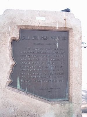
Bill Williams Mountain
Elevation 9,264 Ft
Erected 1962 by Arizona Development Board.
Topics. This historical marker is listed in these topic lists: Exploration • Native Americans. A significant historical year for this entry is 1830.
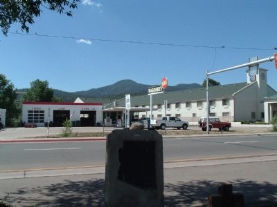
Location. 35° 14.914′ N, 112° 11.727′ W. Marker is in Williams, Arizona, in Coconino County. Marker is on West Bill Williams Avenue/West Route 66, on the left when traveling east. Marker is in Monument Park, between West Railroad Avenue and West Route 66. Touch for map. Marker is at or near this postal address: 823 West Bill Williams Avenue, Williams AZ 86046, United States of America. Touch for directions.
Other nearby markers. At least 8 other markers are within walking distance of this marker. William Sherley Williams (here, next to this marker); Negrette House (approx. 0.2 miles away); Sultana Theater (approx. 0.3 miles away); Babbitt-Polson Building (approx. 0.3 miles away); The "World Famous" Sultana (approx. 0.3 miles away); Pollock Building (approx. 0.4 miles away); Telegraph Office (approx. 0.4 miles away); Caboose Jake 017 (approx. 0.4 miles away). Touch for a list and map of all markers in Williams.
Regarding Bill Williams Mountain. A biography of Bill Williams said, "Today, William Sherley Williams -- Old Bill -- is remembered as a kind, honest, and brave man; charitable toward the less fortunate, expert in the fur-trading business. A river, and a mountain and its town have been named for him. Little is known of Old Bill and his exploits, but he served America honorably in the adventurous days of yore."
Credits. This page was last revised on November 2, 2019. It was originally submitted on July 22, 2010, by Bill Kirchner of Tucson, Arizona. This page has been viewed 1,034 times since then and 41 times this year. Photos: 1, 2. submitted on July 22, 2010, by Bill Kirchner of Tucson, Arizona. • Syd Whittle was the editor who published this page.

