Hillsdale in Hillsdale County, Michigan — The American Midwest (Great Lakes)
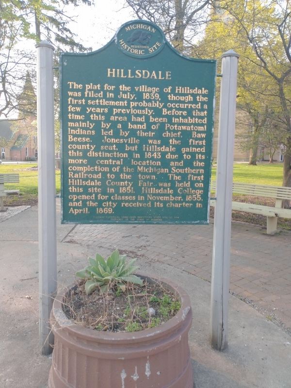
Hillsdale
Erected 1969 by Michigan Historical Commission. (Marker Number S294.)
Topics and series. This historical marker is listed in this topic list: Settlements & Settlers. In addition, it is included in the Michigan Historical Commission series list. A significant historical month for this entry is April 1869.
Location. 41° 55.266′ N, 84° 37.909′ W. Marker is in Hillsdale, Michigan, in Hillsdale County. Marker is at the intersection of Howell Street and McCollum Street, on the left when traveling south on Howell Street. This marker is 1 block west of North Broad Street (State Highway 99). Touch for map. Marker is at or near this postal address: 29 North Howell Street, Hillsdale MI 49242, United States of America. Touch for directions.
Other nearby markers. At least 8 other markers are within walking distance of this marker. American Legion World War I Memorial Tree (a few steps from this marker); Sultana (within shouting distance of this marker); Hillsdale County Heritage (within shouting distance of this marker); American Legion Veterans Memorial (within shouting distance of this marker); D.A.V.-V.F.W. Veterans Memorial (within shouting distance of this marker); Hillsdale County Desert Storm Memorial (within shouting distance of this marker); Hillsdale County World War II & Korean Conflict Memorial (about 300 feet away, measured in a direct line); Taylor - Moore & Co. (about 300 feet away). Touch for a list and map of all markers in Hillsdale.
Also see . . . History of Hillsdale at Wikipedia. (Submitted on February 28, 2022, by Joel Seewald of Madison Heights, Michigan.)
Credits. This page was last revised on May 13, 2022. It was originally submitted on July 26, 2010, by Joel Seewald of Madison Heights, Michigan. This page has been viewed 895 times since then and 12 times this year. Photos: 1. submitted on July 26, 2010, by Joel Seewald of Madison Heights, Michigan. 2. submitted on May 13, 2022, by Craig Doda of Napoleon, Ohio. 3. submitted on July 26, 2010, by Joel Seewald of Madison Heights, Michigan. • Bill Pfingsten was the editor who published this page.


