Raymond in Madera County, California — The American West (Pacific Coastal)
Grub Gulch
Photographed by Lester J Letson, circa April 2006
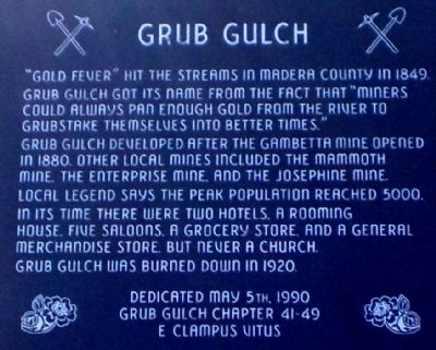
1. Grub Gulch Marker
Grub Gulch developed after the Gambetta Mine opened in 1880. Other local mines included the Mammoth Mine, the Enterprise Mine, and the Josephine Mine. Local legend says the peak population reached 5,000.
In its time there were two hotels, a rooming house, five saloons, a grocery store, and a general merchandise store, but never a church. Grub Gulch burned down in 1920.
Erected 1990 by Grub Gulch Chaper 41-49, E Clampus Vitus.
Topics and series. This historical marker is listed in these topic lists: Notable Places • Settlements & Settlers. In addition, it is included in the E Clampus Vitus series list. A significant historical year for this entry is 1849.
Location. 37° 19.433′ N, 119° 46.233′ W. Marker is in Raymond, California, in Madera County. It is on County Road 600 6 miles State Route 41, on the left when traveling south. Touch for map. Marker is in this post office area: Raymond CA 93653, United States of America.
this page online

Regionally, this marker is in the San Joaquin Valley, specifically in the Central Valley, and in the Sierra Nevada. It is also on the American Pacific Coast. Globally, it is in North America, on the Ring of Fire, on the Pacific Rim, in the Western Hemisphere, in the Western World, and in the Anglosphere. Historically, it finds itself in what was once New Spain and also Mexico’s Alta California.
Other nearby markers. At least 8 other markers are within 7 miles of this marker, measured as the crow flies: Yosemite Stage Route (approx. 0.7 miles away); The Black Kid (approx. 1.1 miles away); Shay's Blacksmith Shop & Canary Cottage (approx. 1.6 miles away); Wassama Roundhouse (approx. 4 miles away); Wassama Village (approx. 4.4 miles away); Ahwahnee Tavern (approx. 4½ miles away); Coarsegold (approx. 5.8 miles away); Highway 49 - The Golden Chain (approx. 6.3 miles away).
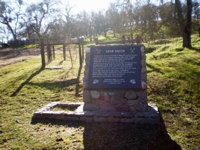
Regarding Grub Gulch. The town of Grub Gulch sat in area behind the marker. All that is left is the cemetery which is located on the side of a hill past the corral on private property.
The Gambetta Mine - also called the Arkansas
Photographed by Lester J Letson, circa April 2006
2. Grub Gulch Marker
The Yellow Grub Gulch Rose once thrived in the square to the left of the marker.
Also see . . . Grub Gulch, California. Wikipedia entry (Submitted on September 7, 2025, by Larry Gertner of New York, New York.)
Fresno Library History room, circa 1913
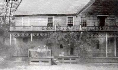
3. One of Two Hotels in Grub Gulch
A 1913 picture of one of two hotels, either the Morrison or the Thomas Hotel.
Credits. This page was last revised on September 7, 2025. It was originally submitted on July 29, 2010, by Lester J Letson of Fresno, California. This page has been viewed 2,810 times since then and 161 times this year. Photos: 1, 2. submitted on July 29, 2010, by Lester J Letson of Fresno, California. 3. submitted on August 17, 2010, by Lester J Letson of Fresno, California. • Syd Whittle was the editor who published this page.
