Southington in Hartford County, Connecticut — The American Northeast (New England)
Southington
[ front ]
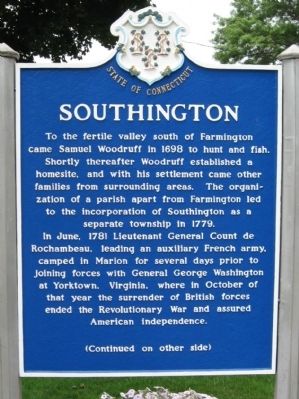
In June, 1781 Lieutenant General Count de Rochambeau, leading an auxiliary French army, camped in Marion for several days prior to joining forces with General George Washington at Yorktown, Virginia, where in October of that year the surrender of British forces ended the Revolutionary War and assured American independence.
[ back ]
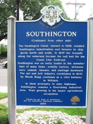
The Farmington Canal, opened in 1828, enabled Southington industrialists and farmers to ship goods north and south. In 1847 the towpath along the waterway became the rail bed for the Canal Line Railroad.
Southington was an early leader in the manufacture of many items, notably buttons, britannia ware, cement, tinware, and carriage hardware. The nut and bolt industry established in 1840 by Micah Rugg continues as a vital business in Milldale.
In close proximity to state highways, Southington remains a flourishing industrial area. Fruit growing is the major agricultural occupation.
Erected by the Town of Southington
and the Connecticut Historical Commission
1975
Erected 1975 by Town of Southington, the Connecticut Historical Commission.
Topics. This historical marker is listed in these topic lists: Colonial Era • Settlements & Settlers. A significant historical month for this entry is June 1781.
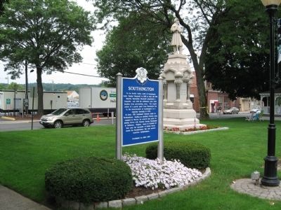
Location. 41° 36.062′ N, 72° 52.7′ W. Marker is in Southington, Connecticut, in Hartford County. Marker is at the intersection of Main Street (Connecticut Route 10) and Academy Street, on the left when traveling north on Main Street. Located on the Southington Green. Touch for map. Marker is in this post office area: Southington CT 06489, United States of America. Touch for directions.
Other nearby markers. At least 8 other markers are within 2 miles of this marker, measured as the crow flies. Southington Soldiers Memorial (a few steps from this marker); Southington World War II (a few steps from this marker); Southington Veterans Memorial (within shouting distance of this marker); Constitution Oak (within shouting distance of this marker); Gang Scarpa Shoda (approx. 0.2 miles away); Washington – Rochambeau Revolutionary Route (approx. 1.1 miles away); Forever Honored Forever Mourned (approx. 1.2 miles away); Near This Spot (approx. 1.3 miles away). Touch for a list and map of all markers in Southington.
Also see . . .
1. Town of Southington, CT. (Submitted on July 29, 2010, by Michael Herrick of Southbury, Connecticut.)
2. Southington, Connecticut on Wikipedia. (Submitted on July 29, 2010, by Michael Herrick of Southbury, Connecticut.)
Credits. This page was last revised on June 16, 2016. It was originally submitted on July 29, 2010, by Michael Herrick of Southbury, Connecticut. This page has been viewed 894 times since then and 34 times this year. Photos: 1, 2, 3, 4. submitted on July 29, 2010, by Michael Herrick of Southbury, Connecticut.


