Wonewoc in Juneau County, Wisconsin — The American Midwest (Great Lakes)
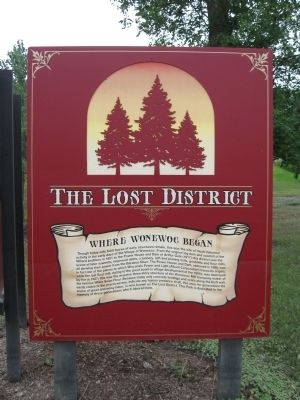
The Lost District
Where Wonewoc Began
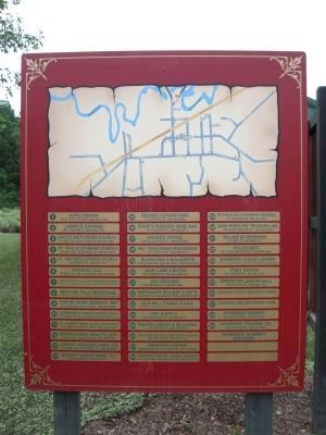
Though today only faint traces of early structures remain, this was the site of much industrial activity in the early days of the Village of Wonewoc. From the original log dam and sawmill of the Willard brothers in 1851 to the Power House and Dam of Arthur Gale (1917) this district was the scene of later sawmills, improved dams, a tannery, lath and planing mills, gristmills and flour mills, all deriving their power from the Baraboo River. The Power House and Dam, removed in 1996, was in fact one of the places to which Wisconsin Power and Light (Alliant Corporation) traces its origins, while the last flour mill, dating to the great boom in village development of the 1890s, was destroyed by fire in 1927; this was the massive three-story structure of the Wonewoc Mill Company maker of the famous White Swan Flour. Because today only concrete footings and scars along the bluff wall, easily visible to the practiced eye, indicate any human presence at all, this area, for generations the scene of great and noisy labor, is now know as The Lost District. This Park is dedicated to the memory of those generations which labored here.
Topics. This historical marker is listed in this topic list: Settlements & Settlers. A significant historical year for this entry is 1851.
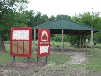
Location. 43° 39.171′ N, 90° 13.624′ W. Marker is in Wonewoc, Wisconsin, in Juneau County. Marker is at the intersection of Washington Street and County Highway FF on Washington Street. Marker is at a canoe landing along the Baraboo River. Touch for map. Marker is in this post office area: Wonewoc WI 53968, United States of America. Touch for directions.
Other nearby markers. At least 8 other markers are within 9 miles of this marker, measured as the crow flies. Wonewoc History (approx. 0.2 miles away); Towns made from this? (approx. 0.6 miles away); Geology of the 400 Trail (approx. one mile away); Mt. Vernon Cemetery Civil War Memorial (approx. 6.1 miles away); African American Settlers of Cheyenne Valley (approx. 6.2 miles away); Admiral Marc A. Mitscher, U.S. Navy (approx. 6.3 miles away); Elroy – Sparta State Trail (approx. 7 miles away); The Ironton Mine (approx. 8.4 miles away). Touch for a list and map of all markers in Wonewoc.
Also see . . .
1. Local History from the Village of Wonewoc. Village website entry (Submitted on August 2, 2010.)
2. Theodore Fisk. Wisconsin Historical Society website entry (Submitted on August 2, 2010.)
Additional commentary.
1. Theodore Fisk
A Dode Fisk Circus & Combined Shows marker or plaque, Wisconsin Registered Landmark #66, is (or was) located in Wonewoc. Note To Editor only visible by Contributor and editor
— Submitted August 2, 2010.
Credits. This page was last revised on January 6, 2022. It was originally submitted on August 2, 2010, by Keith L of Wisconsin Rapids, Wisconsin. This page has been viewed 1,173 times since then and 40 times this year. Photos: 1, 2, 3. submitted on August 2, 2010, by Keith L of Wisconsin Rapids, Wisconsin.


