
Linwood in Davidson County, North Carolina — The American South (South Atlantic)
Stoneman’s Raid
Photographed by Bill Coughlin, August 2, 2010
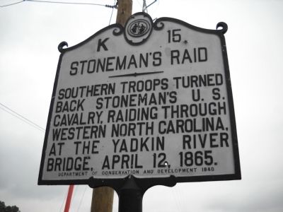
1. Stoneman’s Raid Marker
Southern troops turned back Stoneman's U. S. Cavalry, raiding through western North Carolina, at the Yadkin River Bridge, April 12, 1865.
Erected 1940 by Department of Conservation and Development. (Marker Number K-15.)
Topics and series. This historical marker is listed in these topic lists: Bridges & Viaducts • War, US Civil. In addition, it is included in the North Carolina Division of Archives and History series list. A significant historical date for this entry is April 12, 1903.
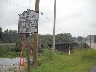
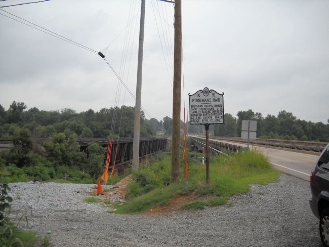
Location. 35° 43.359′ N, 80° 23.418′ W. Marker is in Linwood, North Carolina, in Davidson County. It is at the intersection of U.S. 29 and Old Salisbury Road, on the right when traveling north on U.S. 29. Marker is located on the north side of the bridge over the Yadkin River. Touch for map. Marker is in this post office area: Linwood NC 27299, United States of America. Touch for directions.

Regionally, this marker is in North Carolina’s Piedmont and specifically in Piedmont Triad. It is also in the American South and specifically in the Upper South. Globally, it is in North America, the Western Hemisphere, the Western World,
this page online
Other nearby markers. At least 8 other markers are within 4 miles of this marker, measured as the crow flies: Trading Ford (approx. 0.3 miles away); a different marker also named Trading Ford (approx. 0.8 miles away); Magnetic Signal Company (approx. 3.4 miles away); Signals (approx. 3.4 miles away); Food Lion LLC (approx. 3.4 miles away); Food Lion Trailer No. 893615 (approx. 3.4 miles away); Historic Spencer Shops (approx. 3.4 miles away); Town of Spencer (approx. 3½ miles away).
Also see . . .
1. Stoneman's Raid. NCpedia website entry (Submitted on September 18, 2022, by Larry Gertner of New York, New York.)
2. Major General George Stoneman Led the Last American Civil War Cavalry Raid. HistoryNet.com website. (Submitted on August 2, 2010, by Bill Coughlin of Woodland Park, New Jersey.)
Photographed by Bill Coughlin, August 2, 2010
2. Stoneman’s Raid Marker
Photographed by Bill Coughlin, August 2, 2010
3. Marker at the Yadkin River Bridge
Credits. This page was last revised on September 18, 2022. It was originally submitted on August 2, 2010, by Bill Coughlin of Woodland Park, New Jersey. This page has been viewed 1,161 times since then and 17 times this year. Photos: 1, 2, 3. submitted on August 2, 2010, by Bill Coughlin of Woodland Park, New Jersey.
