Bay City in Bay County, Michigan — The American Midwest (Great Lakes)
Center Avenue
Photographed by Joel S., July 16, 2010
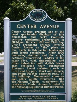
1. Center Avenue Marker
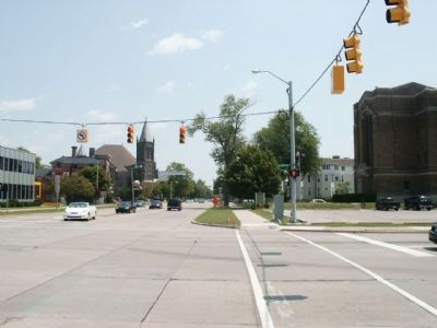
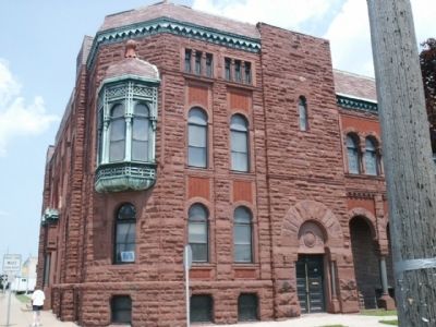
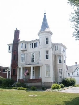
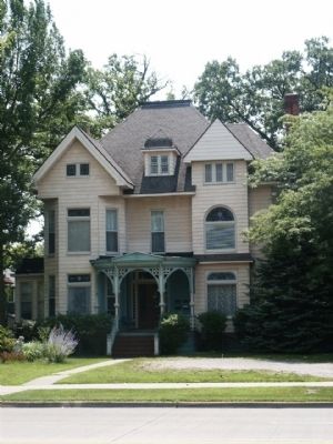
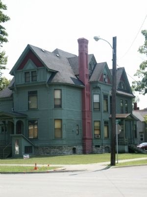
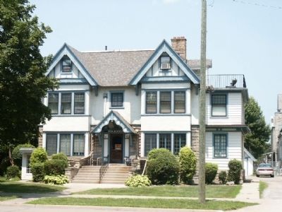
Center Avenue presents one of the most spectacular displays of late nineteenth and early twentieth century residential architecture in Michigan. Between 1870 and 1940 Bay City's prominent citizens favored Center Avenue as "the" place to live. Early in this period lumbermen built lavish residences. After 1900 lumbering declined and the city's economy diversified. Leaders in the sugar beet, coal, shipbuilding, and other industries built stylish homes that reflected their substantial fortunes. Local architects such as Pratt and Koeppe, Clark and Munger, and Philip Floeter designed many of the buildings. Monumental churches and other public structures, like the Masonic Temple, compliment the residences. Center Avenue is listed in the National Register of Historic Places.
Erected 2003 by Michigan Historical Commission - Michigan Historical Center and State of Michigan. (Marker Number L2122.)
Topics and series. This historical marker is listed in these topic lists: Architecture • Settlements & Settlers. In addition, it is included in the Michigan Historical Commission series list. A significant historical year for this entry is 1870.
Location. 43° 35.856′ N,
this page online

Regionally, this marker is in Mid-Michigan and in one of the Lake Huron Shore counties. It is also in the American Midwest. Globally, it is in North America, on the Great Lakes, in the Western Hemisphere, in the Western World, and in the Anglosphere. Historically, it finds itself in what was once the Northwest Territory.
Other nearby markers. At least 8 other markers are within walking distance of this marker: Art Around The City (about 300 feet away, measured in a direct line); Bay County Veterans Memorial (about 300 feet away); a different marker also named Bay County Veterans Memorial (about 300 feet away); US 13-inch Sea-Coast Mortar (about 300 feet away); Bay City Branch Library (about 300 feet away); George H. & Elva Shearer House (about 400
Photographed by Joel S., July 16, 2010
2. Center Avenue Marker - Far
Also see . . . Center Avenue Neighborhood Association. Association website homepage (Submitted on August 30, 2021, by Joel Seewald of Madison Heights, Michigan.)
Additional commentary.
1. Identical Marker, Different Location
An identical marker exists at two different locations. The second location is at the northwest corner of Center Avenue and Livingston Street (see marker 161001.
— Submitted November 27, 2020, by John Garman of Rochester Hills.
Photographed by Joel S., July 16, 2010
3. Masonic Temple
Photographed by Joel S., July 16, 2010
4. Historic Center Avenue House
Photographed by Joel S., July 16, 2010
5. Historic Center Avenue House
Photographed by Joel S., July 16, 2010
6. Historic Center Avenue House
Photographed by Joel S., July 16, 2010
7. Historic Center Avenue House
Credits. This page was last revised on February 18, 2022. It was originally submitted on August 3, 2010, by Joel Seewald of Madison Heights, Michigan. This page has been viewed 1,589 times since then and 42 times this year. Photos: 1, 2, 3, 4, 5, 6, 7. submitted on August 3, 2010, by Joel Seewald of Madison Heights, Michigan. • Syd Whittle was the editor who published this page.
